Property Record
E Academy St, Clayton, NJ 08312


Save to a Folder
{{folder.Name}}
{{folder.ListingIds.length}} Properties
{{folder.ListingIds.length}} Property
Create a New Folder
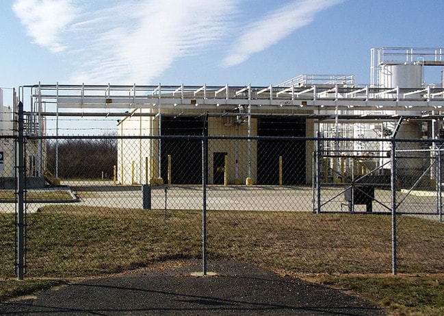
Property Detail
E Academy St
Philadelphia-Camden-Wilmington, PA-NJ-DE-MD
INCL BLK 1904 LOTS 13 14 16 & 17
01-01904-0000-00013
GLOUCESTER
Transportationcommunicationsgeneral
New Jersey
PRD
13
B and X Area of moderate flood hazard, usually the area between the limits of the 100-year and 500-year floods.
2.45 AC
0
Gloucester County
2026
Philadelphia
501502
NEARBY LISTINGS FOR SALE OR LEASE
DEMOGRAPHICS near E Academy St
1 mile
3 mile
5 mile
2025 Total Population
3,274
21,142
85,374
2030 Population
3,377
21,837
88,243
Pop Growth 2025-2030
+ 3.15%
+ 3.29%
+ 3.36%
Average Age
41
40
39
2025 Total Households
1,204
7,342
29,316
HH Growth 2025-2030
+ 3.16%
+ 3.32%
+ 3.60%
Median Household Inc
$83,539
$103,173
$92,934
Avg Household Size
2.60
2.80
2.60
2025 Avg HH Vehicles
2.00
2.00
2.00
Median Home Value
$284,083
$322,635
$314,400
Median Year Built
1988
1986
1984
Nearby Places
Map Layers
Map Styles
 Street
 Aerial
Layers
 Traffic
 Biking
Places
Listings with unknown addresses are not visible on the map
- Restaurants
- Banks
- Shops
- Fitness
- Groceries
PUBLIC TRANSPORTATION
AIRPORT
Philadelphia International
Drive
Walk
Distance
Philadelphia International
46 min
28.8 mi
Wilmington Airport
Drive
Walk
Distance
Wilmington Airport
55 min
33.1 mi
Atlantic City International
Drive
Walk
Distance
Atlantic City International
70 min
39.1 mi
Freight Ports
Broadway Terminal - Pier 5
Drive
Walk
Distance
Broadway Terminal - Pier 5
31 min
20.2 mi
Nearby Properties
Address
Land Use
TOTAL SIZE
Lot Size
Zoning
Address
Land Use
TOTAL SIZE
Lot Size
Zoning
23.80 AC
R-B
Address
Land Use
TOTAL SIZE
Lot Size
Zoning
17.02 AC
PA
Address
Land Use
TOTAL SIZE
Lot Size
Zoning
37.40 AC
CF/I
Address
Land Use
TOTAL SIZE
Lot Size
Zoning
21.14 AC
CF/I
Address
Land Use
TOTAL SIZE
Lot Size
Zoning
35.07 AC
Address
Land Use
TOTAL SIZE
Lot Size
Zoning
76.57 AC
I
Address
Land Use
TOTAL SIZE
Lot Size
Zoning
15.47 AC
C5
Address
Land Use
TOTAL SIZE
Lot Size
Zoning
55.88 AC
APA
Address
Land Use
TOTAL SIZE
Lot Size
Zoning
3,750 SF
5.55 AC
C3
Address
Land Use
TOTAL SIZE
Lot Size
Zoning
7.61 AC
APA
Address
Land Use
TOTAL SIZE
Lot Size
Zoning
469 AC
CF/I
Address
Land Use
TOTAL SIZE
Lot Size
Zoning
1,144 SF
178.34 AC
BP
Address
Land Use
TOTAL SIZE
Lot Size
Zoning
340.56 AC
CF/I
Address
Land Use
TOTAL SIZE
Lot Size
Zoning
5.71 AC
C4
Address
Land Use
TOTAL SIZE
Lot Size
Zoning
176.06 AC
P
Address
Land Use
TOTAL SIZE
Lot Size
Zoning
1.99 AC
I
Address
Land Use
TOTAL SIZE
Lot Size
Zoning
5.68 AC
R5
Address
Land Use
TOTAL SIZE
Lot Size
Zoning
4,096 SF
8.86 AC
CO
Address
Land Use
TOTAL SIZE
Lot Size
Zoning
1.99 AC
CO
Address
Land Use
TOTAL SIZE
Lot Size
Zoning
148.41 AC
P
Address
Land Use
TOTAL SIZE
Lot Size
Zoning
1,669 SF
3.13 AC
C-1
Address
Land Use
TOTAL SIZE
Lot Size
Zoning
36.54 AC
P
Address
Land Use
TOTAL SIZE
Lot Size
Zoning
137.40 AC
P
Address
Land Use
TOTAL SIZE
Lot Size
Zoning
136.65 AC
P
Address
Land Use
TOTAL SIZE
Lot Size
Zoning
1,495 SF
2.01 AC
CO
Address
Land Use
TOTAL SIZE
Lot Size
Zoning
8.62 AC
C5
Address
Land Use
TOTAL SIZE
Lot Size
Zoning
960 SF
3.23 AC
BP
Address
Land Use
TOTAL SIZE
Lot Size
Zoning
119.30 AC
P
Address
Land Use
TOTAL SIZE
Lot Size
Zoning
1,680 SF
4.69 AC
HC
Address
Land Use
TOTAL SIZE
Lot Size
Zoning
8,848 SF
1.33 AC
C1
The World's #1 Commercial Real Estate Marketplace
Connect with us
© 2026 CoStar Group
The information above has been obtained from sources believed reliable. While we do not doubt its accuracy we have not verified it and make no guarantee, warranty or representation about it. It is your responsibility to independently confirm its accuracy and completeness. Any projections, opinions, assumptions, or estimates used are for example only and do not represent the current or future performance of the property. The value of this transaction to you depends on tax and other factors which should be evaluated by your tax, financial, and legal advisors. You and your advisors should conduct a careful, independent investigation of the property to determine to your satisfaction the suitability of the property for your needs.