Property Record
E Blackjack Rd, Pilot Point, TX 76258
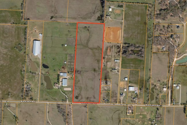


Property Detail
E Blackjack Rd
Dallas-Fort Worth-Arlington, TX
Chambers
R52443
A0223A CHAMBERS, TR 95, 35.5175 ACRES, OLD DCAD SHT 2, TR 12
Agriculturalland
Denton
X
Texas
48121C0255G
35.52 AC
2024
Outlying Denton County
2025
Dallas/Ft Worth
020129
NEARBY LISTINGS FOR SALE OR LEASE
DEMOGRAPHICS near E Blackjack Rd
1 mile
3 mile
5 mile
2024 Total Population
121
5,868
16,507
2029 Population
136
6,804
19,641
Pop Growth 2024-2029
+ 12.40%
+ 15.95%
+ 18.99%
Average Age
44
41
38
2024 Total Households
47
2,160
5,858
HH Growth 2024-2029
+ 14.89%
+ 16.44%
+ 19.36%
Median Household Inc
$96,874
$91,022
$90,866
Avg Household Size
2.40
2.70
2.80
2024 Avg HH Vehicles
3.00
2.00
2.00
Median Home Value
$531,250
$336,305
$344,121
Median Year Built
1993
2000
2010
Nearby Places
Map Layers
Map Styles
 Street
 Aerial
Transit
 Traffic
 Biking
Places
Listings with unknown addresses are not visible on the map
- Restaurants
- Banks
- Shops
- Fitness
- Groceries
PUBLIC TRANSPORTATION
AIRPORT
Dallas-Fort Worth International
Drive
Walk
Distance
Dallas-Fort Worth International
57 min
36.8 mi
Freight Ports
Port of Shreveport
Drive
Walk
Distance
Port of Shreveport
268 min
238.1 mi
SALE & LEASE HISTORY
LISTING DATE
SALE/LEASE

Dec 10, 2024
For Sale
Nearby Properties
Address
Land Use
TOTAL SIZE
Lot Size
Zoning
Address
Land Use
TOTAL SIZE
Lot Size
Zoning
249,782 SF
48.28 AC
Address
Land Use
TOTAL SIZE
Lot Size
Zoning
141,215 SF
32 AC
Address
Land Use
TOTAL SIZE
Lot Size
Zoning
59,334 SF
14.62 AC
Address
Land Use
TOTAL SIZE
Lot Size
Zoning
169,130 SF
8.50 AC
Address
Land Use
TOTAL SIZE
Lot Size
Zoning
63,434 SF
10.70 AC
Address
Land Use
TOTAL SIZE
Lot Size
Zoning
68,910 SF
16.02 AC
Address
Land Use
TOTAL SIZE
Lot Size
Zoning
38,475 SF
5 AC
Address
Land Use
TOTAL SIZE
Lot Size
Zoning
113,212 SF
19.34 AC
Address
Land Use
TOTAL SIZE
Lot Size
Zoning
13,962 SF
6.41 AC
Address
Land Use
TOTAL SIZE
Lot Size
Zoning
8,080 SF
60.39 AC
Address
Land Use
TOTAL SIZE
Lot Size
Zoning
44,690 SF
4.01 AC
Address
Land Use
TOTAL SIZE
Lot Size
Zoning
37,676 SF
Address
Land Use
TOTAL SIZE
Lot Size
Zoning
17,259 SF
19.99 AC
Address
Land Use
TOTAL SIZE
Lot Size
Zoning
124,996 SF
10 AC
Address
Land Use
TOTAL SIZE
Lot Size
Zoning
2,724 SF
58.10 AC
Address
Land Use
TOTAL SIZE
Lot Size
Zoning
11,250 SF
1.75 AC
Address
Land Use
TOTAL SIZE
Lot Size
Zoning
20,180 SF
11.11 AC
Address
Land Use
TOTAL SIZE
Lot Size
Zoning
2,750 SF
97.87 AC
Address
Land Use
TOTAL SIZE
Lot Size
Zoning
16,330 SF
4.86 AC
Address
Land Use
TOTAL SIZE
Lot Size
Zoning
13,900 SF
22.80 AC
Address
Land Use
TOTAL SIZE
Lot Size
Zoning
10,640 SF
3.10 AC
Address
Land Use
TOTAL SIZE
Lot Size
Zoning
25,000 SF
1.73 AC
Address
Land Use
TOTAL SIZE
Lot Size
Zoning
Address
Land Use
TOTAL SIZE
Lot Size
Zoning
20,400 SF
3.17 AC
Address
Land Use
TOTAL SIZE
Lot Size
Zoning
44,790 SF
4.19 AC
Address
Land Use
TOTAL SIZE
Lot Size
Zoning
23,430 SF
19.99 AC
Address
Land Use
TOTAL SIZE
Lot Size
Zoning
2,328 SF
53.95 AC
Address
Land Use
TOTAL SIZE
Lot Size
Zoning
11,734 SF
11.33 AC
Address
Land Use
TOTAL SIZE
Lot Size
Zoning
8,310 SF
20.25 AC
Address
Land Use
TOTAL SIZE
Lot Size
Zoning
9,464 SF
1.50 AC
The World's #1 Commercial Real Estate Marketplace
Connect with us
© 2026 CoStar Group
The information above has been obtained from sources believed reliable. While we do not doubt its accuracy we have not verified it and make no guarantee, warranty or representation about it. It is your responsibility to independently confirm its accuracy and completeness. Any projections, opinions, assumptions, or estimates used are for example only and do not represent the current or future performance of the property. The value of this transaction to you depends on tax and other factors which should be evaluated by your tax, financial, and legal advisors. You and your advisors should conduct a careful, independent investigation of the property to determine to your satisfaction the suitability of the property for your needs.