Property Record
E Highway 90 E, Crestview, FL 32539
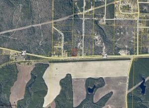

Property Detail
E Highway 90 E
Crestview-Fort Walton Beach-Destin, FL
W1/2 OF SE1/4 OF SW1/4 EXC N890 FT & EXC HWY 90 R/W EXC E400 FT M/L ALSO DESC AS:BEG SW COR SE1/4 SW1/4 N442 FT E247 FT S500 FT TO NR/W US90 S86 DEG W ALG R/W 247 FT N77 FT TO POB LESS PORTION LYING IN SEC 20
17-3N-22-0000-0004-0050
OKALOOSA
Vacantlandnec
Florida
B and X Area of moderate flood hazard, usually the area between the limits of the 100-year and 500-year floods.
50
2025
2.27 AC
2025
Fort Walton Beach
020400
Other Market Areas
NEARBY LISTINGS FOR SALE OR LEASE
DEMOGRAPHICS near E Highway 90 E
1 mile
3 mile
5 mile
2025 Total Population
216
1,736
14,452
2030 Population
224
1,798
14,990
Pop Growth 2025-2030
+ 3.70%
+ 3.57%
+ 3.72%
Average Age
40
40
38
2025 Total Households
79
638
5,247
HH Growth 2025-2030
+ 3.80%
+ 3.45%
+ 3.60%
Median Household Inc
$90,908
$92,924
$86,074
Avg Household Size
2.60
2.60
2.60
2025 Avg HH Vehicles
2.00
2.00
2.00
Median Home Value
$335,294
$319,677
$317,396
Median Year Built
2003
2002
2000
Nearby Places
Map Layers
Map Styles
 Street
 Aerial
Transit
 Traffic
 Biking
Places
Listings with unknown addresses are not visible on the map
- Restaurants
- Banks
- Shops
- Fitness
- Groceries
PUBLIC TRANSPORTATION
AIRPORT
Eglin AFB/Destin-Ft Walton Beach
Drive
Walk
Distance
Eglin AFB/Destin-Ft Walton Beach
56 min
30.9 mi
Freight Ports
Port of Panama City
Drive
Walk
Distance
Port of Panama City
103 min
78.2 mi
SALE & LEASE HISTORY
LISTING DATE
SALE/LEASE

Sep 24, 2016
For Sale
Nearby Properties
Address
Land Use
TOTAL SIZE
Lot Size
Zoning
Address
Land Use
TOTAL SIZE
Lot Size
Zoning
150,810 SF
22.68 AC
Address
Land Use
TOTAL SIZE
Lot Size
Zoning
23,148 SF
1.36 AC
Address
Land Use
TOTAL SIZE
Lot Size
Zoning
512.07 AC
Address
Land Use
TOTAL SIZE
Lot Size
Zoning
466.25 AC
Address
Land Use
TOTAL SIZE
Lot Size
Zoning
358.97 AC
Address
Land Use
TOTAL SIZE
Lot Size
Zoning
9,504 SF
2.08 AC
Address
Land Use
TOTAL SIZE
Lot Size
Zoning
22,688 SF
1.23 AC
Address
Land Use
TOTAL SIZE
Lot Size
Zoning
10,448 SF
2.92 AC
Address
Land Use
TOTAL SIZE
Lot Size
Zoning
5,985 SF
36.51 AC
Address
Land Use
TOTAL SIZE
Lot Size
Zoning
6,622 SF
40 AC
RRS-3
Address
Land Use
TOTAL SIZE
Lot Size
Zoning
243.47 AC
Address
Land Use
TOTAL SIZE
Lot Size
Zoning
4,590 SF
13.80 AC
Address
Land Use
TOTAL SIZE
Lot Size
Zoning
4,201 SF
35.73 AC
Address
Land Use
TOTAL SIZE
Lot Size
Zoning
7,706 SF
10.06 AC
Address
Land Use
TOTAL SIZE
Lot Size
Zoning
352.33 AC
Address
Land Use
TOTAL SIZE
Lot Size
Zoning
392 SF
10.08 AC
Address
Land Use
TOTAL SIZE
Lot Size
Zoning
6,600 SF
0.93 AC
Address
Land Use
TOTAL SIZE
Lot Size
Zoning
164.96 AC
Address
Land Use
TOTAL SIZE
Lot Size
Zoning
4,929 SF
283.73 AC
Address
Land Use
TOTAL SIZE
Lot Size
Zoning
3,043 SF
40 AC
RRS-3
Address
Land Use
TOTAL SIZE
Lot Size
Zoning
5,167 SF
11.93 AC
Address
Land Use
TOTAL SIZE
Lot Size
Zoning
2,944 SF
659.53 AC
Address
Land Use
TOTAL SIZE
Lot Size
Zoning
14.22 AC
Address
Land Use
TOTAL SIZE
Lot Size
Zoning
5,648 SF
8.91 AC
Address
Land Use
TOTAL SIZE
Lot Size
Zoning
37.96 AC
Address
Land Use
TOTAL SIZE
Lot Size
Zoning
2,884 SF
573.70 AC
Address
Land Use
TOTAL SIZE
Lot Size
Zoning
3,793 SF
60 AC
Address
Land Use
TOTAL SIZE
Lot Size
Zoning
864 SF
19.08 AC
Address
Land Use
TOTAL SIZE
Lot Size
Zoning
Address
Land Use
TOTAL SIZE
Lot Size
Zoning
4,384 SF
99.23 AC
The World's #1 Commercial Real Estate Marketplace
Connect with us
© 2026 CoStar Group
The information above has been obtained from sources believed reliable. While we do not doubt its accuracy we have not verified it and make no guarantee, warranty or representation about it. It is your responsibility to independently confirm its accuracy and completeness. Any projections, opinions, assumptions, or estimates used are for example only and do not represent the current or future performance of the property. The value of this transaction to you depends on tax and other factors which should be evaluated by your tax, financial, and legal advisors. You and your advisors should conduct a careful, independent investigation of the property to determine to your satisfaction the suitability of the property for your needs.