Property Record
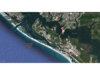
E Highway 98 E, Panama City, FL 32404

NEARBY LISTINGS FOR SALE OR LEASE
Property Detail
E Highway 98 E
Panama City, FL
25 4S 14W -31.1- 120A3 BEG ON W LINE OF HWY 98 AT PT 978.8 FROM CONC MON THAT IS 135 SE OF SE COR LOT 2 LONG POINT PK 1ST & CONT SLY 450 W 647 TO WATER NLY 715 M/L SELY 857.2 TO POB LYING WLY OF TYNDALL PKWY ORB 4638 P 1321 LESS DOT PRCL/CASE # 24-CA
26217-010-000
Bay
Commercialacreage
Florida
AE
2
12005C0426J
0.01 AC
2023
Panama City
2024
Other Market Areas
000500
DEMOGRAPHICS near E Highway 98 E
1 Mile
3 Mile
5 Mile
2024 Total Population
958
15,752
39,169
2029 Population
1,085
17,157
42,481
Pop Growth 2024-2029
+ 13.26%
+ 8.92%
+ 8.46%
Average Age
43
39
39
2024 Total Households
455
6,030
14,807
HH Growth 2024-2029
+ 14.07%
+ 9.19%
+ 8.85%
Median Household Inc
$53,370
$56,695
$51,929
Avg Household Size
2.10
2.60
2.50
2024 Avg HH Vehicles
2.00
2.00
2.00
Median Home Value
$137,383
$164,941
$167,408
Median Year Built
1991
1983
1982
Nearby Places
Map Layers
Map Styles
 Street
 Aerial
- Restaurants
- Banks
- Shops
- Fitness
- Groceries
PUBLIC TRANSPORTATION
AIRPORT
Northwest Florida Beaches International
DRIVE
WALK
Distance
Northwest Florida Beaches International
49 min
31.8 mi
Freight Ports
Port of Panama City
DRIVE
WALK
Distance
Port of Panama City
26 min
15.0 mi
SALE & LEASE HISTORY
LISTING DATE
SALE/LEASE

Mar 06, 2018
For Sale
Nearby Properties
Address
Land Use
TOTAL SIZE
Lot Size
Zoning
Address
Land Use
TOTAL SIZE
Lot Size
Zoning
6.38 AC
BC14
Address
Land Use
TOTAL SIZE
Lot Size
Zoning
600 AC
BC14
Address
Land Use
TOTAL SIZE
Lot Size
Zoning
650 AC
BC14
Address
Land Use
TOTAL SIZE
Lot Size
Zoning
305,058 SF
16.18 AC
Address
Land Use
TOTAL SIZE
Lot Size
Zoning
263,872 SF
41.43 AC
PC12
Address
Land Use
TOTAL SIZE
Lot Size
Zoning
415,651 SF
266 AC
BC13
Address
Land Use
TOTAL SIZE
Lot Size
Zoning
143,208 SF
5.45 AC
Address
Land Use
TOTAL SIZE
Lot Size
Zoning
107,778 SF
10 AC
Address
Land Use
TOTAL SIZE
Lot Size
Zoning
46,368 SF
2.30 AC
CLWY23
Address
Land Use
TOTAL SIZE
Lot Size
Zoning
55,300 SF
10.91 AC
PC12
Address
Land Use
TOTAL SIZE
Lot Size
Zoning
48,576 SF
5.20 AC
CLWY23
Address
Land Use
TOTAL SIZE
Lot Size
Zoning
118,902 SF
33.66 AC
BC13
Address
Land Use
TOTAL SIZE
Lot Size
Zoning
70,028 SF
6.64 AC
CLWY04
Address
Land Use
TOTAL SIZE
Lot Size
Zoning
Address
Land Use
TOTAL SIZE
Lot Size
Zoning
38,784 SF
4.50 AC
CLWY23
Address
Land Use
TOTAL SIZE
Lot Size
Zoning
4,524 SF
16.84 AC
PC12
Address
Land Use
TOTAL SIZE
Lot Size
Zoning
52,727 SF
6.80 AC
Address
Land Use
TOTAL SIZE
Lot Size
Zoning
8.68 AC
Address
Land Use
TOTAL SIZE
Lot Size
Zoning
3,078 SF
7.22 AC
CLWY04
Address
Land Use
TOTAL SIZE
Lot Size
Zoning
41,412 SF
19.58 AC
CLWY05
Address
Land Use
TOTAL SIZE
Lot Size
Zoning
4,869 SF
11.01 AC
CLWY12
Address
Land Use
TOTAL SIZE
Lot Size
Zoning
Address
Land Use
TOTAL SIZE
Lot Size
Zoning
28.50 AC
PC12
Address
Land Use
TOTAL SIZE
Lot Size
Zoning
26,164 SF
15.70 AC
CLWY08
Address
Land Use
TOTAL SIZE
Lot Size
Zoning
46,916 SF
6.05 AC
PC12
Address
Land Use
TOTAL SIZE
Lot Size
Zoning
64,068 SF
5.59 AC
Address
Land Use
TOTAL SIZE
Lot Size
Zoning
19,968 SF
1.07 AC
CLWY10
Address
Land Use
TOTAL SIZE
Lot Size
Zoning
16,000 SF
0.99 AC
CLWY04
Address
Land Use
TOTAL SIZE
Lot Size
Zoning
860 SF
6.10 AC
Address
Land Use
TOTAL SIZE
Lot Size
Zoning
23,900 SF
1.55 AC
CLWY04
The World's #1 Commercial Real Estate Marketplace
Connect with us
© 2025 CoStar Group
The information above has been obtained from sources believed reliable. While we do not doubt its accuracy we have not verified it and make no guarantee, warranty or representation about it. It is your responsibility to independently confirm its accuracy and completeness. Any projections, opinions, assumptions, or estimates used are for example only and do not represent the current or future performance of the property. The value of this transaction to you depends on tax and other factors which should be evaluated by your tax, financial, and legal advisors. You and your advisors should conduct a careful, independent investigation of the property to determine to your satisfaction the suitability of the property for your needs.