Property Record
E Interstate Highway 40, Amarillo, TX

Property Detail
E Interstate Highway 40
Amarillo, TX
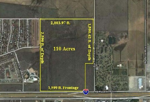
SECT 106 A B & M BLK 0002, IRREG TRAC BEG 43FT N & 2242.73FT W OF SE COR OF SECT, 25.6500 ACRES
R-200-1060-0500-0
POTTER
Commercialnec
Texas
HC
25.65 AC
B and X Area of moderate flood hazard, usually the area between the limits of the 100-year and 500-year floods.
Amarillo
2024
Other Market Areas
2025
NEARBY LISTINGS FOR SALE OR LEASE
DEMOGRAPHICS near E Interstate Highway 40
1 mile
3 mile
5 mile
2025 Total Population
1,953
24,909
71,076
2030 Population
1,941
24,500
71,047
Pop Growth 2025-2030
(0.61%)
(1.64%)
(0.04%)
Average Age
36
36
36
2025 Total Households
659
8,248
23,751
HH Growth 2025-2030
(0.76%)
(1.76%)
0.00%
Median Household Inc
$41,500
$49,529
$49,618
Avg Household Size
2.90
2.90
2.70
2025 Avg HH Vehicles
2.00
2.00
2.00
Median Home Value
$90,983
$121,953
$125,908
Median Year Built
1962
1960
1960
Nearby Places
Map Layers
Map Styles
 Street
 Aerial
Transit
 Traffic
 Biking
Places
Listings with unknown addresses are not visible on the map
- Restaurants
- Banks
- Shops
- Fitness
- Groceries
Nearby Properties
Address
Land Use
TOTAL SIZE
Lot Size
Zoning
Address
Land Use
TOTAL SIZE
Lot Size
Zoning
1,079,953 SF
106.07 AC
Address
Land Use
TOTAL SIZE
Lot Size
Zoning
414,471 SF
104.16 AC
LC
Address
Land Use
TOTAL SIZE
Lot Size
Zoning
572,685 SF
34.93 AC
Address
Land Use
TOTAL SIZE
Lot Size
Zoning
325,220 SF
26.22 AC
PD
Address
Land Use
TOTAL SIZE
Lot Size
Zoning
89,206 SF
17.98 AC
Address
Land Use
TOTAL SIZE
Lot Size
Zoning
127,654 SF
5.73 AC
HC
Address
Land Use
TOTAL SIZE
Lot Size
Zoning
152,702 SF
46.34 AC
Address
Land Use
TOTAL SIZE
Lot Size
Zoning
69,116 SF
4.05 AC
Address
Land Use
TOTAL SIZE
Lot Size
Zoning
136,639 SF
18.07 AC
R2
Address
Land Use
TOTAL SIZE
Lot Size
Zoning
1,604 SF
419.88 AC
A
Address
Land Use
TOTAL SIZE
Lot Size
Zoning
190,035 SF
13.26 AC
Address
Land Use
TOTAL SIZE
Lot Size
Zoning
209,957 SF
24.24 AC
LC
Address
Land Use
TOTAL SIZE
Lot Size
Zoning
136,844 SF
38.77 AC
Address
Land Use
TOTAL SIZE
Lot Size
Zoning
39,430 SF
38.42 AC
Address
Land Use
TOTAL SIZE
Lot Size
Zoning
181,798 SF
17.27 AC
HC
Address
Land Use
TOTAL SIZE
Lot Size
Zoning
89,740 SF
2.71 AC
Address
Land Use
TOTAL SIZE
Lot Size
Zoning
92,341 SF
9.91 AC
R3
Address
Land Use
TOTAL SIZE
Lot Size
Zoning
23.39 AC
Address
Land Use
TOTAL SIZE
Lot Size
Zoning
93,274 SF
7.16 AC
HC
Address
Land Use
TOTAL SIZE
Lot Size
Zoning
49,499 SF
2.84 AC
HC
Address
Land Use
TOTAL SIZE
Lot Size
Zoning
87,936 SF
2.89 AC
Address
Land Use
TOTAL SIZE
Lot Size
Zoning
74,509 SF
2.49 AC
Address
Land Use
TOTAL SIZE
Lot Size
Zoning
37,134 SF
3.26 AC
Address
Land Use
TOTAL SIZE
Lot Size
Zoning
57,489 SF
2.48 AC
Address
Land Use
TOTAL SIZE
Lot Size
Zoning
66,756 SF
6.21 AC
Address
Land Use
TOTAL SIZE
Lot Size
Zoning
71,907 SF
8.54 AC
2F
Address
Land Use
TOTAL SIZE
Lot Size
Zoning
79,521 SF
Address
Land Use
TOTAL SIZE
Lot Size
Zoning
52,318 SF
1.78 AC
Address
Land Use
TOTAL SIZE
Lot Size
Zoning
15,448 SF
16.10 AC
Address
Land Use
TOTAL SIZE
Lot Size
Zoning
74,897 SF
7.33 AC
LC
The World's #1 Commercial Real Estate Marketplace
Connect with us
© 2026 CoStar Group
The information above has been obtained from sources believed reliable. While we do not doubt its accuracy we have not verified it and make no guarantee, warranty or representation about it. It is your responsibility to independently confirm its accuracy and completeness. Any projections, opinions, assumptions, or estimates used are for example only and do not represent the current or future performance of the property. The value of this transaction to you depends on tax and other factors which should be evaluated by your tax, financial, and legal advisors. You and your advisors should conduct a careful, independent investigation of the property to determine to your satisfaction the suitability of the property for your needs.