Property Record
E Magma Rd, , AZ
Property Detail
E Magma Rd
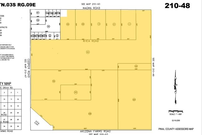
210-49-001B
N-1318.78 OF W-1684.34 OF SEC 34-3S-9E 51.00 AC
Farms
PINAL
UNDESIGNAT
Arizona
B and X Area of moderate flood hazard, usually the area between the limits of the 100-year and 500-year floods.
51 AC
2024
Pinal County
2025
Phoenix
000000
Phoenix-Mesa-Chandler, AZ
NEARBY LISTINGS FOR SALE OR LEASE
-
-
View all listings for sale on LoopNet.com
DEMOGRAPHICS near E Magma Rd
1 mile
3 mile
5 mile
2024 Total Population
183
5,185
14,052
2029 Population
229
6,228
16,936
Pop Growth 2024-2029
+ 25.14%
+ 20.12%
+ 20.52%
Average Age
36
35
42
2024 Total Households
62
1,624
5,003
HH Growth 2024-2029
+ 24.19%
+ 20.32%
+ 20.51%
Median Household Inc
$80,555
$83,273
$79,154
Avg Household Size
3.00
3.10
2.70
2024 Avg HH Vehicles
2.00
2.00
2.00
Median Home Value
$383,333
$364,991
$373,623
Median Year Built
2011
2010
2008
Nearby Places
Map Layers
Map Styles
 Street
 Aerial
Transit
 Traffic
 Biking
Places
Listings with unknown addresses are not visible on the map
- Restaurants
- Banks
- Shops
- Fitness
- Groceries
Nearby Properties
Address
Land Use
TOTAL SIZE
Lot Size
Zoning
Address
Land Use
TOTAL SIZE
Lot Size
Zoning
Address
Land Use
TOTAL SIZE
Lot Size
Zoning
6,685 SF
640.75 AC
Address
Land Use
TOTAL SIZE
Lot Size
Zoning
156.92 AC
CR3
Address
Land Use
TOTAL SIZE
Lot Size
Zoning
5,732 SF
639.08 AC
UNDESIGNAT
Address
Land Use
TOTAL SIZE
Lot Size
Zoning
5,000 SF
2.50 AC
GR
Address
Land Use
TOTAL SIZE
Lot Size
Zoning
936 SF
16.20 AC
Address
Land Use
TOTAL SIZE
Lot Size
Zoning
4,324 SF
23.51 AC
GR
Address
Land Use
TOTAL SIZE
Lot Size
Zoning
14.85 AC
GR
Address
Land Use
TOTAL SIZE
Lot Size
Zoning
2,520 SF
589 AC
UNDESIGNAT
Address
Land Use
TOTAL SIZE
Lot Size
Zoning
20 AC
UNDESIGNAT
Address
Land Use
TOTAL SIZE
Lot Size
Zoning
1,392 SF
11.36 AC
GR
Address
Land Use
TOTAL SIZE
Lot Size
Zoning
15.11 AC
GR
Address
Land Use
TOTAL SIZE
Lot Size
Zoning
60 AC
UNDESIGNAT
Address
Land Use
TOTAL SIZE
Lot Size
Zoning
884 SF
2.63 AC
Address
Land Use
TOTAL SIZE
Lot Size
Zoning
4,422 SF
179.40 AC
UNDESIGNAT
Address
Land Use
TOTAL SIZE
Lot Size
Zoning
5.31 AC
GR
Address
Land Use
TOTAL SIZE
Lot Size
Zoning
15.91 AC
GR
Address
Land Use
TOTAL SIZE
Lot Size
Zoning
472.45 AC
UNDESIGNAT
Address
Land Use
TOTAL SIZE
Lot Size
Zoning
2,144 SF
10 AC
GR
Address
Land Use
TOTAL SIZE
Lot Size
Zoning
3.23 AC
GR
Address
Land Use
TOTAL SIZE
Lot Size
Zoning
3.23 AC
GR
The World's #1 Commercial Real Estate Marketplace
Connect with us
© 2026 CoStar Group
The information above has been obtained from sources believed reliable. While we do not doubt its accuracy we have not verified it and make no guarantee, warranty or representation about it. It is your responsibility to independently confirm its accuracy and completeness. Any projections, opinions, assumptions, or estimates used are for example only and do not represent the current or future performance of the property. The value of this transaction to you depends on tax and other factors which should be evaluated by your tax, financial, and legal advisors. You and your advisors should conduct a careful, independent investigation of the property to determine to your satisfaction the suitability of the property for your needs.