Property Record
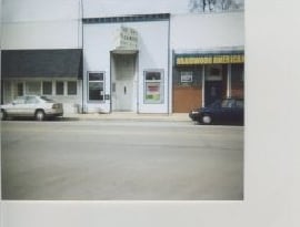
E Main St, Braidwood, IL 60408

Property Detail
E Main St
Chicago-Naperville-Elgin, IL-IN
LOT 1 IN CASEY'S CONSOLIDATION, PRT OF SUBLOTS 1 THRU 5 OF LOT 11 IN BLK 13 OF CHICAGO WILMINGTON COAL COMPANY'S SUB, PRT OF
02-24-08-402-046
WILL
Commercialnec
Illinois
B and X Area of moderate flood hazard, usually the area between the limits of the 100-year and 500-year floods.
11
2025
1.05 AC
2024
Joliet/Central Will
884003
Chicago
NEARBY LISTINGS FOR SALE OR LEASE
DEMOGRAPHICS near E Main St
1 mile
3 mile
5 mile
2025 Total Population
4,074
10,833
25,646
2030 Population
4,239
11,280
26,447
Pop Growth 2025-2030
+ 4.05%
+ 4.13%
+ 3.12%
Average Age
41
42
41
2025 Total Households
1,589
4,349
10,317
HH Growth 2025-2030
+ 4.28%
+ 4.39%
+ 3.29%
Median Household Inc
$92,129
$84,031
$77,103
Avg Household Size
2.50
2.50
2.40
2025 Avg HH Vehicles
2.00
2.00
2.00
Median Home Value
$235,815
$229,967
$233,874
Median Year Built
1993
1994
1986
Nearby Places
Map Layers
Map Styles
 Street
 Aerial
Layers
 Traffic
 Biking
Places
Listings with unknown addresses are not visible on the map
- Restaurants
- Banks
- Shops
- Fitness
- Groceries
Nearby Properties
Address
Land Use
TOTAL SIZE
Lot Size
Zoning
Address
Land Use
TOTAL SIZE
Lot Size
Zoning
38.30 AC
Address
Land Use
TOTAL SIZE
Lot Size
Zoning
38.30 AC
Address
Land Use
TOTAL SIZE
Lot Size
Zoning
Address
Land Use
TOTAL SIZE
Lot Size
Zoning
249.30 AC
Address
Land Use
TOTAL SIZE
Lot Size
Zoning
Address
Land Use
TOTAL SIZE
Lot Size
Zoning
29.49 AC
Address
Land Use
TOTAL SIZE
Lot Size
Zoning
5.36 AC
Address
Land Use
TOTAL SIZE
Lot Size
Zoning
6,696 SF
0.44 AC
Address
Land Use
TOTAL SIZE
Lot Size
Zoning
Address
Land Use
TOTAL SIZE
Lot Size
Zoning
6,696 SF
0.43 AC
Address
Land Use
TOTAL SIZE
Lot Size
Zoning
2.67 AC
Address
Land Use
TOTAL SIZE
Lot Size
Zoning
34.71 AC
Address
Land Use
TOTAL SIZE
Lot Size
Zoning
7,296 SF
0.47 AC
Address
Land Use
TOTAL SIZE
Lot Size
Zoning
7,296 SF
0.38 AC
Address
Land Use
TOTAL SIZE
Lot Size
Zoning
0.20 AC
Address
Land Use
TOTAL SIZE
Lot Size
Zoning
463.85 AC
Address
Land Use
TOTAL SIZE
Lot Size
Zoning
1,944 SF
0.38 AC
Address
Land Use
TOTAL SIZE
Lot Size
Zoning
3,190 SF
0.55 AC
Address
Land Use
TOTAL SIZE
Lot Size
Zoning
64.17 AC
Address
Land Use
TOTAL SIZE
Lot Size
Zoning
7,200 SF
0.94 AC
Address
Land Use
TOTAL SIZE
Lot Size
Zoning
7,692 SF
0.37 AC
Address
Land Use
TOTAL SIZE
Lot Size
Zoning
Address
Land Use
TOTAL SIZE
Lot Size
Zoning
0.60 AC
Address
Land Use
TOTAL SIZE
Lot Size
Zoning
0.54 AC
Address
Land Use
TOTAL SIZE
Lot Size
Zoning
Address
Land Use
TOTAL SIZE
Lot Size
Zoning
1.42 AC
Address
Land Use
TOTAL SIZE
Lot Size
Zoning
Address
Land Use
TOTAL SIZE
Lot Size
Zoning
0.93 AC
Address
Land Use
TOTAL SIZE
Lot Size
Zoning
317.30 AC
The World's #1 Commercial Real Estate Marketplace
Connect with us
© 2026 CoStar Group
The information above has been obtained from sources believed reliable. While we do not doubt its accuracy we have not verified it and make no guarantee, warranty or representation about it. It is your responsibility to independently confirm its accuracy and completeness. Any projections, opinions, assumptions, or estimates used are for example only and do not represent the current or future performance of the property. The value of this transaction to you depends on tax and other factors which should be evaluated by your tax, financial, and legal advisors. You and your advisors should conduct a careful, independent investigation of the property to determine to your satisfaction the suitability of the property for your needs.