Property Record
E Main St S, Collinsville, OK 74021
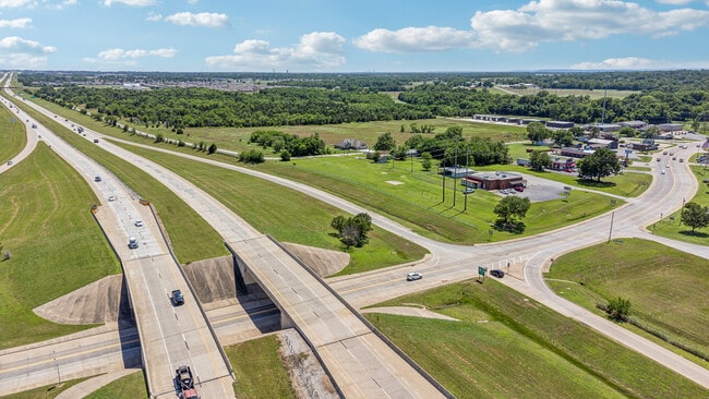
Property Detail
E Main St S
Tulsa, OK
PRT NE NW BEG SWC LT 21 VACATED GARDEN PLACE TH N566.38 NELY ON CRV RT39.63 S194.65 SELY ON CRV LF377.30 W88.15 POB SEC 28 22 14 .659AC
92428-24-28-00650
TULSA
Commercialacreage
Oklahoma
CG
21
B and X Area of moderate flood hazard, usually the area between the limits of the 100-year and 500-year floods.
0.33 AC
2025
Northeast
2025
Tulsa
005403
NEARBY LISTINGS FOR SALE OR LEASE
DEMOGRAPHICS near E Main St S
1 mile
3 mile
5 mile
2025 Total Population
2,534
13,904
38,432
2030 Population
2,647
14,484
40,016
Pop Growth 2025-2030
+ 4.46%
+ 4.17%
+ 4.12%
Average Age
40
39
38
2025 Total Households
969
5,211
14,006
HH Growth 2025-2030
+ 4.54%
+ 4.28%
+ 4.20%
Median Household Inc
$83,781
$86,512
$89,372
Avg Household Size
2.60
2.60
2.70
2025 Avg HH Vehicles
2.00
2.00
2.00
Median Home Value
$232,500
$240,854
$257,118
Median Year Built
1982
1998
2002
Nearby Places
Map Layers
Map Styles
 Street
 Aerial
Layers
 Traffic
 Biking
Places
Listings with unknown addresses are not visible on the map
- Restaurants
- Banks
- Shops
- Fitness
- Groceries
PUBLIC TRANSPORTATION
AIRPORT
Tulsa International
Drive
Walk
Distance
Tulsa International
19 min
14.3 mi
Freight Ports
Tulsa Port Of Catoosa
Drive
Walk
Distance
Tulsa Port Of Catoosa
22 min
17.2 mi
Nearby Properties
Address
Land Use
TOTAL SIZE
Lot Size
Zoning
Address
Land Use
TOTAL SIZE
Lot Size
Zoning
47,798 SF
5.13 AC
CS
Address
Land Use
TOTAL SIZE
Lot Size
Zoning
25,603 SF
4.64 AC
RM1
Address
Land Use
TOTAL SIZE
Lot Size
Zoning
22,679 SF
0.77 AC
CBD
Address
Land Use
TOTAL SIZE
Lot Size
Zoning
40,100 SF
4.36 AC
IM
Address
Land Use
TOTAL SIZE
Lot Size
Zoning
22,874 SF
1.29 AC
CBD
Address
Land Use
TOTAL SIZE
Lot Size
Zoning
41,764 SF
17.87 AC
AG
Address
Land Use
TOTAL SIZE
Lot Size
Zoning
28,400 SF
12.66 AC
AG
Address
Land Use
TOTAL SIZE
Lot Size
Zoning
42,211 SF
0.65 AC
RS3
Address
Land Use
TOTAL SIZE
Lot Size
Zoning
32,575 SF
39.50 AC
AG
Address
Land Use
TOTAL SIZE
Lot Size
Zoning
20,952 SF
5.01 AC
AG
Address
Land Use
TOTAL SIZE
Lot Size
Zoning
61,622 SF
13.96 AC
CG
Address
Land Use
TOTAL SIZE
Lot Size
Zoning
33,157 SF
3.82 AC
AGR
Address
Land Use
TOTAL SIZE
Lot Size
Zoning
14,934 SF
9.15 AC
AG
Address
Land Use
TOTAL SIZE
Lot Size
Zoning
10,701 SF
0.96 AC
CBD
Address
Land Use
TOTAL SIZE
Lot Size
Zoning
143,419 SF
29.73 AC
IM
Address
Land Use
TOTAL SIZE
Lot Size
Zoning
6,035 SF
0.35 AC
CBD
Address
Land Use
TOTAL SIZE
Lot Size
Zoning
17,044 SF
5.28 AC
RD
Address
Land Use
TOTAL SIZE
Lot Size
Zoning
34,568 SF
4.26 AC
RM2
Address
Land Use
TOTAL SIZE
Lot Size
Zoning
36,647 SF
1.93 AC
AGR
Address
Land Use
TOTAL SIZE
Lot Size
Zoning
15,398 SF
19.27 AC
AG
Address
Land Use
TOTAL SIZE
Lot Size
Zoning
16,942 SF
5.80 AC
AG
Address
Land Use
TOTAL SIZE
Lot Size
Zoning
16,097 SF
6.06 AC
AG
Address
Land Use
TOTAL SIZE
Lot Size
Zoning
6,125 SF
17.83 AC
AG
Address
Land Use
TOTAL SIZE
Lot Size
Zoning
5,852 SF
1.04 AC
CS
Address
Land Use
TOTAL SIZE
Lot Size
Zoning
9,068 SF
0.33 AC
CBD
Address
Land Use
TOTAL SIZE
Lot Size
Zoning
10,700 SF
17.32 AC
AG
Address
Land Use
TOTAL SIZE
Lot Size
Zoning
5,625 SF
0.29 AC
CBD
Address
Land Use
TOTAL SIZE
Lot Size
Zoning
11,586 SF
0.65 AC
RS3
Address
Land Use
TOTAL SIZE
Lot Size
Zoning
12,434 SF
9.66 AC
AG
Address
Land Use
TOTAL SIZE
Lot Size
Zoning
17,607 SF
0.31 AC
CBD
The World's #1 Commercial Real Estate Marketplace
Connect with us
© 2026 CoStar Group
The information above has been obtained from sources believed reliable. While we do not doubt its accuracy we have not verified it and make no guarantee, warranty or representation about it. It is your responsibility to independently confirm its accuracy and completeness. Any projections, opinions, assumptions, or estimates used are for example only and do not represent the current or future performance of the property. The value of this transaction to you depends on tax and other factors which should be evaluated by your tax, financial, and legal advisors. You and your advisors should conduct a careful, independent investigation of the property to determine to your satisfaction the suitability of the property for your needs.