Property Record
E Mckay St, Bladenboro, NC 28320

Property Detail
E Mckay St
131112865409
131112865409 OFF MCLEOD ST
Commercialacreage
BLADEN
B and X Area of moderate flood hazard, usually the area between the limits of the 100-year and 500-year floods.
North Carolina
2025
0.45 AC
2025
North Carolina Southeast Area
950501
Other Market Areas
NEARBY LISTINGS FOR SALE OR LEASE
-
-
View all Bladenboro listings for sale on LoopNet.com
DEMOGRAPHICS near E Mckay St
1 mile
3 mile
5 mile
2025 Total Population
2,125
4,560
6,262
2030 Population
2,128
4,540
6,240
Pop Growth 2025-2030
+ 0.14%
(0.44%)
(0.35%)
Average Age
45
44
43
2025 Total Households
943
1,933
2,620
HH Growth 2025-2030
+ 0.11%
(0.52%)
(0.38%)
Median Household Inc
$25,545
$31,966
$34,147
Avg Household Size
2.00
2.20
2.30
2025 Avg HH Vehicles
1.00
2.00
2.00
Median Home Value
$135,437
$183,974
$199,117
Median Year Built
1976
1976
1978
Nearby Places
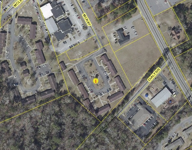
Map Layers
Map Styles
 Street
 Aerial
Layers
 Traffic
 Biking
Places
Listings with unknown addresses are not visible on the map
- Restaurants
- Banks
- Shops
- Fitness
- Groceries
PUBLIC TRANSPORTATION
AIRPORT
Fayetteville Regional/Grannis Field
Drive
Walk
Distance
Fayetteville Regional/Grannis Field
59 min
40.1 mi
Freight Ports
Port of Wilmington
Drive
Walk
Distance
Port of Wilmington
76 min
52.5 mi
SALE & LEASE HISTORY
LISTING DATE
SALE/LEASE

Jan 14, 2019
For Sale
Nearby Properties
Address
Land Use
TOTAL SIZE
Lot Size
Zoning
Address
Land Use
TOTAL SIZE
Lot Size
Zoning
170,001 SF
58.60 AC
Address
Land Use
TOTAL SIZE
Lot Size
Zoning
70,401 SF
9.56 AC
Address
Land Use
TOTAL SIZE
Lot Size
Zoning
32,968 SF
3.58 AC
Address
Land Use
TOTAL SIZE
Lot Size
Zoning
48,583 SF
22.19 AC
Address
Land Use
TOTAL SIZE
Lot Size
Zoning
57,966 SF
48.40 AC
Address
Land Use
TOTAL SIZE
Lot Size
Zoning
68,097 SF
1.60 AC
Address
Land Use
TOTAL SIZE
Lot Size
Zoning
169,087 SF
17.32 AC
Address
Land Use
TOTAL SIZE
Lot Size
Zoning
164,976 SF
81.06 AC
Address
Land Use
TOTAL SIZE
Lot Size
Zoning
44,153 SF
5.40 AC
Address
Land Use
TOTAL SIZE
Lot Size
Zoning
20,223 SF
2.90 AC
Address
Land Use
TOTAL SIZE
Lot Size
Zoning
50,454 SF
3.68 AC
Address
Land Use
TOTAL SIZE
Lot Size
Zoning
29,367 SF
4.90 AC
Address
Land Use
TOTAL SIZE
Lot Size
Zoning
24,272 SF
5.65 AC
Address
Land Use
TOTAL SIZE
Lot Size
Zoning
4,605 SF
227.04 AC
Address
Land Use
TOTAL SIZE
Lot Size
Zoning
45,960 SF
4.61 AC
Address
Land Use
TOTAL SIZE
Lot Size
Zoning
41,600 SF
1.97 AC
Address
Land Use
TOTAL SIZE
Lot Size
Zoning
26,102 SF
2.23 AC
RA
Address
Land Use
TOTAL SIZE
Lot Size
Zoning
18,087 SF
2.29 AC
Address
Land Use
TOTAL SIZE
Lot Size
Zoning
21,344 SF
2.64 AC
Address
Land Use
TOTAL SIZE
Lot Size
Zoning
37,206 SF
5.58 AC
Address
Land Use
TOTAL SIZE
Lot Size
Zoning
23,326 SF
2.53 AC
Address
Land Use
TOTAL SIZE
Lot Size
Zoning
2,520 SF
10.67 AC
Address
Land Use
TOTAL SIZE
Lot Size
Zoning
8,192 SF
1.70 AC
Address
Land Use
TOTAL SIZE
Lot Size
Zoning
40,000 SF
8.99 AC
Address
Land Use
TOTAL SIZE
Lot Size
Zoning
20,218 SF
4.90 AC
Address
Land Use
TOTAL SIZE
Lot Size
Zoning
14,400 SF
0.43 AC
Address
Land Use
TOTAL SIZE
Lot Size
Zoning
55,917 SF
3.20 AC
Address
Land Use
TOTAL SIZE
Lot Size
Zoning
8,000 SF
1.58 AC
Address
Land Use
TOTAL SIZE
Lot Size
Zoning
7,998 SF
2.48 AC
RA
Address
Land Use
TOTAL SIZE
Lot Size
Zoning
6,981 SF
1.40 AC
The World's #1 Commercial Real Estate Marketplace
Connect with us
© 2026 CoStar Group
The information above has been obtained from sources believed reliable. While we do not doubt its accuracy we have not verified it and make no guarantee, warranty or representation about it. It is your responsibility to independently confirm its accuracy and completeness. Any projections, opinions, assumptions, or estimates used are for example only and do not represent the current or future performance of the property. The value of this transaction to you depends on tax and other factors which should be evaluated by your tax, financial, and legal advisors. You and your advisors should conduct a careful, independent investigation of the property to determine to your satisfaction the suitability of the property for your needs.