Property Record
E Owassa Rd, Pharr, TX 78577
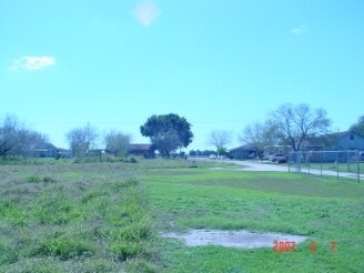

Property Detail
E Owassa Rd
McAllen/Edinburg/Pharr
KELLY PHARR TRACT E600-W660-N990-S1320 LOT 78 13.34AC
McAllen-Edinburg-Mission, TX
HIDALGO
K2400-00-000-0078-02
Texas
Agriculturalland
78
2024
13.34 AC
2025
Pharr
021702
NEARBY LISTINGS FOR SALE OR LEASE
DEMOGRAPHICS near E Owassa Rd
1 mile
3 mile
5 mile
2025 Total Population
9,219
89,172
256,557
2030 Population
9,765
93,048
268,521
Pop Growth 2025-2030
+ 5.92%
+ 4.35%
+ 4.66%
Average Age
33
34
35
2025 Total Households
2,847
28,239
83,782
HH Growth 2025-2030
+ 6.18%
+ 4.41%
+ 4.66%
Median Household Inc
$64,121
$62,728
$57,377
Avg Household Size
3.20
3.10
3.00
2025 Avg HH Vehicles
2.00
2.00
2.00
Median Home Value
$192,378
$183,266
$171,939
Median Year Built
2005
2002
1997
Nearby Places
Map Layers
Map Styles
 Street
 Aerial
Transit
 Traffic
 Biking
Places
Listings with unknown addresses are not visible on the map
- Restaurants
- Banks
- Shops
- Fitness
- Groceries
PUBLIC TRANSPORTATION
AIRPORT
McAllen International
Drive
Walk
Distance
McAllen International
13 min
7.9 mi
Freight Ports
Port of Brownsville
Drive
Walk
Distance
Port of Brownsville
68 min
59.1 mi
Nearby Properties
Address
Land Use
TOTAL SIZE
Lot Size
Zoning
Address
Land Use
TOTAL SIZE
Lot Size
Zoning
543,452 SF
53.23 AC
CO
Address
Land Use
TOTAL SIZE
Lot Size
Zoning
27.19 AC
Address
Land Use
TOTAL SIZE
Lot Size
Zoning
407,190 SF
11.04 AC
CO
Address
Land Use
TOTAL SIZE
Lot Size
Zoning
357,818 SF
11.10 AC
Address
Land Use
TOTAL SIZE
Lot Size
Zoning
1 SF
9.36 AC
Address
Land Use
TOTAL SIZE
Lot Size
Zoning
393,960 SF
60.24 AC
Address
Land Use
TOTAL SIZE
Lot Size
Zoning
85,083 SF
12.84 AC
CO
Address
Land Use
TOTAL SIZE
Lot Size
Zoning
108,575 SF
12.77 AC
Address
Land Use
TOTAL SIZE
Lot Size
Zoning
15,542 SF
34.23 AC
Address
Land Use
TOTAL SIZE
Lot Size
Zoning
210,263 SF
37.52 AC
Address
Land Use
TOTAL SIZE
Lot Size
Zoning
112,792 SF
29 AC
Address
Land Use
TOTAL SIZE
Lot Size
Zoning
184,900 SF
20.82 AC
Address
Land Use
TOTAL SIZE
Lot Size
Zoning
40,248 SF
10.36 AC
Address
Land Use
TOTAL SIZE
Lot Size
Zoning
205,008 SF
22.13 AC
Address
Land Use
TOTAL SIZE
Lot Size
Zoning
16.83 AC
CO
Address
Land Use
TOTAL SIZE
Lot Size
Zoning
82,724 SF
3.27 AC
Address
Land Use
TOTAL SIZE
Lot Size
Zoning
67,995 SF
21.10 AC
Address
Land Use
TOTAL SIZE
Lot Size
Zoning
82,448 SF
4.36 AC
Address
Land Use
TOTAL SIZE
Lot Size
Zoning
78,524 SF
3.83 AC
Address
Land Use
TOTAL SIZE
Lot Size
Zoning
190,712 SF
72.53 AC
GT
Address
Land Use
TOTAL SIZE
Lot Size
Zoning
85,927 SF
3.59 AC
Address
Land Use
TOTAL SIZE
Lot Size
Zoning
174,041 SF
14.66 AC
Address
Land Use
TOTAL SIZE
Lot Size
Zoning
65,496 SF
19.31 AC
CO
Address
Land Use
TOTAL SIZE
Lot Size
Zoning
4 SF
20.92 AC
Address
Land Use
TOTAL SIZE
Lot Size
Zoning
5 SF
71.98 AC
CO
Address
Land Use
TOTAL SIZE
Lot Size
Zoning
200,502 SF
13 AC
CO
Address
Land Use
TOTAL SIZE
Lot Size
Zoning
109,852 SF
10.43 AC
Address
Land Use
TOTAL SIZE
Lot Size
Zoning
88,970 SF
7.96 AC
Address
Land Use
TOTAL SIZE
Lot Size
Zoning
72,284 SF
39.11 AC
Address
Land Use
TOTAL SIZE
Lot Size
Zoning
73,272 SF
32.88 AC
The World's #1 Commercial Real Estate Marketplace
Connect with us
© 2026 CoStar Group
The information above has been obtained from sources believed reliable. While we do not doubt its accuracy we have not verified it and make no guarantee, warranty or representation about it. It is your responsibility to independently confirm its accuracy and completeness. Any projections, opinions, assumptions, or estimates used are for example only and do not represent the current or future performance of the property. The value of this transaction to you depends on tax and other factors which should be evaluated by your tax, financial, and legal advisors. You and your advisors should conduct a careful, independent investigation of the property to determine to your satisfaction the suitability of the property for your needs.