Property Record
E Red Hawk Rd, Littlefield, AZ 86432
Save to a Folder
{{folder.Name}}
{{folder.ListingIds.length}} Properties
{{folder.ListingIds.length}} Property
Create a New Folder
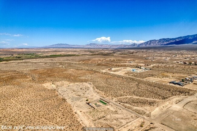
Property Detail
E Red Hawk Rd
Lake Havasu City-Kingman, AZ
W2 S2 NE4 NE4 CONT 10 ACRES ML 402-84-008(402-84-013 & 014)
402-84-020
MOHAVE
Vacantlandnec
Arizona
B and X Area of moderate flood hazard, usually the area between the limits of the 100-year and 500-year floods.
8.66 AC
2025
Grand Canyon Area
2027
Other Market Areas
950101
NEARBY LISTINGS FOR SALE OR LEASE
DEMOGRAPHICS near E Red Hawk Rd
1 mile
3 mile
5 mile
2025 Total Population
73
7,555
23,537
2030 Population
67
7,973
25,282
Pop Growth 2025-2030
(8.22%)
+ 5.53%
+ 7.41%
Average Age
49
46
52
2025 Total Households
29
3,036
10,526
HH Growth 2025-2030
(6.90%)
+ 5.43%
+ 7.63%
Median Household Inc
$24,166
$65,064
$73,705
Avg Household Size
2.30
2.40
2.20
2025 Avg HH Vehicles
2.00
2.00
2.00
Median Home Value
$350,000
$355,578
$407,393
Median Year Built
2005
1999
2003
Nearby Places
Map Layers
Map Styles
 Street
 Aerial
Layers
 Traffic
 Biking
Places
Listings with unknown addresses are not visible on the map
- Restaurants
- Banks
- Shops
- Fitness
- Groceries
SALE & LEASE HISTORY
LISTING DATE
SALE/LEASE

Nov 29, 2021
For Sale
Nearby Properties
Address
Land Use
TOTAL SIZE
Lot Size
Zoning
Address
Land Use
TOTAL SIZE
Lot Size
Zoning
197,938 SF
35.63 AC
HT
Address
Land Use
TOTAL SIZE
Lot Size
Zoning
123,397 SF
26.60 AC
HT
Address
Land Use
TOTAL SIZE
Lot Size
Zoning
33.73 AC
PF
Address
Land Use
TOTAL SIZE
Lot Size
Zoning
37.78 AC
PROS
Address
Land Use
TOTAL SIZE
Lot Size
Zoning
12.49 AC
PF
Address
Land Use
TOTAL SIZE
Lot Size
Zoning
67,184 SF
14.69 AC
HT
Address
Land Use
TOTAL SIZE
Lot Size
Zoning
10.09 AC
PF
Address
Land Use
TOTAL SIZE
Lot Size
Zoning
47,328 SF
4.65 AC
CR2
Address
Land Use
TOTAL SIZE
Lot Size
Zoning
1,056 SF
5.96 AC
MF4
Address
Land Use
TOTAL SIZE
Lot Size
Zoning
60,114 SF
5.54 AC
HT
Address
Land Use
TOTAL SIZE
Lot Size
Zoning
17,110 SF
2.11 AC
Address
Land Use
TOTAL SIZE
Lot Size
Zoning
13,286 SF
1.63 AC
Address
Land Use
TOTAL SIZE
Lot Size
Zoning
4.11 AC
CR3
Address
Land Use
TOTAL SIZE
Lot Size
Zoning
Address
Land Use
TOTAL SIZE
Lot Size
Zoning
52,240 SF
3.74 AC
CR2
Address
Land Use
TOTAL SIZE
Lot Size
Zoning
6.85 AC
PF
Address
Land Use
TOTAL SIZE
Lot Size
Zoning
6,279 SF
4.02 AC
Address
Land Use
TOTAL SIZE
Lot Size
Zoning
20,299 SF
0.99 AC
CR2
Address
Land Use
TOTAL SIZE
Lot Size
Zoning
312.64 AC
Address
Land Use
TOTAL SIZE
Lot Size
Zoning
35,886 SF
3.03 AC
CR2
Address
Land Use
TOTAL SIZE
Lot Size
Zoning
47,156 SF
2.95 AC
CR3
Address
Land Use
TOTAL SIZE
Lot Size
Zoning
24,487 SF
2.23 AC
HT
Address
Land Use
TOTAL SIZE
Lot Size
Zoning
6,131 SF
2.04 AC
Address
Land Use
TOTAL SIZE
Lot Size
Zoning
39,852 SF
4.12 AC
Address
Land Use
TOTAL SIZE
Lot Size
Zoning
15,512 SF
3.11 AC
PUD
Address
Land Use
TOTAL SIZE
Lot Size
Zoning
26.69 AC
HT
Address
Land Use
TOTAL SIZE
Lot Size
Zoning
28,773 SF
1.73 AC
CR2
Address
Land Use
TOTAL SIZE
Lot Size
Zoning
1,511 SF
3.53 AC
PF
The World's #1 Commercial Real Estate Marketplace
Connect with us
© 2026 CoStar Group
The information above has been obtained from sources believed reliable. While we do not doubt its accuracy we have not verified it and make no guarantee, warranty or representation about it. It is your responsibility to independently confirm its accuracy and completeness. Any projections, opinions, assumptions, or estimates used are for example only and do not represent the current or future performance of the property. The value of this transaction to you depends on tax and other factors which should be evaluated by your tax, financial, and legal advisors. You and your advisors should conduct a careful, independent investigation of the property to determine to your satisfaction the suitability of the property for your needs.