Property Record
E Reid Rd, Grand Blanc, MI 48439

Save to a Folder
{{folder.Name}}
{{folder.ListingIds.length}} Properties
{{folder.ListingIds.length}} Property
Create a New Folder
Current Lease Availabilities
Property Detail
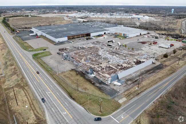
E Reid Rd
12-16-100-014
A PARCEL OF LAND BEG S 89 DEG 57 MIN 10 SEC E 1334.40 FT & S 0 DEG 05 MIN 20 SEC W 545.44 FT FROM NW COR OF SEC TH S 48 DEG
Industrialacreage
GENESEE
I-2
Michigan
B and X Area of moderate flood hazard, usually the area between the limits of the 100-year and 500-year floods.
3.18 AC
2025
Flint
2025
Detroit
011210
Flint, MI
NEARBY LISTINGS FOR SALE OR LEASE
DEMOGRAPHICS near E Reid Rd
1 mile
3 mile
5 mile
2025 Total Population
3,383
39,370
89,596
2030 Population
3,351
38,699
88,563
Pop Growth 2025-2030
(0.95%)
(1.70%)
(1.15%)
Average Age
41
40
40
2025 Total Households
1,395
16,622
36,945
HH Growth 2025-2030
(0.93%)
(1.78%)
(1.22%)
Median Household Inc
$65,585
$74,800
$67,878
Avg Household Size
2.40
2.30
2.40
2025 Avg HH Vehicles
2.00
2.00
2.00
Median Home Value
$224,734
$231,332
$208,192
Median Year Built
1968
1976
1972
Nearby Places
Map Layers
Map Styles
 Street
 Aerial
Layers
 Traffic
 Biking
Places
Listings with unknown addresses are not visible on the map
- Restaurants
- Banks
- Shops
- Fitness
- Groceries
PUBLIC TRANSPORTATION
COMMUTER RAIL
Flint Amtrak Station (Blue Water - Amtrak)
Drive
Walk
Distance
Flint Amtrak Station (Blue Water - Amtrak)
11 min
6.5 mi
AIRPORT
Bishop International
Drive
Walk
Distance
Bishop International
22 min
8.4 mi
Freight Ports
Port of Toledo
Drive
Walk
Distance
Port of Toledo
133 min
105.3 mi
Nearby Properties
Address
Land Use
TOTAL SIZE
Lot Size
Zoning
Address
Land Use
TOTAL SIZE
Lot Size
Zoning
331,630 SF
63.88 AC
MDM
Address
Land Use
TOTAL SIZE
Lot Size
Zoning
55,378 SF
23 AC
PO
Address
Land Use
TOTAL SIZE
Lot Size
Zoning
507,562 SF
39.37 AC
HDM
Address
Land Use
TOTAL SIZE
Lot Size
Zoning
51.26 AC
HDM
Address
Land Use
TOTAL SIZE
Lot Size
Zoning
248,816 SF
20.22 AC
HCD
Address
Land Use
TOTAL SIZE
Lot Size
Zoning
155,220 SF
33.46 AC
GC
Address
Land Use
TOTAL SIZE
Lot Size
Zoning
295,620 SF
25.62 AC
MDM
Address
Land Use
TOTAL SIZE
Lot Size
Zoning
33.65 AC
MDM
Address
Land Use
TOTAL SIZE
Lot Size
Zoning
86,286 SF
71.83 AC
HCD
Address
Land Use
TOTAL SIZE
Lot Size
Zoning
147,756 SF
59.86 AC
R2
Address
Land Use
TOTAL SIZE
Lot Size
Zoning
210,684 SF
27.06 AC
GC
Address
Land Use
TOTAL SIZE
Lot Size
Zoning
173,074 SF
10 AC
MDM
Address
Land Use
TOTAL SIZE
Lot Size
Zoning
223,683 SF
24.88 AC
MDM
Address
Land Use
TOTAL SIZE
Lot Size
Zoning
612,305 SF
116.49 AC
I-2
Address
Land Use
TOTAL SIZE
Lot Size
Zoning
157,756 SF
21.17 AC
MDM
Address
Land Use
TOTAL SIZE
Lot Size
Zoning
78,517 SF
16.80 AC
GC
Address
Land Use
TOTAL SIZE
Lot Size
Zoning
125,825 SF
13.01 AC
B-2
Address
Land Use
TOTAL SIZE
Lot Size
Zoning
674,049 SF
24.02 AC
I-2
Address
Land Use
TOTAL SIZE
Lot Size
Zoning
141,748 SF
8.80 AC
MDM
Address
Land Use
TOTAL SIZE
Lot Size
Zoning
64,897 SF
1.86 AC
GC
Address
Land Use
TOTAL SIZE
Lot Size
Zoning
104,040 SF
17.02 AC
MDM
Address
Land Use
TOTAL SIZE
Lot Size
Zoning
36,638 SF
10.01 AC
GC
Address
Land Use
TOTAL SIZE
Lot Size
Zoning
88,701 SF
10.27 AC
GC
Address
Land Use
TOTAL SIZE
Lot Size
Zoning
137,169 SF
18.50 AC
GC
Address
Land Use
TOTAL SIZE
Lot Size
Zoning
210.33 AC
MHP
Address
Land Use
TOTAL SIZE
Lot Size
Zoning
51,625 SF
6 AC
HCD
Address
Land Use
TOTAL SIZE
Lot Size
Zoning
131,682 SF
11.51 AC
MDM
Address
Land Use
TOTAL SIZE
Lot Size
Zoning
58,648 SF
5.80 AC
OS
Address
Land Use
TOTAL SIZE
Lot Size
Zoning
9.88 AC
HDM
Address
Land Use
TOTAL SIZE
Lot Size
Zoning
48,275 SF
8.69 AC
OS
The World's #1 Commercial Real Estate Marketplace
Connect with us
© 2026 CoStar Group
The information above has been obtained from sources believed reliable. While we do not doubt its accuracy we have not verified it and make no guarantee, warranty or representation about it. It is your responsibility to independently confirm its accuracy and completeness. Any projections, opinions, assumptions, or estimates used are for example only and do not represent the current or future performance of the property. The value of this transaction to you depends on tax and other factors which should be evaluated by your tax, financial, and legal advisors. You and your advisors should conduct a careful, independent investigation of the property to determine to your satisfaction the suitability of the property for your needs.