Property Record
E Rodeo Rd, Casa Grande, AZ 85122


NEARBY LISTINGS FOR SALE OR LEASE
Property Detail
E Rodeo Rd
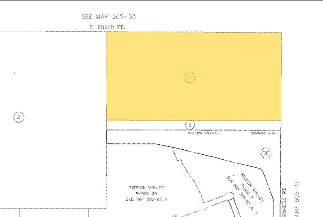
505-10-001
N1/2 NE OF SEC 10-6S-6E 80.00 AC
Vacantlandnec
Pinal
AE
Arizona
04021C1190E
80 AC
2024
Pinal County
2025
Phoenix
001305
Phoenix-Mesa-Chandler, AZ
DEMOGRAPHICS near E Rodeo Rd
1 Mile
3 Mile
5 Mile
2024 Total Population
3,688
35,518
67,719
2029 Population
4,658
45,083
85,974
Pop Growth 2024-2029
+ 26.30%
+ 26.93%
+ 26.96%
Average Age
35
40
41
2024 Total Households
1,071
12,847
24,763
HH Growth 2024-2029
+ 26.33%
+ 26.51%
+ 26.48%
Median Household Inc
$83,901
$70,345
$65,187
Avg Household Size
3.30
2.70
2.70
2024 Avg HH Vehicles
2.00
2.00
2.00
Median Home Value
$319,331
$272,958
$260,964
Median Year Built
2005
2003
2001
Nearby Places
Map Layers
Map Styles
 Street
 Aerial
- Restaurants
- Banks
- Shops
- Fitness
- Groceries
PUBLIC TRANSPORTATION
AIRPORT
Phoenix-Mesa Gateway
DRIVE
WALK
Distance
Phoenix-Mesa Gateway
65 min
43.0 mi
Freight Ports
Port of San Diego
DRIVE
WALK
Distance
Port of San Diego
384 min
353.0 mi
Nearby Properties
Address
Land Use
TOTAL SIZE
Lot Size
Zoning
Address
Land Use
TOTAL SIZE
Lot Size
Zoning
48,433 SF
266.50 AC
Address
Land Use
TOTAL SIZE
Lot Size
Zoning
216,795 SF
11.15 AC
Address
Land Use
TOTAL SIZE
Lot Size
Zoning
289,599 SF
65.03 AC
Address
Land Use
TOTAL SIZE
Lot Size
Zoning
196,294 SF
4.24 AC
Address
Land Use
TOTAL SIZE
Lot Size
Zoning
63,541 SF
12.10 AC
Address
Land Use
TOTAL SIZE
Lot Size
Zoning
55,295 SF
12.14 AC
Address
Land Use
TOTAL SIZE
Lot Size
Zoning
131,275 SF
8.85 AC
Address
Land Use
TOTAL SIZE
Lot Size
Zoning
107,832 SF
11.50 AC
Address
Land Use
TOTAL SIZE
Lot Size
Zoning
42,077 SF
3.37 AC
Address
Land Use
TOTAL SIZE
Lot Size
Zoning
81,467 SF
11.96 AC
Address
Land Use
TOTAL SIZE
Lot Size
Zoning
137,735 SF
14.12 AC
Address
Land Use
TOTAL SIZE
Lot Size
Zoning
100,086 SF
8.24 AC
Address
Land Use
TOTAL SIZE
Lot Size
Zoning
43,355 SF
5.91 AC
Address
Land Use
TOTAL SIZE
Lot Size
Zoning
45,799 SF
7.24 AC
Address
Land Use
TOTAL SIZE
Lot Size
Zoning
115,058 SF
13.41 AC
UNDESIGNAT
Address
Land Use
TOTAL SIZE
Lot Size
Zoning
48,543 SF
3.04 AC
UNDESIGNAT
Address
Land Use
TOTAL SIZE
Lot Size
Zoning
28,115 SF
8.92 AC
Address
Land Use
TOTAL SIZE
Lot Size
Zoning
39,422 SF
2.04 AC
Address
Land Use
TOTAL SIZE
Lot Size
Zoning
59.61 AC
UNDESIGNAT
Address
Land Use
TOTAL SIZE
Lot Size
Zoning
13,414 SF
2.01 AC
Address
Land Use
TOTAL SIZE
Lot Size
Zoning
40,859 SF
3.77 AC
Address
Land Use
TOTAL SIZE
Lot Size
Zoning
78,092 SF
3.95 AC
UNDESIGNAT
Address
Land Use
TOTAL SIZE
Lot Size
Zoning
39,634 SF
1.79 AC
UNDESIGNAT
Address
Land Use
TOTAL SIZE
Lot Size
Zoning
15.11 AC
Address
Land Use
TOTAL SIZE
Lot Size
Zoning
41,018 SF
4.91 AC
Address
Land Use
TOTAL SIZE
Lot Size
Zoning
55,164 SF
5.20 AC
Address
Land Use
TOTAL SIZE
Lot Size
Zoning
3.23 AC
UNDESIGNAT
Address
Land Use
TOTAL SIZE
Lot Size
Zoning
28,403 SF
2.67 AC
UNDESIGNAT
Address
Land Use
TOTAL SIZE
Lot Size
Zoning
32,596 SF
1.78 AC
UNDESIGNAT
The World's #1 Commercial Real Estate Marketplace
Connect with us
© 2026 CoStar Group
The information above has been obtained from sources believed reliable. While we do not doubt its accuracy we have not verified it and make no guarantee, warranty or representation about it. It is your responsibility to independently confirm its accuracy and completeness. Any projections, opinions, assumptions, or estimates used are for example only and do not represent the current or future performance of the property. The value of this transaction to you depends on tax and other factors which should be evaluated by your tax, financial, and legal advisors. You and your advisors should conduct a careful, independent investigation of the property to determine to your satisfaction the suitability of the property for your needs.