Property Record
E Rodeo Rd, Casa Grande, AZ 85122

Property Detail
E Rodeo Rd
Phoenix-Mesa-Chandler, AZ
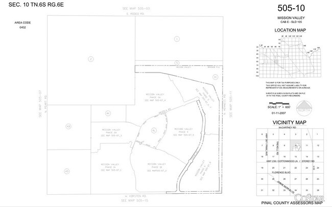
NW SW OF SEC 10-6S-6E 40.00 AC
505-10-002
PINAL
Vacantlandnec
Arizona
AE The base floodplain where base flood elevations are provided. AE Zones are now used on new format FIRMs instead of A1-A30 Zones.
160 AC
2024
Pinal County
2025
Phoenix
001304
NEARBY LISTINGS FOR SALE OR LEASE
-
-
SEC N Trekell Rd and E Rodeo Rd
Casa Grande, AZ 85122
$7,451,374 - $23,945,368
24.53 - 34.49 AC Lot
Land
-
-
-
NWC of N. Colorado St & E. Cottonwood Ln ln
Casa Grande, AZ 85122
Rent Upon Request
93.91 AC Lots
Land
-
-
-
View all Casa Grande listings for sale on LoopNet.com
DEMOGRAPHICS near E Rodeo Rd
1 mile
3 mile
5 mile
2025 Total Population
5,795
45,684
77,692
2030 Population
6,786
54,065
92,190
Pop Growth 2025-2030
+ 17.10%
+ 18.35%
+ 18.66%
Average Age
37
42
42
2025 Total Households
1,784
17,014
28,954
HH Growth 2025-2030
+ 16.98%
+ 18.56%
+ 18.72%
Median Household Inc
$80,848
$65,217
$65,533
Avg Household Size
3.10
2.60
2.60
2025 Avg HH Vehicles
2.00
2.00
2.00
Median Home Value
$362,071
$327,933
$324,898
Median Year Built
2005
2003
2002
Nearby Places
Map Layers
Map Styles
 Street
 Aerial
Layers
 Traffic
 Biking
Places
Listings with unknown addresses are not visible on the map
- Restaurants
- Banks
- Shops
- Fitness
- Groceries
PUBLIC TRANSPORTATION
AIRPORT
Phoenix-Mesa Gateway
Drive
Walk
Distance
Phoenix-Mesa Gateway
59 min
40.8 mi
SALE & LEASE HISTORY
LISTING DATE
SALE/LEASE

Aug 06, 2020
For Sale
Nearby Properties
Address
Land Use
TOTAL SIZE
Lot Size
Zoning
Address
Land Use
TOTAL SIZE
Lot Size
Zoning
48,433 SF
266.50 AC
Address
Land Use
TOTAL SIZE
Lot Size
Zoning
216,795 SF
11.15 AC
Address
Land Use
TOTAL SIZE
Lot Size
Zoning
289,599 SF
65.03 AC
Address
Land Use
TOTAL SIZE
Lot Size
Zoning
222,134 SF
24.14 AC
Address
Land Use
TOTAL SIZE
Lot Size
Zoning
196,294 SF
4.24 AC
Address
Land Use
TOTAL SIZE
Lot Size
Zoning
63,541 SF
12.10 AC
Address
Land Use
TOTAL SIZE
Lot Size
Zoning
55,295 SF
12.14 AC
Address
Land Use
TOTAL SIZE
Lot Size
Zoning
131,275 SF
8.85 AC
Address
Land Use
TOTAL SIZE
Lot Size
Zoning
107,832 SF
11.50 AC
Address
Land Use
TOTAL SIZE
Lot Size
Zoning
42,077 SF
3.37 AC
Address
Land Use
TOTAL SIZE
Lot Size
Zoning
81,467 SF
11.96 AC
Address
Land Use
TOTAL SIZE
Lot Size
Zoning
121,969 SF
9.36 AC
Address
Land Use
TOTAL SIZE
Lot Size
Zoning
137,735 SF
14.12 AC
Address
Land Use
TOTAL SIZE
Lot Size
Zoning
156,264 SF
10.70 AC
UNDESIGNAT
Address
Land Use
TOTAL SIZE
Lot Size
Zoning
43,355 SF
5.91 AC
Address
Land Use
TOTAL SIZE
Lot Size
Zoning
115,058 SF
13.41 AC
UNDESIGNAT
Address
Land Use
TOTAL SIZE
Lot Size
Zoning
48,543 SF
3.04 AC
UNDESIGNAT
Address
Land Use
TOTAL SIZE
Lot Size
Zoning
28,115 SF
8.92 AC
Address
Land Use
TOTAL SIZE
Lot Size
Zoning
39,422 SF
2.04 AC
Address
Land Use
TOTAL SIZE
Lot Size
Zoning
Address
Land Use
TOTAL SIZE
Lot Size
Zoning
59.61 AC
UNDESIGNAT
Address
Land Use
TOTAL SIZE
Lot Size
Zoning
151 AC
UNDESIGNAT
Address
Land Use
TOTAL SIZE
Lot Size
Zoning
13,414 SF
2.01 AC
Address
Land Use
TOTAL SIZE
Lot Size
Zoning
70,583 SF
6.04 AC
Address
Land Use
TOTAL SIZE
Lot Size
Zoning
40,859 SF
3.77 AC
Address
Land Use
TOTAL SIZE
Lot Size
Zoning
31,252 SF
2.89 AC
Address
Land Use
TOTAL SIZE
Lot Size
Zoning
78,092 SF
3.95 AC
UNDESIGNAT
Address
Land Use
TOTAL SIZE
Lot Size
Zoning
39,634 SF
1.79 AC
UNDESIGNAT
Address
Land Use
TOTAL SIZE
Lot Size
Zoning
15.11 AC
The World's #1 Commercial Real Estate Marketplace
Connect with us
© 2026 CoStar Group
The information above has been obtained from sources believed reliable. While we do not doubt its accuracy we have not verified it and make no guarantee, warranty or representation about it. It is your responsibility to independently confirm its accuracy and completeness. Any projections, opinions, assumptions, or estimates used are for example only and do not represent the current or future performance of the property. The value of this transaction to you depends on tax and other factors which should be evaluated by your tax, financial, and legal advisors. You and your advisors should conduct a careful, independent investigation of the property to determine to your satisfaction the suitability of the property for your needs.