Property Record
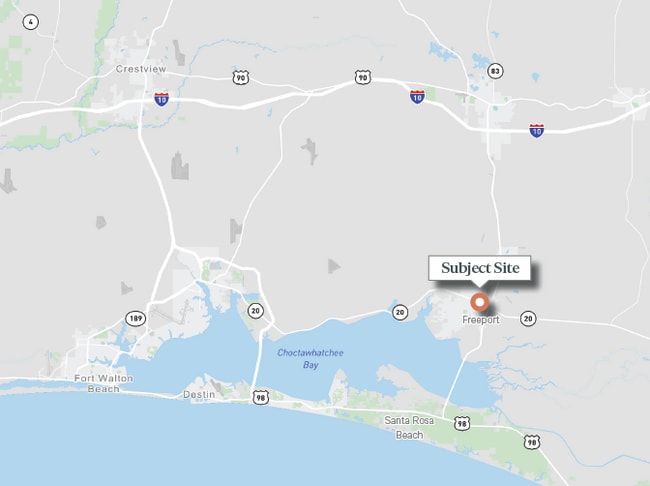
E State Highway 20 E, Freeport, FL 32439


This Property Is For Sale
Property Detail
E State Highway 20 E
Crestview-Fort Walton Beach-Destin, FL
COM NW COR OF SE1/4, RUN S 140 YDS W TO SE COR BARNETT LOT, S 45 FT, W TO PINCH BRANCH, DOWN PINCH BRANCH TO BRIDGE ON RD FROM MILL TO FREEPORT, TO LAFAYETTE CREEK, N UP SAID CREEK TO N LINE SE1/4, W TO BEG OR 954-144 OR 1949-392 OR 1949-393 OR 1949-
15-1S-19-23000-037-0000
WALTON
Timberlandforesttreesagricultural
Florida
AE The base floodplain where base flood elevations are provided. AE Zones are now used on new format FIRMs instead of A1-A30 Zones.
58.82 AC
2025
Florida Panhandle Area
2025
Other Market Areas
950502
NEARBY LISTINGS FOR SALE OR LEASE
DEMOGRAPHICS near E State Highway 20 E
1 mile
3 mile
5 mile
2025 Total Population
1,348
6,434
10,593
2030 Population
1,493
7,139
11,734
Pop Growth 2025-2030
+ 10.76%
+ 10.96%
+ 10.77%
Average Age
37
38
38
2025 Total Households
484
2,328
3,887
HH Growth 2025-2030
+ 9.92%
+ 10.18%
+ 10.03%
Median Household Inc
$64,355
$73,321
$63,584
Avg Household Size
2.70
2.70
2.60
2025 Avg HH Vehicles
2.00
2.00
2.00
Median Home Value
$370,779
$358,384
$315,784
Median Year Built
2004
2010
2007
Nearby Places
Map Layers
Map Styles
 Street
 Aerial
Layers
 Traffic
 Biking
Places
Listings with unknown addresses are not visible on the map
- Restaurants
- Banks
- Shops
- Fitness
- Groceries
PUBLIC TRANSPORTATION
AIRPORT
Eglin AFB/Destin-Ft Walton Beach
Drive
Walk
Distance
Eglin AFB/Destin-Ft Walton Beach
61 min
29.3 mi
Northwest Florida Beaches International
Drive
Walk
Distance
Northwest Florida Beaches International
43 min
31.0 mi
Freight Ports
Port of Panama City
Drive
Walk
Distance
Port of Panama City
59 min
41.7 mi
Nearby Properties
Address
Land Use
TOTAL SIZE
Lot Size
Zoning
Address
Land Use
TOTAL SIZE
Lot Size
Zoning
176,047 SF
29.75 AC
Address
Land Use
TOTAL SIZE
Lot Size
Zoning
469,205 SF
21.39 AC
BYLAGR
Address
Land Use
TOTAL SIZE
Lot Size
Zoning
334,804 SF
13.94 AC
MUNI
Address
Land Use
TOTAL SIZE
Lot Size
Zoning
311,974 SF
7.28 AC
Address
Land Use
TOTAL SIZE
Lot Size
Zoning
161,667 SF
26.97 AC
3310
Address
Land Use
TOTAL SIZE
Lot Size
Zoning
83,348 SF
12.68 AC
MUNI
Address
Land Use
TOTAL SIZE
Lot Size
Zoning
63,166 SF
9.06 AC
3310
Address
Land Use
TOTAL SIZE
Lot Size
Zoning
306.09 AC
3310
Address
Land Use
TOTAL SIZE
Lot Size
Zoning
87,549 SF
11 AC
Address
Land Use
TOTAL SIZE
Lot Size
Zoning
Address
Land Use
TOTAL SIZE
Lot Size
Zoning
333.09 AC
3310
Address
Land Use
TOTAL SIZE
Lot Size
Zoning
1,759 SF
0.63 AC
Address
Land Use
TOTAL SIZE
Lot Size
Zoning
88.24 AC
3310
Address
Land Use
TOTAL SIZE
Lot Size
Zoning
81,765 SF
5.51 AC
BYLAGR
Address
Land Use
TOTAL SIZE
Lot Size
Zoning
46,904 SF
93.38 AC
BYLAGR
Address
Land Use
TOTAL SIZE
Lot Size
Zoning
2,072 SF
23.08 AC
MUNI
Address
Land Use
TOTAL SIZE
Lot Size
Zoning
5,624 SF
1.35 AC
3310
Address
Land Use
TOTAL SIZE
Lot Size
Zoning
31,217 SF
5.45 AC
3310
Address
Land Use
TOTAL SIZE
Lot Size
Zoning
12,472 SF
10.63 AC
Address
Land Use
TOTAL SIZE
Lot Size
Zoning
51,885 SF
8.65 AC
3310
Address
Land Use
TOTAL SIZE
Lot Size
Zoning
16,297 SF
13.93 AC
Address
Land Use
TOTAL SIZE
Lot Size
Zoning
4,400 SF
6.04 AC
3310
Address
Land Use
TOTAL SIZE
Lot Size
Zoning
16,804 SF
2.07 AC
Address
Land Use
TOTAL SIZE
Lot Size
Zoning
12,290 SF
1.45 AC
Address
Land Use
TOTAL SIZE
Lot Size
Zoning
30,164 SF
2.23 AC
3310
Address
Land Use
TOTAL SIZE
Lot Size
Zoning
10.84 AC
MUNI
Address
Land Use
TOTAL SIZE
Lot Size
Zoning
12,080 SF
3.50 AC
3310
Address
Land Use
TOTAL SIZE
Lot Size
Zoning
924 SF
11.89 AC
3310
Address
Land Use
TOTAL SIZE
Lot Size
Zoning
17,730 SF
2.68 AC
Address
Land Use
TOTAL SIZE
Lot Size
Zoning
9,475 SF
8.45 AC
3310
The World's #1 Commercial Real Estate Marketplace
Connect with us
© 2026 CoStar Group
The information above has been obtained from sources believed reliable. While we do not doubt its accuracy we have not verified it and make no guarantee, warranty or representation about it. It is your responsibility to independently confirm its accuracy and completeness. Any projections, opinions, assumptions, or estimates used are for example only and do not represent the current or future performance of the property. The value of this transaction to you depends on tax and other factors which should be evaluated by your tax, financial, and legal advisors. You and your advisors should conduct a careful, independent investigation of the property to determine to your satisfaction the suitability of the property for your needs.