Property Record
E State St, Cassopolis, MI 49031
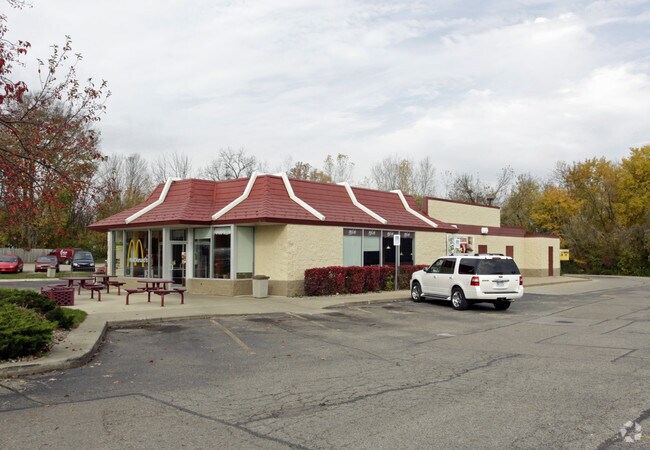

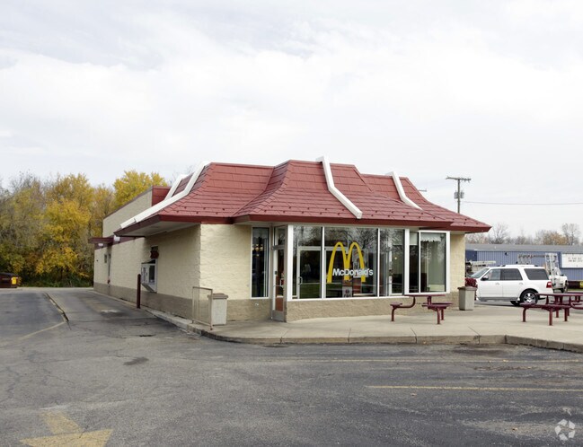
Property Detail
E State St
South Bend-Mishawaka, IN-MI
492-978 312-1263 V-575 LOTS 8 9 10 18 19 25 26 32 33 39 40 51 & 52. ALSO PARTS OF LOTS 11 & 20 DESC AS COM AT SW COR LOT 11,
14-041-165-008-01
CASS
Commercialnec
Michigan
B and X Area of moderate flood hazard, usually the area between the limits of the 100-year and 500-year floods.
8,9
2025
3.65 AC
2025
Cass County
001600
South Bend/Mishawaka
3,322 SF
NEARBY LISTINGS FOR SALE OR LEASE
-
-
View all Cassopolis listings for sale on LoopNet.com
DEMOGRAPHICS near E State St
1 mile
3 mile
5 mile
2025 Total Population
2,231
4,746
6,776
2030 Population
2,239
4,889
6,983
Pop Growth 2025-2030
+ 0.36%
+ 3.01%
+ 3.05%
Average Age
42
44
44
2025 Total Households
916
1,913
2,718
HH Growth 2025-2030
0.00%
+ 2.77%
+ 2.83%
Median Household Inc
$57,925
$65,950
$65,743
Avg Household Size
2.30
2.30
2.30
2025 Avg HH Vehicles
2.00
2.00
2.00
Median Home Value
$172,182
$246,575
$249,651
Median Year Built
1952
1970
1973
Nearby Places
Map Layers
Map Styles
 Street
 Aerial
Layers
 Traffic
 Biking
Places
Listings with unknown addresses are not visible on the map
- Restaurants
- Banks
- Shops
- Fitness
- Groceries
PUBLIC TRANSPORTATION
COMMUTER RAIL
Dowagiac Amtrak Station (Blue Water - Amtrak, Wolverine - Amtrak)
Drive
Walk
Distance
Dowagiac Amtrak Station (Blue Water - Amtrak, Wolverine - Amtrak)
16 min
9.1 mi
AIRPORT
South Bend International
Drive
Walk
Distance
South Bend International
48 min
30.3 mi
Freight Ports
Port Milwaukee
Drive
Walk
Distance
Port Milwaukee
243 min
199.7 mi
Nearby Properties
Address
Land Use
TOTAL SIZE
Lot Size
Zoning
Address
Land Use
TOTAL SIZE
Lot Size
Zoning
155,224 SF
Address
Land Use
TOTAL SIZE
Lot Size
Zoning
151.41 AC
Address
Land Use
TOTAL SIZE
Lot Size
Zoning
374,347 SF
64.39 AC
Address
Land Use
TOTAL SIZE
Lot Size
Zoning
Address
Land Use
TOTAL SIZE
Lot Size
Zoning
157,588 SF
10.60 AC
Address
Land Use
TOTAL SIZE
Lot Size
Zoning
30,495 SF
15.63 AC
Address
Land Use
TOTAL SIZE
Lot Size
Zoning
26,968 SF
5.55 AC
Address
Land Use
TOTAL SIZE
Lot Size
Zoning
15.24 AC
Address
Land Use
TOTAL SIZE
Lot Size
Zoning
52,500 SF
Address
Land Use
TOTAL SIZE
Lot Size
Zoning
14,100 SF
1.25 AC
Address
Land Use
TOTAL SIZE
Lot Size
Zoning
63,600 SF
4.04 AC
Address
Land Use
TOTAL SIZE
Lot Size
Zoning
15,738 SF
0.26 AC
Address
Land Use
TOTAL SIZE
Lot Size
Zoning
280 AC
Address
Land Use
TOTAL SIZE
Lot Size
Zoning
15,632 SF
5 AC
Address
Land Use
TOTAL SIZE
Lot Size
Zoning
157.75 AC
Address
Land Use
TOTAL SIZE
Lot Size
Zoning
Address
Land Use
TOTAL SIZE
Lot Size
Zoning
116,668 SF
15.25 AC
Address
Land Use
TOTAL SIZE
Lot Size
Zoning
0.19 AC
Address
Land Use
TOTAL SIZE
Lot Size
Zoning
19.60 AC
Address
Land Use
TOTAL SIZE
Lot Size
Zoning
Address
Land Use
TOTAL SIZE
Lot Size
Zoning
Address
Land Use
TOTAL SIZE
Lot Size
Zoning
Address
Land Use
TOTAL SIZE
Lot Size
Zoning
Address
Land Use
TOTAL SIZE
Lot Size
Zoning
0.55 AC
Address
Land Use
TOTAL SIZE
Lot Size
Zoning
33,180 SF
4.45 AC
Address
Land Use
TOTAL SIZE
Lot Size
Zoning
139 AC
Address
Land Use
TOTAL SIZE
Lot Size
Zoning
1,514 SF
141.50 AC
Address
Land Use
TOTAL SIZE
Lot Size
Zoning
140.35 AC
Address
Land Use
TOTAL SIZE
Lot Size
Zoning
124.41 AC
Address
Land Use
TOTAL SIZE
Lot Size
Zoning
3,364 SF
0.45 AC
The World's #1 Commercial Real Estate Marketplace
Connect with us
© 2026 CoStar Group
The information above has been obtained from sources believed reliable. While we do not doubt its accuracy we have not verified it and make no guarantee, warranty or representation about it. It is your responsibility to independently confirm its accuracy and completeness. Any projections, opinions, assumptions, or estimates used are for example only and do not represent the current or future performance of the property. The value of this transaction to you depends on tax and other factors which should be evaluated by your tax, financial, and legal advisors. You and your advisors should conduct a careful, independent investigation of the property to determine to your satisfaction the suitability of the property for your needs.