Property Record
E Statler Rd, Piqua, OH 45356
Property Detail
E Statler Rd
Dayton, OH
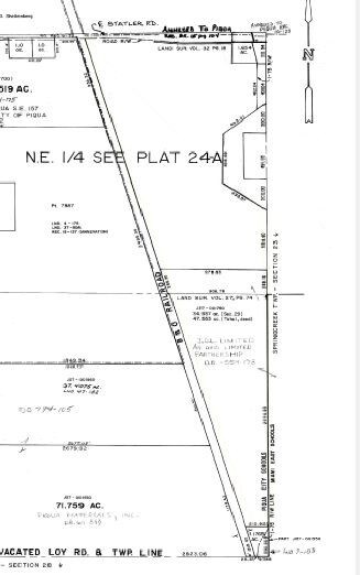
11-1-29 E PT SE
J27002160
MIAMI
Industrialacreage
Ohio
B and X Area of moderate flood hazard, usually the area between the limits of the 100-year and 500-year floods.
61.22 AC
2025
North Dayton
2025
Cincinnati/Dayton
315100
NEARBY LISTINGS FOR SALE OR LEASE
DEMOGRAPHICS near E Statler Rd
1 mile
3 mile
5 mile
2025 Total Population
1,149
21,095
26,792
2030 Population
1,182
21,760
27,613
Pop Growth 2025-2030
+ 2.87%
+ 3.15%
+ 3.06%
Average Age
41
41
42
2025 Total Households
454
8,754
11,108
HH Growth 2025-2030
+ 3.08%
+ 3.16%
+ 3.10%
Median Household Inc
$41,985
$63,216
$65,145
Avg Household Size
2.30
2.30
2.30
2025 Avg HH Vehicles
2.00
2.00
2.00
Median Home Value
$227,586
$151,969
$172,848
Median Year Built
1948
1953
1958
Nearby Places
Map Layers
Map Styles
 Street
 Aerial
Layers
 Traffic
 Biking
Places
Listings with unknown addresses are not visible on the map
- Restaurants
- Banks
- Shops
- Fitness
- Groceries
PUBLIC TRANSPORTATION
AIRPORT
James M Cox Dayton International
Drive
Walk
Distance
James M Cox Dayton International
28 min
21.3 mi
Freight Ports
Port of Toledo
Drive
Walk
Distance
Port of Toledo
152 min
131.1 mi
Nearby Properties
Address
Land Use
TOTAL SIZE
Lot Size
Zoning
Address
Land Use
TOTAL SIZE
Lot Size
Zoning
7.55 AC
Address
Land Use
TOTAL SIZE
Lot Size
Zoning
3,424 SF
35.81 AC
Address
Land Use
TOTAL SIZE
Lot Size
Zoning
139,643 SF
80.48 AC
Address
Land Use
TOTAL SIZE
Lot Size
Zoning
71,802 SF
7.24 AC
Address
Land Use
TOTAL SIZE
Lot Size
Zoning
149,633 SF
20 AC
Address
Land Use
TOTAL SIZE
Lot Size
Zoning
95,206 SF
24.01 AC
Address
Land Use
TOTAL SIZE
Lot Size
Zoning
31,456 SF
6.88 AC
Address
Land Use
TOTAL SIZE
Lot Size
Zoning
103,404 SF
12.91 AC
Address
Land Use
TOTAL SIZE
Lot Size
Zoning
36,638 SF
0.94 AC
Address
Land Use
TOTAL SIZE
Lot Size
Zoning
20,412 SF
0.19 AC
Address
Land Use
TOTAL SIZE
Lot Size
Zoning
112,500 SF
Address
Land Use
TOTAL SIZE
Lot Size
Zoning
0.38 AC
Address
Land Use
TOTAL SIZE
Lot Size
Zoning
8,362 SF
11.53 AC
Address
Land Use
TOTAL SIZE
Lot Size
Zoning
103,451 SF
30.52 AC
Address
Land Use
TOTAL SIZE
Lot Size
Zoning
41,468 SF
5.38 AC
Address
Land Use
TOTAL SIZE
Lot Size
Zoning
57,747 SF
18.26 AC
Address
Land Use
TOTAL SIZE
Lot Size
Zoning
3.15 AC
Address
Land Use
TOTAL SIZE
Lot Size
Zoning
23,042 SF
4.89 AC
Address
Land Use
TOTAL SIZE
Lot Size
Zoning
Address
Land Use
TOTAL SIZE
Lot Size
Zoning
189,009 SF
22.32 AC
Address
Land Use
TOTAL SIZE
Lot Size
Zoning
52,820 SF
6 AC
Address
Land Use
TOTAL SIZE
Lot Size
Zoning
44,300 SF
19.41 AC
Address
Land Use
TOTAL SIZE
Lot Size
Zoning
81.07 AC
Address
Land Use
TOTAL SIZE
Lot Size
Zoning
202,504 SF
19.04 AC
Address
Land Use
TOTAL SIZE
Lot Size
Zoning
37,762 SF
0.21 AC
Address
Land Use
TOTAL SIZE
Lot Size
Zoning
20,736 SF
12.52 AC
Address
Land Use
TOTAL SIZE
Lot Size
Zoning
39,394 SF
17.03 AC
Address
Land Use
TOTAL SIZE
Lot Size
Zoning
116,000 SF
14.56 AC
Address
Land Use
TOTAL SIZE
Lot Size
Zoning
Address
Land Use
TOTAL SIZE
Lot Size
Zoning
16,789 SF
0.31 AC
The World's #1 Commercial Real Estate Marketplace
Connect with us
© 2026 CoStar Group
The information above has been obtained from sources believed reliable. While we do not doubt its accuracy we have not verified it and make no guarantee, warranty or representation about it. It is your responsibility to independently confirm its accuracy and completeness. Any projections, opinions, assumptions, or estimates used are for example only and do not represent the current or future performance of the property. The value of this transaction to you depends on tax and other factors which should be evaluated by your tax, financial, and legal advisors. You and your advisors should conduct a careful, independent investigation of the property to determine to your satisfaction the suitability of the property for your needs.