Property Record
E Stroop Rd, Dayton, OH 45440
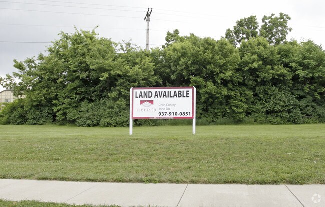
This Property Is For Sale
Property Detail
E Stroop Rd
Dayton, OH
6-2-17
N64-03402-0010
MONTGOMERY
Recreationalacreage
Ohio
B and X Area of moderate flood hazard, usually the area between the limits of the 100-year and 500-year floods.
10
2024
0.27 AC
2025
South Central Dayton
021602
Cincinnati/Dayton
NEARBY LISTINGS FOR SALE OR LEASE
-
-
-
-
-
-
-
-
-
-
SE Corner of Clyo Rd & Feedwire rd
Sugarcreek Township, OH 45440
Rent Upon Request
2.30 - 18.50 AC Lot
Land
-
-
-
-
-
-
View all Dayton listings for sale on LoopNet.com
DEMOGRAPHICS near E Stroop Rd
1 mile
3 mile
5 mile
2025 Total Population
9,536
64,810
175,911
2030 Population
9,544
64,758
176,092
Pop Growth 2025-2030
+ 0.08%
(0.08%)
+ 0.10%
Average Age
41
42
41
2025 Total Households
4,273
28,332
74,337
HH Growth 2025-2030
+ 0.33%
(0.16%)
+ 0.06%
Median Household Inc
$81,753
$79,276
$80,449
Avg Household Size
2.20
2.20
2.30
2025 Avg HH Vehicles
2.00
2.00
2.00
Median Home Value
$228,835
$236,630
$243,551
Median Year Built
1968
1965
1962
Nearby Places
Map Layers
Map Styles
 Street
 Aerial
Layers
 Traffic
 Biking
Places
Listings with unknown addresses are not visible on the map
- Restaurants
- Banks
- Shops
- Fitness
- Groceries
PUBLIC TRANSPORTATION
AIRPORT
James M Cox Dayton International
Drive
Walk
Distance
James M Cox Dayton International
33 min
19.9 mi
Freight Ports
Port of Toledo
Drive
Walk
Distance
Port of Toledo
189 min
160.1 mi
Nearby Properties
Address
Land Use
TOTAL SIZE
Lot Size
Zoning
Address
Land Use
TOTAL SIZE
Lot Size
Zoning
508,366 SF
114.86 AC
Address
Land Use
TOTAL SIZE
Lot Size
Zoning
414,094 SF
36.48 AC
Address
Land Use
TOTAL SIZE
Lot Size
Zoning
24.77 AC
Address
Land Use
TOTAL SIZE
Lot Size
Zoning
275,808 SF
19.97 AC
Address
Land Use
TOTAL SIZE
Lot Size
Zoning
752,874 SF
74.85 AC
Address
Land Use
TOTAL SIZE
Lot Size
Zoning
240,090 SF
1.93 AC
MXPUD02
Address
Land Use
TOTAL SIZE
Lot Size
Zoning
175,938 SF
49.33 AC
Address
Land Use
TOTAL SIZE
Lot Size
Zoning
53.48 AC
RP1
Address
Land Use
TOTAL SIZE
Lot Size
Zoning
16.21 AC
Address
Land Use
TOTAL SIZE
Lot Size
Zoning
1,951 SF
56.54 AC
Address
Land Use
TOTAL SIZE
Lot Size
Zoning
Address
Land Use
TOTAL SIZE
Lot Size
Zoning
1,180 SF
23.28 AC
Address
Land Use
TOTAL SIZE
Lot Size
Zoning
18.33 AC
Address
Land Use
TOTAL SIZE
Lot Size
Zoning
38,832 SF
30.51 AC
R-PUD 03-7
Address
Land Use
TOTAL SIZE
Lot Size
Zoning
1,008 SF
7 AC
R1A
Address
Land Use
TOTAL SIZE
Lot Size
Zoning
109,680 SF
32.24 AC
R4
Address
Land Use
TOTAL SIZE
Lot Size
Zoning
19.76 AC
Address
Land Use
TOTAL SIZE
Lot Size
Zoning
100,450 SF
1.66 AC
MXPUD02
Address
Land Use
TOTAL SIZE
Lot Size
Zoning
187,824 SF
27.52 AC
Address
Land Use
TOTAL SIZE
Lot Size
Zoning
148,309 SF
1.50 AC
MXPUD02
Address
Land Use
TOTAL SIZE
Lot Size
Zoning
10.33 AC
Address
Land Use
TOTAL SIZE
Lot Size
Zoning
152,844 SF
14.80 AC
Address
Land Use
TOTAL SIZE
Lot Size
Zoning
70,754 SF
75.48 AC
Address
Land Use
TOTAL SIZE
Lot Size
Zoning
119,701 SF
71.85 AC
Address
Land Use
TOTAL SIZE
Lot Size
Zoning
89,176 SF
17.52 AC
Address
Land Use
TOTAL SIZE
Lot Size
Zoning
108,274 SF
26.09 AC
RPUD427
Address
Land Use
TOTAL SIZE
Lot Size
Zoning
109,775 SF
1.25 AC
Address
Land Use
TOTAL SIZE
Lot Size
Zoning
54,604 SF
6.29 AC
MXPUD02
Address
Land Use
TOTAL SIZE
Lot Size
Zoning
309,331 SF
36 AC
Address
Land Use
TOTAL SIZE
Lot Size
Zoning
256,686 SF
11.05 AC
The World's #1 Commercial Real Estate Marketplace
Connect with us
© 2026 CoStar Group
The information above has been obtained from sources believed reliable. While we do not doubt its accuracy we have not verified it and make no guarantee, warranty or representation about it. It is your responsibility to independently confirm its accuracy and completeness. Any projections, opinions, assumptions, or estimates used are for example only and do not represent the current or future performance of the property. The value of this transaction to you depends on tax and other factors which should be evaluated by your tax, financial, and legal advisors. You and your advisors should conduct a careful, independent investigation of the property to determine to your satisfaction the suitability of the property for your needs.