Property Record
E Tugalo St, Toccoa, GA 30577
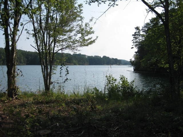

Property Detail
E Tugalo St
041-001
TRACTS 1-B & 3
Agriculturalland
STEPHENS
AR
Georgia
A Areas with a 1% annual chance of flooding and a 26% chance of flooding over the life of a 30-year mortgage.
45.07 AC
2025
Georgia Northeast
2025
Other Market Areas
970302
Toccoa, GA
NEARBY LISTINGS FOR SALE OR LEASE
DEMOGRAPHICS near E Tugalo St
1 mile
3 mile
5 mile
2025 Total Population
85
6,584
17,063
2030 Population
88
6,683
17,431
Pop Growth 2025-2030
+ 3.53%
+ 1.50%
+ 2.16%
Average Age
47
42
42
2025 Total Households
35
2,637
6,758
HH Growth 2025-2030
+ 2.86%
+ 1.40%
+ 2.10%
Median Household Inc
$73,928
$56,774
$48,891
Avg Household Size
2.40
2.40
2.40
2025 Avg HH Vehicles
3.00
2.00
2.00
Median Home Value
$350,000
$226,735
$185,260
Median Year Built
1993
1980
1979
Nearby Places
Map Layers
Map Styles
 Street
 Aerial
Layers
 Traffic
 Biking
Places
Listings with unknown addresses are not visible on the map
- Restaurants
- Banks
- Shops
- Fitness
- Groceries
PUBLIC TRANSPORTATION
COMMUTER RAIL
Toccoa Amtrak Station (Crescent - Amtrak)
Drive
Walk
Distance
Toccoa Amtrak Station (Crescent - Amtrak)
5 min
3.7 mi
Freight Ports
Georgia Ports - Savannah
Drive
Walk
Distance
Georgia Ports - Savannah
304 min
248.6 mi
Nearby Properties
Address
Land Use
TOTAL SIZE
Lot Size
Zoning
Address
Land Use
TOTAL SIZE
Lot Size
Zoning
3.47 AC
CI
Address
Land Use
TOTAL SIZE
Lot Size
Zoning
6.56 AC
CG
Address
Land Use
TOTAL SIZE
Lot Size
Zoning
5,120 SF
154.08 AC
CG
Address
Land Use
TOTAL SIZE
Lot Size
Zoning
49,548 SF
14.80 AC
R-II
Address
Land Use
TOTAL SIZE
Lot Size
Zoning
13,568 SF
7.50 AC
B-II
Address
Land Use
TOTAL SIZE
Lot Size
Zoning
110,718 SF
10.14 AC
B-II
Address
Land Use
TOTAL SIZE
Lot Size
Zoning
11,600 SF
199.79 AC
A-I
Address
Land Use
TOTAL SIZE
Lot Size
Zoning
11,914 SF
2.04 AC
B-I
Address
Land Use
TOTAL SIZE
Lot Size
Zoning
74,957 SF
13.98 AC
B-II
Address
Land Use
TOTAL SIZE
Lot Size
Zoning
51,660 SF
2.39 AC
R-IA
Address
Land Use
TOTAL SIZE
Lot Size
Zoning
16,872 SF
2.53 AC
B-II
Address
Land Use
TOTAL SIZE
Lot Size
Zoning
43,350 SF
6.43 AC
B-I
Address
Land Use
TOTAL SIZE
Lot Size
Zoning
131,290 SF
20.92 AC
CI
Address
Land Use
TOTAL SIZE
Lot Size
Zoning
1,960 SF
5.99 AC
R-II
Address
Land Use
TOTAL SIZE
Lot Size
Zoning
15,169 SF
1.56 AC
R-IA
Address
Land Use
TOTAL SIZE
Lot Size
Zoning
2,212 SF
5.24 AC
R-III
Address
Land Use
TOTAL SIZE
Lot Size
Zoning
11,568 SF
10.14 AC
CG
Address
Land Use
TOTAL SIZE
Lot Size
Zoning
12,292 SF
11.01 AC
R-III
Address
Land Use
TOTAL SIZE
Lot Size
Zoning
6,600 SF
14.82 AC
R-III
Address
Land Use
TOTAL SIZE
Lot Size
Zoning
20,451 SF
9 AC
CG
Address
Land Use
TOTAL SIZE
Lot Size
Zoning
4,560 SF
9 AC
R-IA
Address
Land Use
TOTAL SIZE
Lot Size
Zoning
1,290 SF
4.05 AC
R-II
Address
Land Use
TOTAL SIZE
Lot Size
Zoning
14,466 SF
1.36 AC
B-II
Address
Land Use
TOTAL SIZE
Lot Size
Zoning
20,000 SF
1.75 AC
B-II
Address
Land Use
TOTAL SIZE
Lot Size
Zoning
26,861 SF
8.67 AC
M-I
Address
Land Use
TOTAL SIZE
Lot Size
Zoning
5,169 SF
1.51 AC
B-II
Address
Land Use
TOTAL SIZE
Lot Size
Zoning
14,612 SF
2.16 AC
B-II
Address
Land Use
TOTAL SIZE
Lot Size
Zoning
4,796 SF
5 AC
R-II
Address
Land Use
TOTAL SIZE
Lot Size
Zoning
17,400 SF
4.61 AC
CG
Address
Land Use
TOTAL SIZE
Lot Size
Zoning
124,708 SF
10.72 AC
B-II
The World's #1 Commercial Real Estate Marketplace
Connect with us
© 2026 CoStar Group
The information above has been obtained from sources believed reliable. While we do not doubt its accuracy we have not verified it and make no guarantee, warranty or representation about it. It is your responsibility to independently confirm its accuracy and completeness. Any projections, opinions, assumptions, or estimates used are for example only and do not represent the current or future performance of the property. The value of this transaction to you depends on tax and other factors which should be evaluated by your tax, financial, and legal advisors. You and your advisors should conduct a careful, independent investigation of the property to determine to your satisfaction the suitability of the property for your needs.