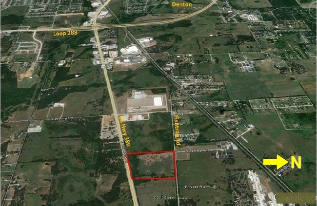
Property Record
E Us 380, Denton, TX 76208


Save to a Folder
{{folder.Name}}
{{folder.ListingIds.length}} Properties
{{folder.ListingIds.length}} Property
Create a New Folder
This Property Is For Sale
Property Detail
E Us 380
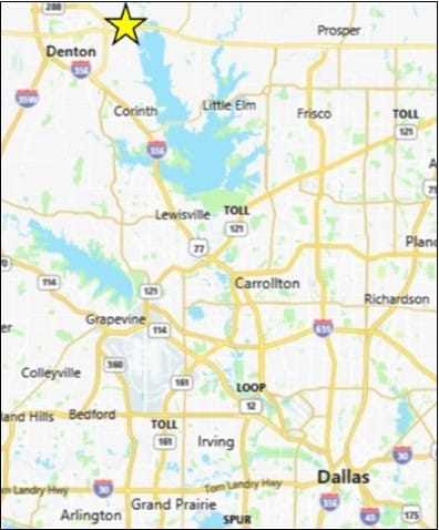
Dallas-Fort Worth-Arlington, TX
A0417A M. FORREST, TR 72, 12.6927 ACRES, (OUTSIDE CITY)
R36604
DENTON
Vacantlandnec
Texas
B and X Area of moderate flood hazard, usually the area between the limits of the 100-year and 500-year floods.
12.69 AC
2024
Denton
2025
Dallas/Ft Worth
021415
NEARBY LISTINGS FOR SALE OR LEASE
DEMOGRAPHICS near E Us 380
1 mile
3 mile
5 mile
2025 Total Population
844
29,938
112,361
2030 Population
952
33,619
126,357
Pop Growth 2025-2030
+ 12.80%
+ 12.30%
+ 12.46%
Average Age
43
37
36
2025 Total Households
295
11,076
44,056
HH Growth 2025-2030
+ 13.22%
+ 12.62%
+ 12.74%
Median Household Inc
$76,136
$78,522
$67,460
Avg Household Size
2.70
2.60
2.40
2025 Avg HH Vehicles
2.00
2.00
2.00
Median Home Value
$462,499
$312,531
$347,260
Median Year Built
1982
1990
1993
Nearby Places
Map Layers
Map Styles
 Street
 Aerial
Layers
 Traffic
 Biking
Places
Listings with unknown addresses are not visible on the map
- Restaurants
- Banks
- Shops
- Fitness
- Groceries
PUBLIC TRANSPORTATION
COMMUTER RAIL
Downtown Denton Transit Center (A-train - Denton County Transportation Authority)
Drive
Walk
Distance
Downtown Denton Transit Center (A-train - Denton County Transportation Authority)
10 min
5.2 mi
Medpark Station (A-train - Denton County Transportation Authority)
Drive
Walk
Distance
Medpark Station (A-train - Denton County Transportation Authority)
13 min
5.6 mi
AIRPORT
Dallas-Fort Worth International
Drive
Walk
Distance
Dallas-Fort Worth International
40 min
28.9 mi
Dallas Love Field
Drive
Walk
Distance
Dallas Love Field
52 min
37.9 mi
Freight Ports
Port of Shreveport
Drive
Walk
Distance
Port of Shreveport
259 min
235.5 mi
Nearby Properties
Address
Land Use
TOTAL SIZE
Lot Size
Zoning
Address
Land Use
TOTAL SIZE
Lot Size
Zoning
361,731 SF
15.96 AC
Address
Land Use
TOTAL SIZE
Lot Size
Zoning
184,710 SF
16.82 AC
Address
Land Use
TOTAL SIZE
Lot Size
Zoning
347,845 SF
15.53 AC
Address
Land Use
TOTAL SIZE
Lot Size
Zoning
300,000 SF
11.31 AC
Address
Land Use
TOTAL SIZE
Lot Size
Zoning
246,287 SF
9.92 AC
Address
Land Use
TOTAL SIZE
Lot Size
Zoning
262,222 SF
15.47 AC
Address
Land Use
TOTAL SIZE
Lot Size
Zoning
198,755 SF
10.57 AC
Address
Land Use
TOTAL SIZE
Lot Size
Zoning
219,059 SF
11.41 AC
19G
Address
Land Use
TOTAL SIZE
Lot Size
Zoning
352,129 SF
19.02 AC
Address
Land Use
TOTAL SIZE
Lot Size
Zoning
150,162 SF
40.40 AC
Address
Land Use
TOTAL SIZE
Lot Size
Zoning
76,608 SF
22.43 AC
Address
Land Use
TOTAL SIZE
Lot Size
Zoning
282,960 SF
21.97 AC
Address
Land Use
TOTAL SIZE
Lot Size
Zoning
336,342 SF
11.81 AC
Address
Land Use
TOTAL SIZE
Lot Size
Zoning
211,160 SF
10.99 AC
19G
Address
Land Use
TOTAL SIZE
Lot Size
Zoning
246,669 SF
16.11 AC
Address
Land Use
TOTAL SIZE
Lot Size
Zoning
178,596 SF
9.71 AC
19G
Address
Land Use
TOTAL SIZE
Lot Size
Zoning
261,360 SF
19.51 AC
Address
Land Use
TOTAL SIZE
Lot Size
Zoning
162,500 SF
11.04 AC
Address
Land Use
TOTAL SIZE
Lot Size
Zoning
269,200 SF
21.20 AC
19G
Address
Land Use
TOTAL SIZE
Lot Size
Zoning
240,116 SF
11.17 AC
19A
Address
Land Use
TOTAL SIZE
Lot Size
Zoning
127,128 SF
9.35 AC
Address
Land Use
TOTAL SIZE
Lot Size
Zoning
198,750 SF
22.44 AC
17G
Address
Land Use
TOTAL SIZE
Lot Size
Zoning
412,656 SF
43.71 AC
Address
Land Use
TOTAL SIZE
Lot Size
Zoning
114,062 SF
4.89 AC
Address
Land Use
TOTAL SIZE
Lot Size
Zoning
247,560 SF
17.63 AC
Address
Land Use
TOTAL SIZE
Lot Size
Zoning
168,505 SF
14.55 AC
Address
Land Use
TOTAL SIZE
Lot Size
Zoning
87,588 SF
10.44 AC
Address
Land Use
TOTAL SIZE
Lot Size
Zoning
147,637 SF
6.29 AC
Address
Land Use
TOTAL SIZE
Lot Size
Zoning
123,961 SF
6.93 AC
17A
Address
Land Use
TOTAL SIZE
Lot Size
Zoning
158,812 SF
7.12 AC
The World's #1 Commercial Real Estate Marketplace
Connect with us
© 2026 CoStar Group
The information above has been obtained from sources believed reliable. While we do not doubt its accuracy we have not verified it and make no guarantee, warranty or representation about it. It is your responsibility to independently confirm its accuracy and completeness. Any projections, opinions, assumptions, or estimates used are for example only and do not represent the current or future performance of the property. The value of this transaction to you depends on tax and other factors which should be evaluated by your tax, financial, and legal advisors. You and your advisors should conduct a careful, independent investigation of the property to determine to your satisfaction the suitability of the property for your needs.