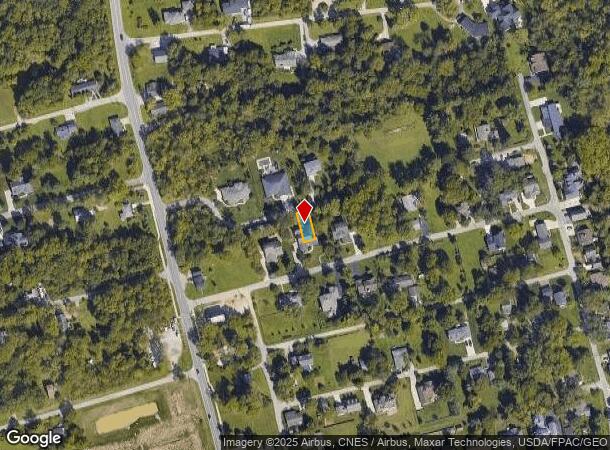
Property Record
E Wilma Dr, Powell, OH 43065
NEARBY LISTINGS FOR SALE OR LEASE
Property Detail
E Wilma Dr
Columbus, OH
Wedgewood Sec 02
600-426-07-017-000
LOTS 3385
Recreationalacreage
Delaware
X
Ohio
39159C0395E
3385
2024
0.07 AC
2024
Outlying Delaware County
011900
Columbus
DEMOGRAPHICS near E Wilma Dr
1 mile
3 mile
5 mile
2024 Total Population
4,121
47,337
115,220
2029 Population
4,667
52,778
125,235
Pop Growth 2024-2029
+ 13.25%
+ 11.49%
+ 8.69%
Average Age
41
40
39
2024 Total Households
1,389
16,280
40,848
HH Growth 2024-2029
+ 13.32%
+ 11.73%
+ 8.41%
Median Household Inc
$185,091
$168,883
$141,485
Avg Household Size
3.00
2.90
2.80
2024 Avg HH Vehicles
2.00
2.00
2.00
Median Home Value
$581,757
$480,367
$437,128
Median Year Built
1988
2000
1995
Nearby Places
Map Layers
Map Styles
 Street
 Aerial
Transit
 Traffic
 Biking
Places
Listings with unknown addresses are not visible on the map
- Restaurants
- Banks
- Shops
- Fitness
- Groceries
PUBLIC TRANSPORTATION
AIRPORT
John Glenn Columbus International
Drive
Walk
Distance
John Glenn Columbus International
35 min
24.4 mi
Rickenbacker International
Drive
Walk
Distance
Rickenbacker International
48 min
35.2 mi
Freight Ports
Port of Toledo
Drive
Walk
Distance
Port of Toledo
166 min
132.0 mi
SALE & LEASE HISTORY
LISTING DATE
SALE/LEASE

Sep 24, 2016
For Sale
Mar 18, 2022
For Sale
Nearby Properties
Address
Land Use
TOTAL SIZE
Lot Size
Zoning
Address
Land Use
TOTAL SIZE
Lot Size
Zoning
90.16 AC
Address
Land Use
TOTAL SIZE
Lot Size
Zoning
56,770 SF
22.62 AC
Address
Land Use
TOTAL SIZE
Lot Size
Zoning
247,368 SF
7.88 AC
Address
Land Use
TOTAL SIZE
Lot Size
Zoning
67,908 SF
32.65 AC
Address
Land Use
TOTAL SIZE
Lot Size
Zoning
159,901 SF
19.97 AC
Address
Land Use
TOTAL SIZE
Lot Size
Zoning
136,123 SF
5.07 AC
Address
Land Use
TOTAL SIZE
Lot Size
Zoning
64,147 SF
28.90 AC
Address
Land Use
TOTAL SIZE
Lot Size
Zoning
113,169 SF
33.30 AC
Address
Land Use
TOTAL SIZE
Lot Size
Zoning
16,735 SF
10.40 AC
Address
Land Use
TOTAL SIZE
Lot Size
Zoning
103,368 SF
13.48 AC
Address
Land Use
TOTAL SIZE
Lot Size
Zoning
86,760 SF
12.73 AC
Address
Land Use
TOTAL SIZE
Lot Size
Zoning
31,496 SF
3.25 AC
Address
Land Use
TOTAL SIZE
Lot Size
Zoning
4,204 SF
118.93 AC
Address
Land Use
TOTAL SIZE
Lot Size
Zoning
9,493 SF
248.77 AC
Address
Land Use
TOTAL SIZE
Lot Size
Zoning
86,046 SF
20.36 AC
Address
Land Use
TOTAL SIZE
Lot Size
Zoning
70,638 SF
17.50 AC
Address
Land Use
TOTAL SIZE
Lot Size
Zoning
47,548 SF
9.28 AC
Address
Land Use
TOTAL SIZE
Lot Size
Zoning
64,520 SF
12 AC
Address
Land Use
TOTAL SIZE
Lot Size
Zoning
133,348 SF
12.46 AC
Address
Land Use
TOTAL SIZE
Lot Size
Zoning
75,139 SF
4.37 AC
Address
Land Use
TOTAL SIZE
Lot Size
Zoning
38,932 SF
25.74 AC
Address
Land Use
TOTAL SIZE
Lot Size
Zoning
51,561 SF
7.79 AC
Address
Land Use
TOTAL SIZE
Lot Size
Zoning
12,336 SF
147.79 AC
Address
Land Use
TOTAL SIZE
Lot Size
Zoning
37,997 SF
160.59 AC
Address
Land Use
TOTAL SIZE
Lot Size
Zoning
94,321 SF
6.40 AC
Address
Land Use
TOTAL SIZE
Lot Size
Zoning
49,896 SF
5.15 AC
Address
Land Use
TOTAL SIZE
Lot Size
Zoning
32,891 SF
11.94 AC
Address
Land Use
TOTAL SIZE
Lot Size
Zoning
63,984 SF
6.38 AC
Address
Land Use
TOTAL SIZE
Lot Size
Zoning
33,711 SF
5.08 AC
Address
Land Use
TOTAL SIZE
Lot Size
Zoning
22,080 SF
11.95 AC
The World's #1 Commercial Real Estate Marketplace
Connect with us
© 2026 CoStar Group
The information above has been obtained from sources believed reliable. While we do not doubt its accuracy we have not verified it and make no guarantee, warranty or representation about it. It is your responsibility to independently confirm its accuracy and completeness. Any projections, opinions, assumptions, or estimates used are for example only and do not represent the current or future performance of the property. The value of this transaction to you depends on tax and other factors which should be evaluated by your tax, financial, and legal advisors. You and your advisors should conduct a careful, independent investigation of the property to determine to your satisfaction the suitability of the property for your needs.