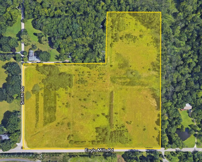
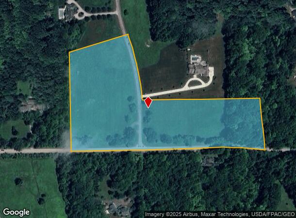
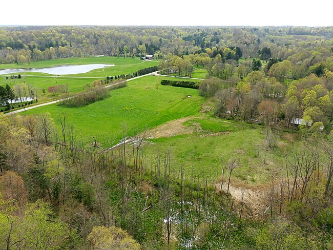
Property Record
Eagle Rd, Waite Hill, OH 44094
NEARBY LISTINGS FOR SALE OR LEASE
Property Detail
Eagle Rd
Cleveland-Elyria, OH
LOT 1 TRACT 2
25-A-010-0-00-037
Lake
Residentialacreage
Ohio
X
1
39035C0110E
11.28 AC
0
Northeast
2024
Cleveland
201400
DEMOGRAPHICS near Eagle Rd
1 Mile
3 Mile
5 Mile
2024 Total Population
828
18,770
74,684
2029 Population
822
18,784
74,558
Pop Growth 2024-2029
(0.72%)
+ 0.07%
(0.17%)
Average Age
46
46
45
2024 Total Households
315
8,297
33,397
HH Growth 2024-2029
(0.63%)
+ 0.17%
(0.09%)
Median Household Inc
$124,721
$93,514
$76,545
Avg Household Size
2.60
2.20
2.20
2024 Avg HH Vehicles
2.00
2.00
2.00
Median Home Value
$411,956
$283,481
$198,625
Median Year Built
1966
1969
1968
Nearby Places
Map Layers
Map Styles
 Street
 Aerial
- Restaurants
- Banks
- Shops
- Fitness
- Groceries
PUBLIC TRANSPORTATION
AIRPORT
Cleveland-Hopkins International
DRIVE
WALK
Distance
Cleveland-Hopkins International
51 min
33.9 mi
Freight Ports
Port of Toledo
DRIVE
WALK
Distance
Port of Toledo
165 min
134.3 mi
SALE & LEASE HISTORY
LISTING DATE
SALE/LEASE

Apr 19, 2021
For Sale
Nearby Properties
Address
Land Use
TOTAL SIZE
Lot Size
Zoning
Address
Land Use
TOTAL SIZE
Lot Size
Zoning
455,945 SF
78.40 AC
B-1
Address
Land Use
TOTAL SIZE
Lot Size
Zoning
307,867 SF
31.16 AC
S-CMF
Address
Land Use
TOTAL SIZE
Lot Size
Zoning
327,593 SF
103.27 AC
Address
Land Use
TOTAL SIZE
Lot Size
Zoning
308,298 SF
15.93 AC
Address
Land Use
TOTAL SIZE
Lot Size
Zoning
45,768 SF
13.53 AC
Address
Land Use
TOTAL SIZE
Lot Size
Zoning
214,881 SF
47.99 AC
S-5
Address
Land Use
TOTAL SIZE
Lot Size
Zoning
233,534 SF
26.21 AC
B-2
Address
Land Use
TOTAL SIZE
Lot Size
Zoning
136,722 SF
10.25 AC
GB
Address
Land Use
TOTAL SIZE
Lot Size
Zoning
187,332 SF
10 AC
R-100
Address
Land Use
TOTAL SIZE
Lot Size
Zoning
164,666 SF
8 AC
R-100
Address
Land Use
TOTAL SIZE
Lot Size
Zoning
163,810 SF
15.39 AC
Address
Land Use
TOTAL SIZE
Lot Size
Zoning
109,803 SF
9.77 AC
Address
Land Use
TOTAL SIZE
Lot Size
Zoning
95,798 SF
222.29 AC
R-1
Address
Land Use
TOTAL SIZE
Lot Size
Zoning
77,012 SF
10 AC
Address
Land Use
TOTAL SIZE
Lot Size
Zoning
20,383 SF
3.48 AC
Address
Land Use
TOTAL SIZE
Lot Size
Zoning
84,714 SF
4.23 AC
Address
Land Use
TOTAL SIZE
Lot Size
Zoning
41,030 SF
2.61 AC
R-3
Address
Land Use
TOTAL SIZE
Lot Size
Zoning
62,109 SF
4.93 AC
Address
Land Use
TOTAL SIZE
Lot Size
Zoning
49,517 SF
2.15 AC
G-B
Address
Land Use
TOTAL SIZE
Lot Size
Zoning
89,942 SF
5.12 AC
B-2
Address
Land Use
TOTAL SIZE
Lot Size
Zoning
153,027 SF
6.99 AC
L-1
Address
Land Use
TOTAL SIZE
Lot Size
Zoning
89,530 SF
8.82 AC
Address
Land Use
TOTAL SIZE
Lot Size
Zoning
13.53 AC
Address
Land Use
TOTAL SIZE
Lot Size
Zoning
96,980 SF
16.15 AC
B-1
Address
Land Use
TOTAL SIZE
Lot Size
Zoning
102,933 SF
42.80 AC
N2
Address
Land Use
TOTAL SIZE
Lot Size
Zoning
25,717 SF
8.43 AC
R-MFL
Address
Land Use
TOTAL SIZE
Lot Size
Zoning
33,856 SF
4.45 AC
L-B
Address
Land Use
TOTAL SIZE
Lot Size
Zoning
23,203 SF
1.72 AC
L-B
Address
Land Use
TOTAL SIZE
Lot Size
Zoning
21,709 SF
13.74 AC
Address
Land Use
TOTAL SIZE
Lot Size
Zoning
34.35 AC
C-1
The World's #1 Commercial Real Estate Marketplace
Connect with us
© 2025 CoStar Group
The information above has been obtained from sources believed reliable. While we do not doubt its accuracy we have not verified it and make no guarantee, warranty or representation about it. It is your responsibility to independently confirm its accuracy and completeness. Any projections, opinions, assumptions, or estimates used are for example only and do not represent the current or future performance of the property. The value of this transaction to you depends on tax and other factors which should be evaluated by your tax, financial, and legal advisors. You and your advisors should conduct a careful, independent investigation of the property to determine to your satisfaction the suitability of the property for your needs.