Property Record
Eagle Village Rd S, Manlius, NY 13104

NEARBY LISTINGS FOR SALE OR LEASE
-
-
View all Manlius listings for sale on LoopNet.com
Property Detail
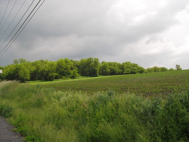
Eagle Village Rd S
313889-117-000-0003-002-000-0000
Onondaga
Agriculturalland
New York
X
2.000
36067C0381F
147.41 AC
2025
Other Market Areas
2024
Syracuse, NY
015203
DEMOGRAPHICS near Eagle Village Rd S
1 Mile
3 Mile
5 Mile
2024 Total Population
1,575
12,567
29,965
2029 Population
1,598
12,568
29,840
Pop Growth 2024-2029
+ 1.46%
+ 0.01%
(0.42%)
Average Age
42
41
42
2024 Total Households
542
4,813
11,902
HH Growth 2024-2029
+ 1.48%
(0.06%)
(0.49%)
Median Household Inc
$146,656
$113,634
$97,550
Avg Household Size
2.90
2.60
2.50
2024 Avg HH Vehicles
2.00
2.00
2.00
Median Home Value
$282,652
$248,249
$206,677
Median Year Built
1986
1979
1971
Nearby Places
Map Layers
Map Styles
 Street
 Aerial
- Restaurants
- Banks
- Shops
- Fitness
- Groceries
PUBLIC TRANSPORTATION
AIRPORT
Syracuse Hancock International
DRIVE
WALK
Distance
Syracuse Hancock International
36 min
21.7 mi
Freight Ports
Albany, NY Port
DRIVE
WALK
Distance
Albany, NY Port
169 min
136.4 mi
Nearby Properties
Address
Land Use
TOTAL SIZE
Lot Size
Zoning
Address
Land Use
TOTAL SIZE
Lot Size
Zoning
293,638 SF
58.90 AC
R1
Address
Land Use
TOTAL SIZE
Lot Size
Zoning
151,628 SF
38.98 AC
RA
Address
Land Use
TOTAL SIZE
Lot Size
Zoning
6.24 AC
RA
Address
Land Use
TOTAL SIZE
Lot Size
Zoning
15,240 SF
12.46 AC
R1
Address
Land Use
TOTAL SIZE
Lot Size
Zoning
26,508 SF
4.38 AC
C
Address
Land Use
TOTAL SIZE
Lot Size
Zoning
401,546 SF
24 AC
C
Address
Land Use
TOTAL SIZE
Lot Size
Zoning
5,376 SF
8.91 AC
R2
Address
Land Use
TOTAL SIZE
Lot Size
Zoning
60,621 SF
5.63 AC
C1
Address
Land Use
TOTAL SIZE
Lot Size
Zoning
13,225 SF
1.48 AC
R2
Address
Land Use
TOTAL SIZE
Lot Size
Zoning
59,066 SF
3.46 AC
R2
Address
Land Use
TOTAL SIZE
Lot Size
Zoning
12,787 SF
1.52 AC
C
Address
Land Use
TOTAL SIZE
Lot Size
Zoning
9,616 SF
6.40 AC
R5
Address
Land Use
TOTAL SIZE
Lot Size
Zoning
Address
Land Use
TOTAL SIZE
Lot Size
Zoning
28,037 SF
40.68 AC
C
Address
Land Use
TOTAL SIZE
Lot Size
Zoning
45,285 SF
5.33 AC
C1
Address
Land Use
TOTAL SIZE
Lot Size
Zoning
36,072 SF
2.27 AC
C
Address
Land Use
TOTAL SIZE
Lot Size
Zoning
28,334 SF
3.97 AC
IND
Address
Land Use
TOTAL SIZE
Lot Size
Zoning
1,776 SF
14.74 AC
C
Address
Land Use
TOTAL SIZE
Lot Size
Zoning
35,188 SF
20.90 AC
C
Address
Land Use
TOTAL SIZE
Lot Size
Zoning
15,186 SF
2.57 AC
RM
Address
Land Use
TOTAL SIZE
Lot Size
Zoning
37,659 SF
2.76 AC
C
Address
Land Use
TOTAL SIZE
Lot Size
Zoning
13,256 SF
17.25 AC
C
Address
Land Use
TOTAL SIZE
Lot Size
Zoning
56,580 SF
9.59 AC
IND
Address
Land Use
TOTAL SIZE
Lot Size
Zoning
20,320 SF
1.01 AC
C1
Address
Land Use
TOTAL SIZE
Lot Size
Zoning
112,978 SF
6.83 AC
IND
Address
Land Use
TOTAL SIZE
Lot Size
Zoning
6,072 SF
2.15 AC
C
Address
Land Use
TOTAL SIZE
Lot Size
Zoning
4,531 SF
1.39 AC
R2
Address
Land Use
TOTAL SIZE
Lot Size
Zoning
13,984 SF
2.83 AC
R1
Address
Land Use
TOTAL SIZE
Lot Size
Zoning
12,851 SF
2.27 AC
C
Address
Land Use
TOTAL SIZE
Lot Size
Zoning
14,416 SF
2.75 AC
IND
The World's #1 Commercial Real Estate Marketplace
Connect with us
© 2026 CoStar Group
The information above has been obtained from sources believed reliable. While we do not doubt its accuracy we have not verified it and make no guarantee, warranty or representation about it. It is your responsibility to independently confirm its accuracy and completeness. Any projections, opinions, assumptions, or estimates used are for example only and do not represent the current or future performance of the property. The value of this transaction to you depends on tax and other factors which should be evaluated by your tax, financial, and legal advisors. You and your advisors should conduct a careful, independent investigation of the property to determine to your satisfaction the suitability of the property for your needs.