Property Record
Eastpark Blvd, Denton, TX 76201
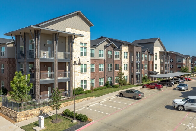

Property Detail
Eastpark Blvd
Dallas-Fort Worth-Arlington, TX
RAYZOR RANCH EAST BLK A LOT 4R-1
R957938
DENTON
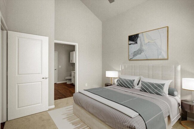
Apartment
Texas
2024
4r-1
2025
11.11 AC
020700
Rayzor Ranch
262,008 SF
Dallas/Ft Worth
NEARBY LISTINGS FOR SALE OR LEASE
DEMOGRAPHICS near Eastpark Blvd
1 mile
3 mile
5 mile
2025 Total Population
9,599
66,377
126,607
2030 Population
11,139
75,022
143,156
Pop Growth 2025-2030
+ 16.04%
+ 13.02%
+ 13.07%
Average Age
35
34
35
2025 Total Households
4,282
27,734
50,436
HH Growth 2025-2030
+ 16.25%
+ 13.52%
+ 13.37%
Median Household Inc
$49,322
$51,338
$63,911
Avg Household Size
2.20
2.10
2.30
2025 Avg HH Vehicles
2.00
2.00
2.00
Median Home Value
$313,980
$296,671
$333,385
Median Year Built
1989
1987
1991
Nearby Places
Map Layers
Map Styles
 Street
 Aerial
Layers
 Traffic
 Biking
Places
Listings with unknown addresses are not visible on the map
- Restaurants
- Banks
- Shops
- Fitness
- Groceries
PUBLIC TRANSPORTATION
COMMUTER RAIL
Downtown Denton Transit Center (A-train - Denton County Transportation Authority)
Drive
Walk
Distance
Downtown Denton Transit Center (A-train - Denton County Transportation Authority)
7 min
3.7 mi
Medpark Station (A-train - Denton County Transportation Authority)
Drive
Walk
Distance
Medpark Station (A-train - Denton County Transportation Authority)
12 min
7.5 mi
AIRPORT
Dallas-Fort Worth International
Drive
Walk
Distance
Dallas-Fort Worth International
37 min
30.0 mi
Freight Ports
Port of Shreveport
Drive
Walk
Distance
Port of Shreveport
256 min
236.6 mi
Nearby Properties
Address
Land Use
TOTAL SIZE
Lot Size
Zoning
Address
Land Use
TOTAL SIZE
Lot Size
Zoning
490,000 SF
144.26 AC
Address
Land Use
TOTAL SIZE
Lot Size
Zoning
594,945 SF
139.10 AC
Address
Land Use
TOTAL SIZE
Lot Size
Zoning
515,375 SF
24.39 AC
Address
Land Use
TOTAL SIZE
Lot Size
Zoning
490,000 SF
27.69 AC
Address
Land Use
TOTAL SIZE
Lot Size
Zoning
337,730 SF
65.39 AC
Address
Land Use
TOTAL SIZE
Lot Size
Zoning
347,844 SF
14.09 AC
Address
Land Use
TOTAL SIZE
Lot Size
Zoning
1,121,760 SF
73.87 AC
Address
Land Use
TOTAL SIZE
Lot Size
Zoning
884,278 SF
77.21 AC
Address
Land Use
TOTAL SIZE
Lot Size
Zoning
576,664 SF
189.26 AC
Address
Land Use
TOTAL SIZE
Lot Size
Zoning
398,028 SF
18.89 AC
Address
Land Use
TOTAL SIZE
Lot Size
Zoning
272,599 SF
4.01 AC
Address
Land Use
TOTAL SIZE
Lot Size
Zoning
368,434 SF
16.39 AC
Address
Land Use
TOTAL SIZE
Lot Size
Zoning
343,800 SF
10.95 AC
Address
Land Use
TOTAL SIZE
Lot Size
Zoning
409,957 SF
5.91 AC
Address
Land Use
TOTAL SIZE
Lot Size
Zoning
373,498 SF
54.27 AC
Address
Land Use
TOTAL SIZE
Lot Size
Zoning
144,771 SF
Address
Land Use
TOTAL SIZE
Lot Size
Zoning
285,578 SF
42.28 AC
Address
Land Use
TOTAL SIZE
Lot Size
Zoning
334,834 SF
11.95 AC
Address
Land Use
TOTAL SIZE
Lot Size
Zoning
350,457 SF
4.25 AC
Address
Land Use
TOTAL SIZE
Lot Size
Zoning
298,744 SF
32.12 AC
Address
Land Use
TOTAL SIZE
Lot Size
Zoning
352,862 SF
47.44 AC
Address
Land Use
TOTAL SIZE
Lot Size
Zoning
702,810 SF
37.91 AC
Address
Land Use
TOTAL SIZE
Lot Size
Zoning
362,191 SF
6.81 AC
Address
Land Use
TOTAL SIZE
Lot Size
Zoning
216,314 SF
22.10 AC
Address
Land Use
TOTAL SIZE
Lot Size
Zoning
310,078 SF
18.22 AC
29G
Address
Land Use
TOTAL SIZE
Lot Size
Zoning
611,770 SF
44.56 AC
Address
Land Use
TOTAL SIZE
Lot Size
Zoning
138,000 SF
2.91 AC
Address
Land Use
TOTAL SIZE
Lot Size
Zoning
238,200 SF
85.31 AC
Address
Land Use
TOTAL SIZE
Lot Size
Zoning
352,950 SF
21.43 AC
The World's #1 Commercial Real Estate Marketplace
Connect with us
© 2026 CoStar Group
The information above has been obtained from sources believed reliable. While we do not doubt its accuracy we have not verified it and make no guarantee, warranty or representation about it. It is your responsibility to independently confirm its accuracy and completeness. Any projections, opinions, assumptions, or estimates used are for example only and do not represent the current or future performance of the property. The value of this transaction to you depends on tax and other factors which should be evaluated by your tax, financial, and legal advisors. You and your advisors should conduct a careful, independent investigation of the property to determine to your satisfaction the suitability of the property for your needs.