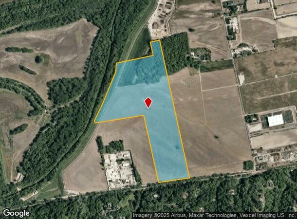
Property Record
18415 Centaur Rd, Wildwood, MO 63005
NEARBY LISTINGS FOR SALE OR LEASE
Property Detail
18415 Centaur Rd
18X-33-0033
SURVEYS 132 134 & 1956 TWN 45 R 3 LOC 138.24 FT W OF EATHERTON RD & SUR 1956 PT
Farms
St. Louis
AE
Missouri
29183C0445G
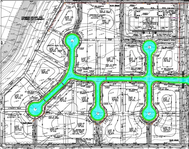
85.31 AC
2024
West County
2025
St. Louis
221629
St. Louis, MO-IL
DEMOGRAPHICS near 18415 Centaur Rd
1 mile
3 mile
5 mile
2024 Total Population
66
4,920
32,946
2029 Population
66
4,832
33,473
Pop Growth 2024-2029
0.00%
(1.79%)
+ 1.60%
Average Age
38
40
42
2024 Total Households
20
1,543
11,518
HH Growth 2024-2029
+ 5.00%
(1.81%)
+ 1.85%
Median Household Inc
$246,154
$220,070
$154,451
Avg Household Size
3.20
3.20
2.80
2024 Avg HH Vehicles
2.00
3.00
2.00
Median Home Value
$791,666
$734,758
$474,159
Median Year Built
2002
1994
1993
Nearby Places
Map Layers
Map Styles
 Street
 Aerial
Transit
 Traffic
 Biking
Places
Listings with unknown addresses are not visible on the map
- Restaurants
- Banks
- Shops
- Fitness
- Groceries
PUBLIC TRANSPORTATION
AIRPORT
St Louis Lambert International
Drive
Walk
Distance
St Louis Lambert International
43 min
28.0 mi
Freight Ports
Tulsa Port of Inola
Drive
Walk
Distance
Tulsa Port of Inola
410 min
366.2 mi
SALE & LEASE HISTORY
LISTING DATE
SALE/LEASE

Sep 24, 2016
For Sale
Nearby Properties
Address
Land Use
TOTAL SIZE
Lot Size
Zoning
Address
Land Use
TOTAL SIZE
Lot Size
Zoning
Address
Land Use
TOTAL SIZE
Lot Size
Zoning
351,496 SF
31.73 AC
NU
Address
Land Use
TOTAL SIZE
Lot Size
Zoning
117,704 SF
9.27 AC
105PI
Address
Land Use
TOTAL SIZE
Lot Size
Zoning
7,860 SF
223.24 AC
105M3
Address
Land Use
TOTAL SIZE
Lot Size
Zoning
84,818 SF
10.11 AC
105M3
Address
Land Use
TOTAL SIZE
Lot Size
Zoning
8.15 AC
105PI
Address
Land Use
TOTAL SIZE
Lot Size
Zoning
74,783 SF
14.31 AC
105M3
Address
Land Use
TOTAL SIZE
Lot Size
Zoning
148,519 SF
12.76 AC
FPM3
Address
Land Use
TOTAL SIZE
Lot Size
Zoning
10.71 AC
105NU
Address
Land Use
TOTAL SIZE
Lot Size
Zoning
163,924 SF
11.56 AC
105M3
Address
Land Use
TOTAL SIZE
Lot Size
Zoning
134,313 SF
11.65 AC
105M3
Address
Land Use
TOTAL SIZE
Lot Size
Zoning
78,976 SF
10.24 AC
105M3
Address
Land Use
TOTAL SIZE
Lot Size
Zoning
78,566 SF
6.13 AC
105PI
Address
Land Use
TOTAL SIZE
Lot Size
Zoning
60,655 SF
10.33 AC
FPNU
Address
Land Use
TOTAL SIZE
Lot Size
Zoning
7.12 AC
105PI
Address
Land Use
TOTAL SIZE
Lot Size
Zoning
58,733 SF
4 AC
105M3
Address
Land Use
TOTAL SIZE
Lot Size
Zoning
66,180 SF
7.40 AC
105M3
Address
Land Use
TOTAL SIZE
Lot Size
Zoning
63,000 SF
6.32 AC
105M3
Address
Land Use
TOTAL SIZE
Lot Size
Zoning
64,669 SF
2.17 AC
Address
Land Use
TOTAL SIZE
Lot Size
Zoning
22.37 AC
NU
Address
Land Use
TOTAL SIZE
Lot Size
Zoning
47,198 SF
4.95 AC
105M3
Address
Land Use
TOTAL SIZE
Lot Size
Zoning
101,980 SF
5.99 AC
105M3
Address
Land Use
TOTAL SIZE
Lot Size
Zoning
80,875 SF
10.06 AC
105M3
Address
Land Use
TOTAL SIZE
Lot Size
Zoning
30,740 SF
8.53 AC
105PI
Address
Land Use
TOTAL SIZE
Lot Size
Zoning
30,346 SF
6.35 AC
107NU
Address
Land Use
TOTAL SIZE
Lot Size
Zoning
42,320 SF
4.80 AC
105M3
Address
Land Use
TOTAL SIZE
Lot Size
Zoning
59,700 SF
4.58 AC
M3
Address
Land Use
TOTAL SIZE
Lot Size
Zoning
17.56 AC
NU
Address
Land Use
TOTAL SIZE
Lot Size
Zoning
50,550 SF
2.60 AC
105C8
Address
Land Use
TOTAL SIZE
Lot Size
Zoning
4,620 SF
47.97 AC
105M3
The World's #1 Commercial Real Estate Marketplace
Connect with us
© 2026 CoStar Group
The information above has been obtained from sources believed reliable. While we do not doubt its accuracy we have not verified it and make no guarantee, warranty or representation about it. It is your responsibility to independently confirm its accuracy and completeness. Any projections, opinions, assumptions, or estimates used are for example only and do not represent the current or future performance of the property. The value of this transaction to you depends on tax and other factors which should be evaluated by your tax, financial, and legal advisors. You and your advisors should conduct a careful, independent investigation of the property to determine to your satisfaction the suitability of the property for your needs.