Property Record
Edison Dr, Monroe, OH 45050


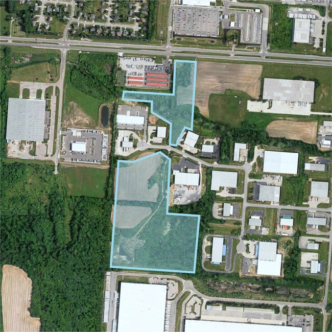
Property Detail
Edison Dr
Cincinnati, OH-KY-IN
5709 ENT SEE TIF PCL 050T - PARK 63-SUMMIT PK TIF
C1800-017-000-050
BUTLER
Agriculturalland
Ohio
B and X Area of moderate flood hazard, usually the area between the limits of the 100-year and 500-year floods.
30.95 AC
2024
Butler County
2025
Cincinnati/Dayton
011200
NEARBY LISTINGS FOR SALE OR LEASE
DEMOGRAPHICS near Edison Dr
1 mile
3 mile
5 mile
2025 Total Population
3,534
32,797
104,378
2030 Population
3,648
33,774
107,595
Pop Growth 2025-2030
+ 3.23%
+ 2.98%
+ 3.08%
Average Age
36
38
38
2025 Total Households
1,126
10,760
36,801
HH Growth 2025-2030
+ 3.20%
+ 2.96%
+ 3.12%
Median Household Inc
$112,822
$116,812
$95,964
Avg Household Size
3.10
3.00
2.80
2025 Avg HH Vehicles
2.00
2.00
2.00
Median Home Value
$331,962
$350,254
$310,309
Median Year Built
2004
2001
1990
Nearby Places
Map Layers
Map Styles
 Street
 Aerial
Transit
 Traffic
 Biking
Places
Listings with unknown addresses are not visible on the map
- Restaurants
- Banks
- Shops
- Fitness
- Groceries
PUBLIC TRANSPORTATION
AIRPORT
James M Cox Dayton International
Drive
Walk
Distance
James M Cox Dayton International
58 min
41.7 mi
Cincinnati/Northern Kentucky International
Drive
Walk
Distance
Cincinnati/Northern Kentucky International
70 min
46.0 mi
SALE & LEASE HISTORY
LISTING DATE
SALE/LEASE

Sep 24, 2016
For Sale
Aug 17, 2017
For Sale
Nearby Properties
Address
Land Use
TOTAL SIZE
Lot Size
Zoning
Address
Land Use
TOTAL SIZE
Lot Size
Zoning
40.03 AC
Address
Land Use
TOTAL SIZE
Lot Size
Zoning
34.66 AC
Address
Land Use
TOTAL SIZE
Lot Size
Zoning
746,883 SF
40.03 AC
Address
Land Use
TOTAL SIZE
Lot Size
Zoning
12,040 SF
49.57 AC
Address
Land Use
TOTAL SIZE
Lot Size
Zoning
1,380,095 SF
47.11 AC
Address
Land Use
TOTAL SIZE
Lot Size
Zoning
833,210 SF
57.88 AC
Address
Land Use
TOTAL SIZE
Lot Size
Zoning
57.88 AC
Address
Land Use
TOTAL SIZE
Lot Size
Zoning
3,956 SF
186.57 AC
Address
Land Use
TOTAL SIZE
Lot Size
Zoning
99.22 AC
Address
Land Use
TOTAL SIZE
Lot Size
Zoning
334,640 SF
41.28 AC
Address
Land Use
TOTAL SIZE
Lot Size
Zoning
85,587 SF
7.67 AC
Address
Land Use
TOTAL SIZE
Lot Size
Zoning
189,571 SF
10.79 AC
ADV
Address
Land Use
TOTAL SIZE
Lot Size
Zoning
123,662 SF
17.69 AC
Address
Land Use
TOTAL SIZE
Lot Size
Zoning
148,762 SF
5.01 AC
Address
Land Use
TOTAL SIZE
Lot Size
Zoning
402,440 SF
25.46 AC
Address
Land Use
TOTAL SIZE
Lot Size
Zoning
41.28 AC
Address
Land Use
TOTAL SIZE
Lot Size
Zoning
57,248 SF
224.87 AC
Address
Land Use
TOTAL SIZE
Lot Size
Zoning
235,831 SF
15.01 AC
Address
Land Use
TOTAL SIZE
Lot Size
Zoning
192.22 AC
Address
Land Use
TOTAL SIZE
Lot Size
Zoning
7,564 SF
25.63 AC
Address
Land Use
TOTAL SIZE
Lot Size
Zoning
73,178 SF
5.12 AC
Address
Land Use
TOTAL SIZE
Lot Size
Zoning
Address
Land Use
TOTAL SIZE
Lot Size
Zoning
71,525 SF
6.87 AC
Address
Land Use
TOTAL SIZE
Lot Size
Zoning
161,195 SF
37.71 AC
Address
Land Use
TOTAL SIZE
Lot Size
Zoning
96.04 AC
Address
Land Use
TOTAL SIZE
Lot Size
Zoning
104,888 SF
7.45 AC
Address
Land Use
TOTAL SIZE
Lot Size
Zoning
74,502 SF
7.95 AC
Address
Land Use
TOTAL SIZE
Lot Size
Zoning
100,000 SF
5.74 AC
Address
Land Use
TOTAL SIZE
Lot Size
Zoning
71,649 SF
26.15 AC
ADV
Address
Land Use
TOTAL SIZE
Lot Size
Zoning
18,688 SF
4.91 AC
The World's #1 Commercial Real Estate Marketplace
Connect with us
© 2026 CoStar Group
The information above has been obtained from sources believed reliable. While we do not doubt its accuracy we have not verified it and make no guarantee, warranty or representation about it. It is your responsibility to independently confirm its accuracy and completeness. Any projections, opinions, assumptions, or estimates used are for example only and do not represent the current or future performance of the property. The value of this transaction to you depends on tax and other factors which should be evaluated by your tax, financial, and legal advisors. You and your advisors should conduct a careful, independent investigation of the property to determine to your satisfaction the suitability of the property for your needs.