Property Record
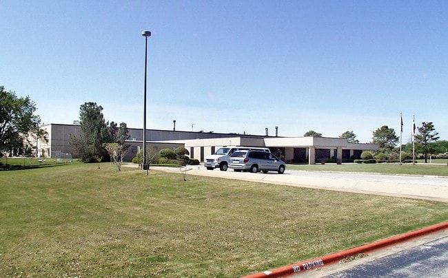
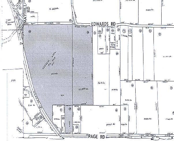
Edwards Rd, Denton, TX 76208

Property Detail
Edwards Rd
Dallas-Fort Worth-Arlington, TX
FLOWERS FOOD ADDN BLK A LOT 1R
R754437
DENTON
Industrialgeneral
Texas
B and X Area of moderate flood hazard, usually the area between the limits of the 100-year and 500-year floods.
1r
2024
67.08 AC
2025
Denton
021415
Dallas/Ft Worth
263,968 SF
NEARBY LISTINGS FOR SALE OR LEASE
DEMOGRAPHICS near Edwards Rd
1 mile
3 mile
5 mile
2025 Total Population
9,771
79,974
165,035
2030 Population
10,944
89,419
184,850
Pop Growth 2025-2030
+ 12.00%
+ 11.81%
+ 12.01%
Average Age
36
38
37
2025 Total Households
3,580
29,134
61,516
HH Growth 2025-2030
+ 12.29%
+ 12.15%
+ 12.39%
Median Household Inc
$93,804
$89,423
$79,563
Avg Household Size
2.70
2.70
2.50
2025 Avg HH Vehicles
2.00
2.00
2.00
Median Home Value
$370,669
$393,719
$383,899
Median Year Built
2007
2001
1998
Nearby Places
Map Layers
Map Styles
 Street
 Aerial
Transit
 Traffic
 Biking
Places
Listings with unknown addresses are not visible on the map
- Restaurants
- Banks
- Shops
- Fitness
- Groceries
PUBLIC TRANSPORTATION
COMMUTER RAIL
Medpark Station (A-train - Denton County Transportation Authority)
Drive
Walk
Distance
Medpark Station (A-train - Denton County Transportation Authority)
4 min
14 min
0.7 mi
Downtown Denton Transit Center (A-train - Denton County Transportation Authority)
Drive
Walk
Distance
Downtown Denton Transit Center (A-train - Denton County Transportation Authority)
11 min
4.9 mi
AIRPORT
Dallas-Fort Worth International
Drive
Walk
Distance
Dallas-Fort Worth International
31 min
23.5 mi
Dallas Love Field
Drive
Walk
Distance
Dallas Love Field
43 min
32.6 mi
Freight Ports
Port of Shreveport
Drive
Walk
Distance
Port of Shreveport
250 min
230.1 mi
Nearby Properties
Address
Land Use
TOTAL SIZE
Lot Size
Zoning
Address
Land Use
TOTAL SIZE
Lot Size
Zoning
394,618 SF
12.29 AC
Address
Land Use
TOTAL SIZE
Lot Size
Zoning
387,383 SF
27.58 AC
Address
Land Use
TOTAL SIZE
Lot Size
Zoning
310,952 SF
56.11 AC
Address
Land Use
TOTAL SIZE
Lot Size
Zoning
361,731 SF
15.96 AC
Address
Land Use
TOTAL SIZE
Lot Size
Zoning
184,710 SF
16.82 AC
Address
Land Use
TOTAL SIZE
Lot Size
Zoning
310,772 SF
11.77 AC
Address
Land Use
TOTAL SIZE
Lot Size
Zoning
278,316 SF
17.81 AC
30G
Address
Land Use
TOTAL SIZE
Lot Size
Zoning
338,378 SF
11.89 AC
Address
Land Use
TOTAL SIZE
Lot Size
Zoning
294,021 SF
30.81 AC
Address
Land Use
TOTAL SIZE
Lot Size
Zoning
208,582 SF
8.58 AC
Address
Land Use
TOTAL SIZE
Lot Size
Zoning
191,512 SF
8.04 AC
Address
Land Use
TOTAL SIZE
Lot Size
Zoning
326,832 SF
19.54 AC
30G
Address
Land Use
TOTAL SIZE
Lot Size
Zoning
246,287 SF
9.92 AC
Address
Land Use
TOTAL SIZE
Lot Size
Zoning
262,222 SF
15.47 AC
Address
Land Use
TOTAL SIZE
Lot Size
Zoning
243,397 SF
14.43 AC
Address
Land Use
TOTAL SIZE
Lot Size
Zoning
195,121 SF
10.16 AC
30G
Address
Land Use
TOTAL SIZE
Lot Size
Zoning
226,040 SF
19.51 AC
Address
Land Use
TOTAL SIZE
Lot Size
Zoning
123,133 SF
13.05 AC
Address
Land Use
TOTAL SIZE
Lot Size
Zoning
281,644 SF
4.50 AC
30G
Address
Land Use
TOTAL SIZE
Lot Size
Zoning
198,755 SF
10.57 AC
Address
Land Use
TOTAL SIZE
Lot Size
Zoning
229,968 SF
6.93 AC
Address
Land Use
TOTAL SIZE
Lot Size
Zoning
232,942 SF
12.58 AC
30G
Address
Land Use
TOTAL SIZE
Lot Size
Zoning
210,801 SF
6.14 AC
Address
Land Use
TOTAL SIZE
Lot Size
Zoning
176,838 SF
15.64 AC
Address
Land Use
TOTAL SIZE
Lot Size
Zoning
221,051 SF
19.24 AC
Address
Land Use
TOTAL SIZE
Lot Size
Zoning
178,272 SF
10.25 AC
Address
Land Use
TOTAL SIZE
Lot Size
Zoning
76,608 SF
22.43 AC
Address
Land Use
TOTAL SIZE
Lot Size
Zoning
237,540 SF
11.05 AC
30G
Address
Land Use
TOTAL SIZE
Lot Size
Zoning
276,244 SF
7.53 AC
Address
Land Use
TOTAL SIZE
Lot Size
Zoning
203,193 SF
23.34 AC
The World's #1 Commercial Real Estate Marketplace
Connect with us
© 2026 CoStar Group
The information above has been obtained from sources believed reliable. While we do not doubt its accuracy we have not verified it and make no guarantee, warranty or representation about it. It is your responsibility to independently confirm its accuracy and completeness. Any projections, opinions, assumptions, or estimates used are for example only and do not represent the current or future performance of the property. The value of this transaction to you depends on tax and other factors which should be evaluated by your tax, financial, and legal advisors. You and your advisors should conduct a careful, independent investigation of the property to determine to your satisfaction the suitability of the property for your needs.