Property Record
El Paso Rd, Palmer Lake, CO 80133


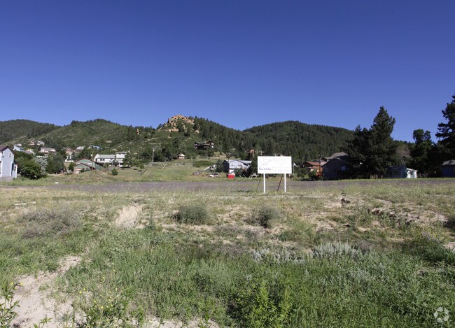
Property Detail
El Paso Rd
71051-12-006
ALL BLK 22, BROWNS FIL PALMER LAKE, N2 OF VAC HAREBELL ST ADJ TO SW OF SD BLK, EX PART DES AS FOLS, BEG AT NELY COR OF BLK 22, TH WLY 142.33 FT ALG NWLY LN OF SD BLK TO WLY LN OF SD BLK, SWLY 34.62 FT ALG WLY LN, ANG L 118<15 ELY 142.23 FT TO ELY LN,
Recreationalacreage
EL PASO
CC
Colorado
B and X Area of moderate flood hazard, usually the area between the limits of the 100-year and 500-year floods.
0.67 AC
2024
Northwest
2025
Colorado Springs
003713
Colorado Springs, CO
NEARBY LISTINGS FOR SALE OR LEASE
DEMOGRAPHICS near El Paso Rd
1 mile
3 mile
5 mile
2025 Total Population
1,294
5,471
21,303
2030 Population
1,243
5,470
21,745
Pop Growth 2025-2030
(3.94%)
(0.02%)
+ 2.07%
Average Age
45
44
42
2025 Total Households
516
2,098
7,705
HH Growth 2025-2030
(3.68%)
+ 0.14%
+ 2.25%
Median Household Inc
$126,154
$130,588
$142,254
Avg Household Size
2.50
2.60
2.80
2025 Avg HH Vehicles
3.00
3.00
3.00
Median Home Value
$602,678
$714,191
$739,446
Median Year Built
1982
1990
1994
Nearby Places
Map Layers
Map Styles
 Street
 Aerial
Layers
 Traffic
 Biking
Places
Listings with unknown addresses are not visible on the map
- Restaurants
- Banks
- Shops
- Fitness
- Groceries
PUBLIC TRANSPORTATION
AIRPORT
City of Colorado Springs Municipal
Drive
Walk
Distance
City of Colorado Springs Municipal
45 min
31.2 mi
SALE & LEASE HISTORY
LISTING DATE
SALE/LEASE

Dec 28, 2018
For Sale
Nearby Properties
Address
Land Use
TOTAL SIZE
Lot Size
Zoning
Address
Land Use
TOTAL SIZE
Lot Size
Zoning
600 SF
40 AC
A-5
Address
Land Use
TOTAL SIZE
Lot Size
Zoning
31,037 SF
9.80 AC
PUD
Address
Land Use
TOTAL SIZE
Lot Size
Zoning
1,047.40 AC
OS
Address
Land Use
TOTAL SIZE
Lot Size
Zoning
9,631 SF
15.85 AC
PUD
Address
Land Use
TOTAL SIZE
Lot Size
Zoning
1.68 AC
A-5
Address
Land Use
TOTAL SIZE
Lot Size
Zoning
12.30 AC
CC
Address
Land Use
TOTAL SIZE
Lot Size
Zoning
7,040 SF
0.22 AC
Address
Land Use
TOTAL SIZE
Lot Size
Zoning
53,688 SF
14.12 AC
PUD
Address
Land Use
TOTAL SIZE
Lot Size
Zoning
11,616 SF
4.81 AC
RR-5
Address
Land Use
TOTAL SIZE
Lot Size
Zoning
29,253 SF
21.12 AC
Address
Land Use
TOTAL SIZE
Lot Size
Zoning
10 AC
CC
Address
Land Use
TOTAL SIZE
Lot Size
Zoning
7,797 SF
1.28 AC
RA
Address
Land Use
TOTAL SIZE
Lot Size
Zoning
53,981 SF
4 AC
CC
Address
Land Use
TOTAL SIZE
Lot Size
Zoning
5,277 SF
2 AC
R3
Address
Land Use
TOTAL SIZE
Lot Size
Zoning
21,338 SF
1.97 AC
PUD
Address
Land Use
TOTAL SIZE
Lot Size
Zoning
36,389 SF
1.92 AC
C2
Address
Land Use
TOTAL SIZE
Lot Size
Zoning
8,182 SF
2.14 AC
PUD
Address
Land Use
TOTAL SIZE
Lot Size
Zoning
24,000 SF
5.55 AC
Address
Land Use
TOTAL SIZE
Lot Size
Zoning
24,000 SF
5.17 AC
M-1
Address
Land Use
TOTAL SIZE
Lot Size
Zoning
4,515 SF
46.62 AC
RR-5
Address
Land Use
TOTAL SIZE
Lot Size
Zoning
157.92 AC
A-5
Address
Land Use
TOTAL SIZE
Lot Size
Zoning
16,628 SF
1.98 AC
PUD
Address
Land Use
TOTAL SIZE
Lot Size
Zoning
24,500 SF
2.42 AC
I-2
Address
Land Use
TOTAL SIZE
Lot Size
Zoning
3.36 AC
R3
Address
Land Use
TOTAL SIZE
Lot Size
Zoning
2,549 SF
0.27 AC
Address
Land Use
TOTAL SIZE
Lot Size
Zoning
3,024 SF
2.01 AC
M-1
Address
Land Use
TOTAL SIZE
Lot Size
Zoning
5,280 SF
5.02 AC
PUD
Address
Land Use
TOTAL SIZE
Lot Size
Zoning
11,784 SF
3.59 AC
CS
Address
Land Use
TOTAL SIZE
Lot Size
Zoning
3,289 SF
10 AC
Address
Land Use
TOTAL SIZE
Lot Size
Zoning
12,448 SF
1.39 AC
PUD
The World's #1 Commercial Real Estate Marketplace
Connect with us
© 2026 CoStar Group
The information above has been obtained from sources believed reliable. While we do not doubt its accuracy we have not verified it and make no guarantee, warranty or representation about it. It is your responsibility to independently confirm its accuracy and completeness. Any projections, opinions, assumptions, or estimates used are for example only and do not represent the current or future performance of the property. The value of this transaction to you depends on tax and other factors which should be evaluated by your tax, financial, and legal advisors. You and your advisors should conduct a careful, independent investigation of the property to determine to your satisfaction the suitability of the property for your needs.