Property Record
145 S Higley Rd, Gilbert, AZ 85296


NEARBY LISTINGS FOR SALE OR LEASE
Property Detail
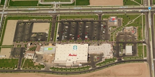
145 S Higley Rd
Phoenix-Mesa-Scottsdale, AZ
Lakeview Village At Morrison Ranch
304-19-016
LAKEVIEW VILLAGE AT MORRISON RANCH MCR 742-48
Restaurantdrivein
Maricopa
X
Arizona
04013C2751M
2
2025
1.05 AC
2025
Gateway Airport/Loop 202
422658
Phoenix
4,536 SF
DEMOGRAPHICS near 145 S Higley Rd
1 Mile
3 Mile
5 Mile
2024 Total Population
12,498
113,194
300,828
2029 Population
13,688
122,726
326,223
Pop Growth 2024-2029
+ 9.52%
+ 8.42%
+ 8.44%
Average Age
34
35
38
2024 Total Households
3,431
36,971
109,226
HH Growth 2024-2029
+ 9.50%
+ 8.56%
+ 8.70%
Median Household Inc
$147,290
$105,272
$86,768
Avg Household Size
3.50
3.00
2.70
2024 Avg HH Vehicles
2.00
2.00
2.00
Median Home Value
$539,332
$439,096
$385,634
Median Year Built
2006
2001
1996
Nearby Places
Map Layers
Map Styles
 Street
 Aerial
- Restaurants
- Banks
- Shops
- Fitness
- Groceries
PUBLIC TRANSPORTATION
AIRPORT
Phoenix-Mesa Gateway
DRIVE
WALK
Distance
Phoenix-Mesa Gateway
12 min
6.2 mi
Phoenix Sky Harbor International
DRIVE
WALK
Distance
Phoenix Sky Harbor International
33 min
23.0 mi
SALE & LEASE HISTORY
LISTING DATE
SALE/LEASE

Sep 24, 2016
For Sale
Feb 20, 2018
For Lease
Nearby Properties
Address
Land Use
TOTAL SIZE
Lot Size
Zoning
Address
Land Use
TOTAL SIZE
Lot Size
Zoning
184.86 AC
Address
Land Use
TOTAL SIZE
Lot Size
Zoning
93,214 SF
10.60 AC
PF
Address
Land Use
TOTAL SIZE
Lot Size
Zoning
981,158 SF
43.42 AC
C-G
Address
Land Use
TOTAL SIZE
Lot Size
Zoning
12.66 AC
Address
Land Use
TOTAL SIZE
Lot Size
Zoning
403,171 SF
34.53 AC
PF
Address
Land Use
TOTAL SIZE
Lot Size
Zoning
580,492 SF
41.81 AC
R3
Address
Land Use
TOTAL SIZE
Lot Size
Zoning
479,727 SF
14.25 AC
MFM
Address
Land Use
TOTAL SIZE
Lot Size
Zoning
412,581 SF
21.15 AC
MFM
Address
Land Use
TOTAL SIZE
Lot Size
Zoning
4.60 AC
C-C
Address
Land Use
TOTAL SIZE
Lot Size
Zoning
290,450 SF
38.47 AC
PF
Address
Land Use
TOTAL SIZE
Lot Size
Zoning
441,928 SF
17.31 AC
RM3
Address
Land Use
TOTAL SIZE
Lot Size
Zoning
414,288 SF
28.67 AC
LI
Address
Land Use
TOTAL SIZE
Lot Size
Zoning
238,386 SF
40.25 AC
BP
Address
Land Use
TOTAL SIZE
Lot Size
Zoning
387,535 SF
15.80 AC
C-G
Address
Land Use
TOTAL SIZE
Lot Size
Zoning
380,383 SF
14.79 AC
C-G
Address
Land Use
TOTAL SIZE
Lot Size
Zoning
323,064 SF
15.90 AC
MFM
Address
Land Use
TOTAL SIZE
Lot Size
Zoning
461,845 SF
21.62 AC
LI
Address
Land Use
TOTAL SIZE
Lot Size
Zoning
278,044 SF
19.98 AC
PF
Address
Land Use
TOTAL SIZE
Lot Size
Zoning
274,993 SF
16.44 AC
Address
Land Use
TOTAL SIZE
Lot Size
Zoning
18.75 AC
PF
Address
Land Use
TOTAL SIZE
Lot Size
Zoning
63,507 SF
83.58 AC
PF
Address
Land Use
TOTAL SIZE
Lot Size
Zoning
143,232 SF
26.94 AC
PF
Address
Land Use
TOTAL SIZE
Lot Size
Zoning
3.03 AC
C-C
Address
Land Use
TOTAL SIZE
Lot Size
Zoning
330,496 SF
18.63 AC
LI
Address
Land Use
TOTAL SIZE
Lot Size
Zoning
238,856 SF
6.53 AC
R3
Address
Land Use
TOTAL SIZE
Lot Size
Zoning
142,871 SF
40.83 AC
PF
Address
Land Use
TOTAL SIZE
Lot Size
Zoning
312,726 SF
17.01 AC
MFL
Address
Land Use
TOTAL SIZE
Lot Size
Zoning
129,201 SF
24.65 AC
LI
Address
Land Use
TOTAL SIZE
Lot Size
Zoning
292,095 SF
15.38 AC
M-M
The World's #1 Commercial Real Estate Marketplace
Connect with us
© 2025 CoStar Group
The information above has been obtained from sources believed reliable. While we do not doubt its accuracy we have not verified it and make no guarantee, warranty or representation about it. It is your responsibility to independently confirm its accuracy and completeness. Any projections, opinions, assumptions, or estimates used are for example only and do not represent the current or future performance of the property. The value of this transaction to you depends on tax and other factors which should be evaluated by your tax, financial, and legal advisors. You and your advisors should conduct a careful, independent investigation of the property to determine to your satisfaction the suitability of the property for your needs.