Property Record
Energy Dr, Louisville, OH 44641
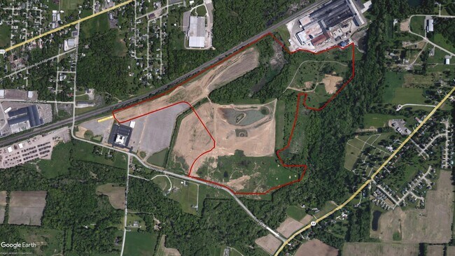

This Property Is For Sale
Property Detail
Energy Dr
Canton-Massillon, OH
OL397 - 80.61A
10005233
STARK
Officebuilding
Ohio
AE The base floodplain where base flood elevations are provided. AE Zones are now used on new format FIRMs instead of A1-A30 Zones.
80.61 AC
0
Stark County
2025
Cleveland
712601
NEARBY LISTINGS FOR SALE OR LEASE
-
-
View all Louisville listings for sale on LoopNet.com
DEMOGRAPHICS near Energy Dr
1 mile
3 mile
5 mile
2025 Total Population
1,414
25,016
62,509
2030 Population
1,427
25,026
62,484
Pop Growth 2025-2030
+ 0.92%
+ 0.04%
(0.04%)
Average Age
42
42
41
2025 Total Households
587
10,250
25,647
HH Growth 2025-2030
+ 1.02%
+ 0.01%
(0.11%)
Median Household Inc
$67,500
$58,513
$57,647
Avg Household Size
2.40
2.40
2.30
2025 Avg HH Vehicles
2.00
2.00
2.00
Median Home Value
$169,837
$163,266
$156,724
Median Year Built
1969
1966
1960
Nearby Places
Map Layers
Map Styles
 Street
 Aerial
Layers
 Traffic
 Biking
Places
Listings with unknown addresses are not visible on the map
- Restaurants
- Banks
- Shops
- Fitness
- Groceries
PUBLIC TRANSPORTATION
AIRPORT
Akron-Canton Regional
Drive
Walk
Distance
Akron-Canton Regional
26 min
16.8 mi
Freight Ports
Port of Toledo
Drive
Walk
Distance
Port of Toledo
197 min
164.0 mi
Nearby Properties
Address
Land Use
TOTAL SIZE
Lot Size
Zoning
Address
Land Use
TOTAL SIZE
Lot Size
Zoning
91.83 AC
Address
Land Use
TOTAL SIZE
Lot Size
Zoning
125,619 SF
13.15 AC
Address
Land Use
TOTAL SIZE
Lot Size
Zoning
272,327 SF
23.62 AC
Address
Land Use
TOTAL SIZE
Lot Size
Zoning
129,374 SF
63.36 AC
Address
Land Use
TOTAL SIZE
Lot Size
Zoning
141,077 SF
21.73 AC
Address
Land Use
TOTAL SIZE
Lot Size
Zoning
109,663 SF
4.26 AC
Address
Land Use
TOTAL SIZE
Lot Size
Zoning
681,718 SF
35.20 AC
Address
Land Use
TOTAL SIZE
Lot Size
Zoning
202,684 SF
40.97 AC
Address
Land Use
TOTAL SIZE
Lot Size
Zoning
133,991 SF
24.51 AC
Address
Land Use
TOTAL SIZE
Lot Size
Zoning
153,834 SF
20.21 AC
Address
Land Use
TOTAL SIZE
Lot Size
Zoning
52,876 SF
4.96 AC
Address
Land Use
TOTAL SIZE
Lot Size
Zoning
81,369 SF
3 AC
Address
Land Use
TOTAL SIZE
Lot Size
Zoning
124,064 SF
3.52 AC
Address
Land Use
TOTAL SIZE
Lot Size
Zoning
1,083,703 SF
91.83 AC
Address
Land Use
TOTAL SIZE
Lot Size
Zoning
47,160 SF
19.76 AC
Address
Land Use
TOTAL SIZE
Lot Size
Zoning
68,419 SF
8.93 AC
Address
Land Use
TOTAL SIZE
Lot Size
Zoning
51,131 SF
9.73 AC
Address
Land Use
TOTAL SIZE
Lot Size
Zoning
187,797 SF
20.29 AC
Address
Land Use
TOTAL SIZE
Lot Size
Zoning
14,070 SF
10.04 AC
Address
Land Use
TOTAL SIZE
Lot Size
Zoning
49,900 SF
1.31 AC
Address
Land Use
TOTAL SIZE
Lot Size
Zoning
54,593 SF
10.66 AC
Address
Land Use
TOTAL SIZE
Lot Size
Zoning
52,324 SF
8.52 AC
Address
Land Use
TOTAL SIZE
Lot Size
Zoning
11,179 SF
79.99 AC
Address
Land Use
TOTAL SIZE
Lot Size
Zoning
28,777 SF
3.24 AC
Address
Land Use
TOTAL SIZE
Lot Size
Zoning
86,331 SF
3.67 AC
Address
Land Use
TOTAL SIZE
Lot Size
Zoning
22,341 SF
11.09 AC
Address
Land Use
TOTAL SIZE
Lot Size
Zoning
84,815 SF
5.54 AC
Address
Land Use
TOTAL SIZE
Lot Size
Zoning
106,719 SF
16.09 AC
Address
Land Use
TOTAL SIZE
Lot Size
Zoning
92,435 SF
9.29 AC
Address
Land Use
TOTAL SIZE
Lot Size
Zoning
257,354 SF
31.06 AC
The World's #1 Commercial Real Estate Marketplace
Connect with us
© 2026 CoStar Group
The information above has been obtained from sources believed reliable. While we do not doubt its accuracy we have not verified it and make no guarantee, warranty or representation about it. It is your responsibility to independently confirm its accuracy and completeness. Any projections, opinions, assumptions, or estimates used are for example only and do not represent the current or future performance of the property. The value of this transaction to you depends on tax and other factors which should be evaluated by your tax, financial, and legal advisors. You and your advisors should conduct a careful, independent investigation of the property to determine to your satisfaction the suitability of the property for your needs.