Property Record
Engineering Design Group & Highpointe Properties, Pelham, AL 35124
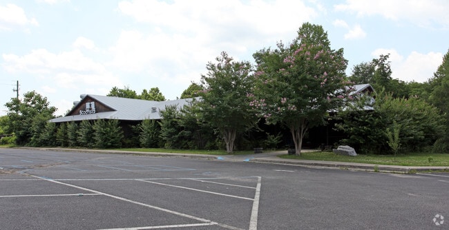


Property Detail
Engineering Design Group & Highpointe Properties
10-9-31-4-001-007-017
COM INT N ROW BISHOP CIR & W ROW OAK MTN PK RD WLY316.12 TO POB N210.58 SW449.57 SE200.21 NE276.49 NELY74.55 TO POB
Officebuilding
SHELBY
AE The base floodplain where base flood elevations are provided. AE Zones are now used on new format FIRMs instead of A1-A30 Zones.
Alabama
2024
1.70 AC
2024
I-65 Corr/S Shelby County
030315
Birmingham
10,888 SF
Birmingham, AL
NEARBY LISTINGS FOR SALE OR LEASE
DEMOGRAPHICS near Engineering Design Group & Highpointe Properties
1 mile
3 mile
5 mile
2025 Total Population
1,739
27,637
79,673
2030 Population
1,869
28,410
80,457
Pop Growth 2025-2030
+ 7.48%
+ 2.80%
+ 0.98%
Average Age
37
41
40
2025 Total Households
623
11,367
32,206
HH Growth 2025-2030
+ 7.22%
+ 2.60%
+ 0.64%
Median Household Inc
$73,656
$82,287
$89,083
Avg Household Size
2.70
2.40
2.40
2025 Avg HH Vehicles
2.00
2.00
2.00
Median Home Value
$234,121
$318,790
$352,246
Median Year Built
1989
1990
1991
Nearby Places
Map Layers
Map Styles
 Street
 Aerial
Transit
 Traffic
 Biking
Places
Listings with unknown addresses are not visible on the map
- Restaurants
- Banks
- Shops
- Fitness
- Groceries
PUBLIC TRANSPORTATION
AIRPORT
Birmingham-Shuttlesworth International
Drive
Walk
Distance
Birmingham-Shuttlesworth International
29 min
20.3 mi
Nearby Properties
Address
Land Use
TOTAL SIZE
Lot Size
Zoning
Address
Land Use
TOTAL SIZE
Lot Size
Zoning
501,099 SF
33 AC
PO
Address
Land Use
TOTAL SIZE
Lot Size
Zoning
442,000 SF
36.44 AC
Address
Land Use
TOTAL SIZE
Lot Size
Zoning
267,122 SF
26 AC
PC
Address
Land Use
TOTAL SIZE
Lot Size
Zoning
12,200 SF
28.77 AC
Address
Land Use
TOTAL SIZE
Lot Size
Zoning
240,661 SF
53 AC
Address
Land Use
TOTAL SIZE
Lot Size
Zoning
210,033 SF
7.85 AC
Address
Land Use
TOTAL SIZE
Lot Size
Zoning
186,953 SF
20 AC
PR2
Address
Land Use
TOTAL SIZE
Lot Size
Zoning
2,199 SF
23 AC
Address
Land Use
TOTAL SIZE
Lot Size
Zoning
18,781 SF
12.09 AC
Address
Land Use
TOTAL SIZE
Lot Size
Zoning
241,232 SF
15 AC
PR2
Address
Land Use
TOTAL SIZE
Lot Size
Zoning
165,474 SF
90 AC
PR2
Address
Land Use
TOTAL SIZE
Lot Size
Zoning
2,792 SF
15 AC
Address
Land Use
TOTAL SIZE
Lot Size
Zoning
94,094 SF
14.40 AC
PO-P
Address
Land Use
TOTAL SIZE
Lot Size
Zoning
102,342 SF
11 AC
Address
Land Use
TOTAL SIZE
Lot Size
Zoning
295,144 SF
22 AC
PR-2
Address
Land Use
TOTAL SIZE
Lot Size
Zoning
20,680 SF
6.60 AC
Address
Land Use
TOTAL SIZE
Lot Size
Zoning
22,726 SF
15.77 AC
Address
Land Use
TOTAL SIZE
Lot Size
Zoning
230,053 SF
23 AC
Address
Land Use
TOTAL SIZE
Lot Size
Zoning
30,123 SF
14.55 AC
Address
Land Use
TOTAL SIZE
Lot Size
Zoning
5,070 SF
15.38 AC
Address
Land Use
TOTAL SIZE
Lot Size
Zoning
152,735 SF
10 AC
R-4
Address
Land Use
TOTAL SIZE
Lot Size
Zoning
1 SF
15 AC
Address
Land Use
TOTAL SIZE
Lot Size
Zoning
57,600 SF
15.45 AC
Address
Land Use
TOTAL SIZE
Lot Size
Zoning
132,627 SF
14 AC
PR-2
Address
Land Use
TOTAL SIZE
Lot Size
Zoning
13,992 SF
8.70 AC
Address
Land Use
TOTAL SIZE
Lot Size
Zoning
6,050 SF
623 AC
Address
Land Use
TOTAL SIZE
Lot Size
Zoning
Address
Land Use
TOTAL SIZE
Lot Size
Zoning
80,218 SF
6 AC
PO
Address
Land Use
TOTAL SIZE
Lot Size
Zoning
32,373 SF
7.42 AC
The World's #1 Commercial Real Estate Marketplace
Connect with us
© 2026 CoStar Group
The information above has been obtained from sources believed reliable. While we do not doubt its accuracy we have not verified it and make no guarantee, warranty or representation about it. It is your responsibility to independently confirm its accuracy and completeness. Any projections, opinions, assumptions, or estimates used are for example only and do not represent the current or future performance of the property. The value of this transaction to you depends on tax and other factors which should be evaluated by your tax, financial, and legal advisors. You and your advisors should conduct a careful, independent investigation of the property to determine to your satisfaction the suitability of the property for your needs.