Property Record
Entry Rd, Fontana, CA 92335
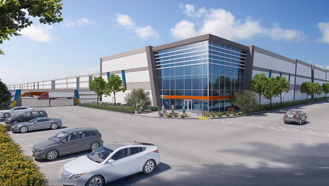


Current Lease Availabilities
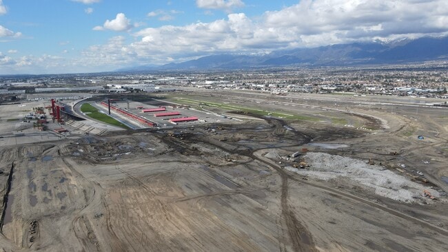
Property Detail
Entry Rd
Riverside-San Bernardino-Ontario, CA
PARCEL MAP 20478 PARCEL 7 BOOK 263 PAGE 53
0231-291-02
SAN BERNARDINO
Vacantlandnec
California
2025
27.05 AC
2025
Airport Area
003101
Inland Empire (California)
NEARBY LISTINGS FOR SALE OR LEASE
DEMOGRAPHICS near Entry Rd
1 mile
3 mile
5 mile
2025 Total Population
494
75,236
289,122
2030 Population
498
75,855
291,148
Pop Growth 2025-2030
+ 0.81%
+ 0.82%
+ 0.70%
Average Age
35
37
36
2025 Total Households
119
20,186
83,380
HH Growth 2025-2030
+ 0.84%
+ 0.99%
+ 0.69%
Median Household Inc
$83,333
$111,660
$101,601
Avg Household Size
3.70
3.50
3.40
2025 Avg HH Vehicles
2.00
2.00
2.00
Median Home Value
$684,210
$640,184
$670,593
Median Year Built
1979
1993
1989
Nearby Places
Map Layers
Map Styles
 Street
 Aerial
Transit
 Traffic
 Biking
Places
Listings with unknown addresses are not visible on the map
- Restaurants
- Banks
- Shops
- Fitness
- Groceries
PUBLIC TRANSPORTATION
COMMUTER RAIL
Fontana (San Bernardino Line - Southern California Regional Rail Authority (Metrolink))
Drive
Walk
Distance
Fontana (San Bernardino Line - Southern California Regional Rail Authority (Metrolink))
12 min
4.8 mi
Rancho Cucamonga (San Bernardino Line - Southern California Regional Rail Authority (Metrolink))
Drive
Walk
Distance
Rancho Cucamonga (San Bernardino Line - Southern California Regional Rail Authority (Metrolink))
12 min
5.3 mi
AIRPORT
Ontario International
Drive
Walk
Distance
Ontario International
17 min
7.2 mi
Freight Ports
Port of Long Beach
Drive
Walk
Distance
Port of Long Beach
79 min
59.6 mi
Nearby Properties
Address
Land Use
TOTAL SIZE
Lot Size
Zoning
Address
Land Use
TOTAL SIZE
Lot Size
Zoning
1,459,702 SF
96.41 AC
Address
Land Use
TOTAL SIZE
Lot Size
Zoning
1,422,524 SF
44.96 AC
Address
Land Use
TOTAL SIZE
Lot Size
Zoning
362.37 AC
Address
Land Use
TOTAL SIZE
Lot Size
Zoning
1,613,290 SF
59.42 AC
Address
Land Use
TOTAL SIZE
Lot Size
Zoning
707,551 SF
20.36 AC
Address
Land Use
TOTAL SIZE
Lot Size
Zoning
502,314 SF
40.06 AC
Address
Land Use
TOTAL SIZE
Lot Size
Zoning
817,750 SF
35.82 AC
Address
Land Use
TOTAL SIZE
Lot Size
Zoning
912 SF
370.60 AC
IR
Address
Land Use
TOTAL SIZE
Lot Size
Zoning
752,497 SF
24.89 AC
Address
Land Use
TOTAL SIZE
Lot Size
Zoning
1,385,866 SF
69.84 AC
Address
Land Use
TOTAL SIZE
Lot Size
Zoning
1,286,569 SF
53.96 AC
Address
Land Use
TOTAL SIZE
Lot Size
Zoning
459,431 SF
23.10 AC
Address
Land Use
TOTAL SIZE
Lot Size
Zoning
275,783 SF
11.82 AC
Address
Land Use
TOTAL SIZE
Lot Size
Zoning
261,114 SF
11.23 AC
Address
Land Use
TOTAL SIZE
Lot Size
Zoning
34.80 AC
Address
Land Use
TOTAL SIZE
Lot Size
Zoning
145,111 SF
48.01 AC
Address
Land Use
TOTAL SIZE
Lot Size
Zoning
249,658 SF
20.03 AC
Address
Land Use
TOTAL SIZE
Lot Size
Zoning
500,403 SF
24.69 AC
Address
Land Use
TOTAL SIZE
Lot Size
Zoning
453,960 SF
18.54 AC
Address
Land Use
TOTAL SIZE
Lot Size
Zoning
319,375 SF
14.66 AC
Address
Land Use
TOTAL SIZE
Lot Size
Zoning
104,537 SF
30.72 AC
Address
Land Use
TOTAL SIZE
Lot Size
Zoning
611,573 SF
26.64 AC
Address
Land Use
TOTAL SIZE
Lot Size
Zoning
87,909 SF
30.12 AC
Address
Land Use
TOTAL SIZE
Lot Size
Zoning
286,732 SF
9.58 AC
Address
Land Use
TOTAL SIZE
Lot Size
Zoning
55.52 AC
Address
Land Use
TOTAL SIZE
Lot Size
Zoning
314,580 SF
24 AC
Address
Land Use
TOTAL SIZE
Lot Size
Zoning
300,205 SF
12.63 AC
Address
Land Use
TOTAL SIZE
Lot Size
Zoning
76.50 AC
Address
Land Use
TOTAL SIZE
Lot Size
Zoning
849,900 SF
39.25 AC
KCSP
Address
Land Use
TOTAL SIZE
Lot Size
Zoning
291,742 SF
12.10 AC
The World's #1 Commercial Real Estate Marketplace
Connect with us
© 2026 CoStar Group
The information above has been obtained from sources believed reliable. While we do not doubt its accuracy we have not verified it and make no guarantee, warranty or representation about it. It is your responsibility to independently confirm its accuracy and completeness. Any projections, opinions, assumptions, or estimates used are for example only and do not represent the current or future performance of the property. The value of this transaction to you depends on tax and other factors which should be evaluated by your tax, financial, and legal advisors. You and your advisors should conduct a careful, independent investigation of the property to determine to your satisfaction the suitability of the property for your needs.