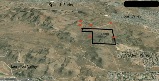
Property Record
Estates Rd, Reno, NV 89506

Save to a Folder
{{folder.Name}}
{{folder.ListingIds.length}} Properties
{{folder.ListingIds.length}} Property
Create a New Folder
Property Detail
Estates Rd
552-020-03
SW4 SE4 SEC 1 TWP 20N RGE 19E
Residentialacreage
WASHOE
GR
Nevada
B and X Area of moderate flood hazard, usually the area between the limits of the 100-year and 500-year floods.
40 AC
0
N Outlying Washoe County
2026
Reno/Sparks
002615
Reno, NV
NEARBY LISTINGS FOR SALE OR LEASE
DEMOGRAPHICS near Estates Rd
1 mile
3 mile
5 mile
2025 Total Population
51
26,863
100,323
2030 Population
54
27,562
103,980
Pop Growth 2025-2030
+ 5.88%
+ 2.60%
+ 3.65%
Average Age
45
39
38
2025 Total Households
19
8,745
35,022
HH Growth 2025-2030
0.00%
+ 2.70%
+ 3.75%
Median Household Inc
$131,250
$85,717
$85,418
Avg Household Size
2.70
3.00
2.80
2025 Avg HH Vehicles
2.00
2.00
2.00
Median Home Value
$645,833
$393,303
$441,307
Median Year Built
2007
1992
1998
Nearby Places
Map Layers
Map Styles
 Street
 Aerial
Layers
 Traffic
 Biking
Places
Listings with unknown addresses are not visible on the map
- Restaurants
- Banks
- Shops
- Fitness
- Groceries
PUBLIC TRANSPORTATION
AIRPORT
Reno/Tahoe International
Drive
Walk
Distance
Reno/Tahoe International
40 min
15.2 mi
Freight Ports
Port of Stockton
Drive
Walk
Distance
Port of Stockton
226 min
189.6 mi
SALE & LEASE HISTORY
LISTING DATE
SALE/LEASE

Jan 11, 2021
For Sale
Nearby Properties
Address
Land Use
TOTAL SIZE
Lot Size
Zoning
Address
Land Use
TOTAL SIZE
Lot Size
Zoning
282,355 SF
82.61 AC
LDS 86% /
Address
Land Use
TOTAL SIZE
Lot Size
Zoning
188,281 SF
641.92 AC
OS 88% / G
Address
Land Use
TOTAL SIZE
Lot Size
Zoning
57,443 SF
26.56 AC
PSP
Address
Land Use
TOTAL SIZE
Lot Size
Zoning
57,942 SF
11.32 AC
PF
Address
Land Use
TOTAL SIZE
Lot Size
Zoning
38,080 SF
2.64 AC
GC
Address
Land Use
TOTAL SIZE
Lot Size
Zoning
24.89 AC
MDS 95% /
Address
Land Use
TOTAL SIZE
Lot Size
Zoning
46,657 SF
8.57 AC
PSP
Address
Land Use
TOTAL SIZE
Lot Size
Zoning
34,409 SF
8.58 AC
GC
Address
Land Use
TOTAL SIZE
Lot Size
Zoning
44,181 SF
8.76 AC
PSP
Address
Land Use
TOTAL SIZE
Lot Size
Zoning
12,000 SF
1.66 AC
NC
Address
Land Use
TOTAL SIZE
Lot Size
Zoning
41,356 SF
9.12 AC
PSP
Address
Land Use
TOTAL SIZE
Lot Size
Zoning
12,937 SF
4.47 AC
MDS
Address
Land Use
TOTAL SIZE
Lot Size
Zoning
37.21 AC
PSP
Address
Land Use
TOTAL SIZE
Lot Size
Zoning
24,547 SF
4.37 AC
GC
Address
Land Use
TOTAL SIZE
Lot Size
Zoning
17,069 SF
1.77 AC
GC
Address
Land Use
TOTAL SIZE
Lot Size
Zoning
14,320 SF
3.05 AC
LDS
Address
Land Use
TOTAL SIZE
Lot Size
Zoning
11,296 SF
3 AC
IC
Address
Land Use
TOTAL SIZE
Lot Size
Zoning
3,008 SF
0.90 AC
GC
Address
Land Use
TOTAL SIZE
Lot Size
Zoning
8,127 SF
1.68 AC
MDS
Address
Land Use
TOTAL SIZE
Lot Size
Zoning
33.60 AC
HDS 89% /
Address
Land Use
TOTAL SIZE
Lot Size
Zoning
4,840 SF
3 AC
IC
Address
Land Use
TOTAL SIZE
Lot Size
Zoning
424.58 AC
OS
Address
Land Use
TOTAL SIZE
Lot Size
Zoning
19,316 SF
3.92 AC
GC
Address
Land Use
TOTAL SIZE
Lot Size
Zoning
0.66 AC
GR
Address
Land Use
TOTAL SIZE
Lot Size
Zoning
24.93 AC
SF-6
Address
Land Use
TOTAL SIZE
Lot Size
Zoning
9,802 SF
26.09 AC
PR
Address
Land Use
TOTAL SIZE
Lot Size
Zoning
1.44 AC
PSP
Address
Land Use
TOTAL SIZE
Lot Size
Zoning
28,600 SF
5.70 AC
MDS 14% /
Address
Land Use
TOTAL SIZE
Lot Size
Zoning
3,218 SF
0.71 AC
GC
Address
Land Use
TOTAL SIZE
Lot Size
Zoning
4.94 AC
LDS
The World's #1 Commercial Real Estate Marketplace
Connect with us
© 2026 CoStar Group
The information above has been obtained from sources believed reliable. While we do not doubt its accuracy we have not verified it and make no guarantee, warranty or representation about it. It is your responsibility to independently confirm its accuracy and completeness. Any projections, opinions, assumptions, or estimates used are for example only and do not represent the current or future performance of the property. The value of this transaction to you depends on tax and other factors which should be evaluated by your tax, financial, and legal advisors. You and your advisors should conduct a careful, independent investigation of the property to determine to your satisfaction the suitability of the property for your needs.