Property Record
Estero Rd, Pinon Hills, CA 92372


NEARBY LISTINGS FOR SALE OR LEASE
Property Detail
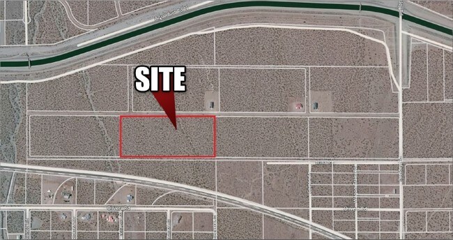
Estero Rd
Riverside-San Bernardino-Ontario, CA
Parcel Map No 14298
3099-391-07
PARCEL MAP 14298 PARCEL 6 BOOK 185 PAGE 70
Vacantlandnec
San Bernardino
X
California
06071C6450H
19.54 AC
2025
Mojave River Valley
2025
Inland Empire (California)
009121
DEMOGRAPHICS near Estero Rd
1 Mile
3 Mile
5 Mile
2024 Total Population
340
4,483
9,824
2029 Population
328
4,395
9,594
Pop Growth 2024-2029
(3.53%)
(1.96%)
(2.34%)
Average Age
40
39
40
2024 Total Households
108
1,224
2,895
HH Growth 2024-2029
(3.70%)
(2.45%)
(2.76%)
Median Household Inc
$62,143
$62,298
$60,218
Avg Household Size
3.10
3.10
3.00
2024 Avg HH Vehicles
2.00
2.00
2.00
Median Home Value
$348,484
$320,880
$328,925
Median Year Built
1993
1992
1989
Nearby Places
Map Layers
Map Styles
 Street
 Aerial
- Restaurants
- Banks
- Shops
- Fitness
- Groceries
SALE & LEASE HISTORY
LISTING DATE
SALE/LEASE

Sep 05, 2017
For Sale
Nearby Properties
Address
Land Use
TOTAL SIZE
Lot Size
Zoning
Address
Land Use
TOTAL SIZE
Lot Size
Zoning
147.78 AC
PHIC
Address
Land Use
TOTAL SIZE
Lot Size
Zoning
37.13 AC
PHRL
Address
Land Use
TOTAL SIZE
Lot Size
Zoning
40 AC
PHRL
Address
Land Use
TOTAL SIZE
Lot Size
Zoning
80 AC
PHRL5
Address
Land Use
TOTAL SIZE
Lot Size
Zoning
78.20 AC
PHRL
Address
Land Use
TOTAL SIZE
Lot Size
Zoning
9.74 AC
PHRL
Address
Land Use
TOTAL SIZE
Lot Size
Zoning
156.59 AC
PHRL
Address
Land Use
TOTAL SIZE
Lot Size
Zoning
3,750 SF
2.37 AC
PHRM
Address
Land Use
TOTAL SIZE
Lot Size
Zoning
7.39 AC
PHRL
Address
Land Use
TOTAL SIZE
Lot Size
Zoning
79.03 AC
PHRL
Address
Land Use
TOTAL SIZE
Lot Size
Zoning
78.52 AC
PHRL
Address
Land Use
TOTAL SIZE
Lot Size
Zoning
40 AC
PHRL
Address
Land Use
TOTAL SIZE
Lot Size
Zoning
19.15 AC
PHRL
Address
Land Use
TOTAL SIZE
Lot Size
Zoning
7 AC
PHRL
Address
Land Use
TOTAL SIZE
Lot Size
Zoning
59.57 AC
PHRL
Address
Land Use
TOTAL SIZE
Lot Size
Zoning
40 AC
PHRL
Address
Land Use
TOTAL SIZE
Lot Size
Zoning
37.53 AC
PHRL
Address
Land Use
TOTAL SIZE
Lot Size
Zoning
80 AC
PHRL
Address
Land Use
TOTAL SIZE
Lot Size
Zoning
39.25 AC
PHRL
Address
Land Use
TOTAL SIZE
Lot Size
Zoning
38.75 AC
PHRL5
Address
Land Use
TOTAL SIZE
Lot Size
Zoning
10 AC
PHRL
Address
Land Use
TOTAL SIZE
Lot Size
Zoning
38.30 AC
PHRS1
Address
Land Use
TOTAL SIZE
Lot Size
Zoning
19.60 AC
PHRL
Address
Land Use
TOTAL SIZE
Lot Size
Zoning
20 AC
PHRL
Address
Land Use
TOTAL SIZE
Lot Size
Zoning
4,320 SF
1.57 AC
PHRM
Address
Land Use
TOTAL SIZE
Lot Size
Zoning
9.75 AC
PHRL
Address
Land Use
TOTAL SIZE
Lot Size
Zoning
3.79 AC
PHCG
Address
Land Use
TOTAL SIZE
Lot Size
Zoning
68.41 AC
PHRL
Address
Land Use
TOTAL SIZE
Lot Size
Zoning
9.72 AC
PHRL
Address
Land Use
TOTAL SIZE
Lot Size
Zoning
10 AC
PHRL
The World's #1 Commercial Real Estate Marketplace
Connect with us
© 2026 CoStar Group
The information above has been obtained from sources believed reliable. While we do not doubt its accuracy we have not verified it and make no guarantee, warranty or representation about it. It is your responsibility to independently confirm its accuracy and completeness. Any projections, opinions, assumptions, or estimates used are for example only and do not represent the current or future performance of the property. The value of this transaction to you depends on tax and other factors which should be evaluated by your tax, financial, and legal advisors. You and your advisors should conduct a careful, independent investigation of the property to determine to your satisfaction the suitability of the property for your needs.