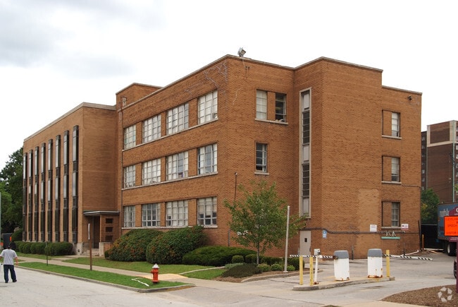
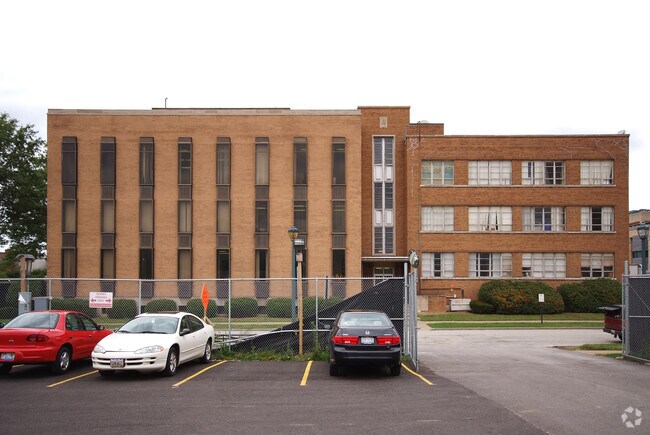
Property Record
Euclid Ave, Cleveland, OH 44106


NEARBY LISTINGS FOR SALE OR LEASE
Property Detail
Euclid Ave
Cleveland-Elyria, OH
Add
121-08-001
PCL A VOL 360 PG 46 FF 370.00 D 489.82 4.082AC OL 403 ADDITIONAL PPN'S 12108002 TO 006, 017 & 008, 024 TO 029, & 031 2010S/R MB121 PG08 MB360 PG46
Charitableorganization
Cuyahoga
X
Ohio
39035C0088E
a-1
2024
4.08 AC
2024
Midtown
196800
Cleveland
370,230 SF
DEMOGRAPHICS near Euclid Ave
1 Mile
3 Mile
5 Mile
2024 Total Population
21,786
148,918
318,768
2029 Population
21,820
148,354
314,704
Pop Growth 2024-2029
+ 0.16%
(0.38%)
(1.27%)
Average Age
35
39
39
2024 Total Households
10,094
67,785
142,885
HH Growth 2024-2029
+ 0.77%
(0.45%)
(1.24%)
Median Household Inc
$31,048
$31,765
$38,187
Avg Household Size
1.70
2.00
2.10
2024 Avg HH Vehicles
1.00
1.00
1.00
Median Home Value
$208,277
$105,540
$110,984
Median Year Built
1949
1947
1948
Nearby Places
Map Layers
Map Styles
 Street
 Aerial
- Restaurants
- Banks
- Shops
- Fitness
- Groceries
PUBLIC TRANSPORTATION
TRANSIT/SUBWAY
Little Italy-Univ Circle Station (Heavy Rail - Greater Cleveland Regional Transit Authority)
DRIVE
WALK
Distance
Little Italy-Univ Circle Station (Heavy Rail - Greater Cleveland Regional Transit Authority)
1 min
8 min
0.4 mi
Cedar - University (Red Line - Greater Cleveland Regional Transit Authority Rapid Transit (The Rapid))
DRIVE
WALK
Distance
Cedar - University (Red Line - Greater Cleveland Regional Transit Authority Rapid Transit (The Rapid))
2 min
14 min
0.7 mi
COMMUTER RAIL
Cleveland Lakefront Station (Blue Line - Greater Cleveland Regional Transit Authority Rapid Transit (The Rapid), Green Line - Greater Cleveland Regional Transit Authority Rapid Transit (The Rapid))
DRIVE
WALK
Distance
Cleveland Lakefront Station (Blue Line - Greater Cleveland Regional Transit Authority Rapid Transit (The Rapid), Green Line - Greater Cleveland Regional Transit Authority Rapid Transit (The Rapid))
16 min
7.5 mi
AIRPORT
Cleveland-Hopkins International
DRIVE
WALK
Distance
Cleveland-Hopkins International
31 min
17.8 mi
Freight Ports
Port of Toledo
DRIVE
WALK
Distance
Port of Toledo
144 min
117.8 mi
Nearby Properties
Address
Land Use
TOTAL SIZE
Lot Size
Zoning
Address
Land Use
TOTAL SIZE
Lot Size
Zoning
3,172,147 SF
20.33 AC
GR
Address
Land Use
TOTAL SIZE
Lot Size
Zoning
1,211,519 SF
13.57 AC
GR
Address
Land Use
TOTAL SIZE
Lot Size
Zoning
2,064,168 SF
17.90 AC
GR
Address
Land Use
TOTAL SIZE
Lot Size
Zoning
1,104,152 SF
13.96 AC
GR
Address
Land Use
TOTAL SIZE
Lot Size
Zoning
942,168 SF
8.34 AC
IR
Address
Land Use
TOTAL SIZE
Lot Size
Zoning
53.85 AC
2F
Address
Land Use
TOTAL SIZE
Lot Size
Zoning
1,211,519 SF
13.63 AC
GR
Address
Land Use
TOTAL SIZE
Lot Size
Zoning
484,355 SF
11.60 AC
GR
Address
Land Use
TOTAL SIZE
Lot Size
Zoning
1,151,581 SF
10.13 AC
L1F
Address
Land Use
TOTAL SIZE
Lot Size
Zoning
500,042 SF
1.34 AC
1F
Address
Land Use
TOTAL SIZE
Lot Size
Zoning
592,922 SF
11.72 AC
GR
Address
Land Use
TOTAL SIZE
Lot Size
Zoning
1,227,793 SF
6.80 AC
GR
Address
Land Use
TOTAL SIZE
Lot Size
Zoning
595,671 SF
14.98 AC
MF3+
Address
Land Use
TOTAL SIZE
Lot Size
Zoning
128,967 SF
3.54 AC
Address
Land Use
TOTAL SIZE
Lot Size
Zoning
913,527 SF
5.17 AC
GR
Address
Land Use
TOTAL SIZE
Lot Size
Zoning
942,168 SF
9.93 AC
IR
Address
Land Use
TOTAL SIZE
Lot Size
Zoning
707,658 SF
17.57 AC
2F
Address
Land Use
TOTAL SIZE
Lot Size
Zoning
243,720 SF
0.20 AC
GR
Address
Land Use
TOTAL SIZE
Lot Size
Zoning
374,227 SF
13.10 AC
MF3+
Address
Land Use
TOTAL SIZE
Lot Size
Zoning
724,884 SF
8.67 AC
Address
Land Use
TOTAL SIZE
Lot Size
Zoning
435,964 SF
55.03 AC
1F
Address
Land Use
TOTAL SIZE
Lot Size
Zoning
455,560 SF
1.23 AC
GR
Address
Land Use
TOTAL SIZE
Lot Size
Zoning
395,625 SF
0.74 AC
Address
Land Use
TOTAL SIZE
Lot Size
Zoning
745,953 SF
14.34 AC
MF3+
Address
Land Use
TOTAL SIZE
Lot Size
Zoning
767,400 SF
0.27 AC
GR
Address
Land Use
TOTAL SIZE
Lot Size
Zoning
143,000 SF
2.68 AC
MF3+
Address
Land Use
TOTAL SIZE
Lot Size
Zoning
252,736 SF
3.71 AC
GR
Address
Land Use
TOTAL SIZE
Lot Size
Zoning
794,077 SF
3.15 AC
IR
Address
Land Use
TOTAL SIZE
Lot Size
Zoning
282,498 SF
0.71 AC
GR
The World's #1 Commercial Real Estate Marketplace
Connect with us
© 2025 CoStar Group
The information above has been obtained from sources believed reliable. While we do not doubt its accuracy we have not verified it and make no guarantee, warranty or representation about it. It is your responsibility to independently confirm its accuracy and completeness. Any projections, opinions, assumptions, or estimates used are for example only and do not represent the current or future performance of the property. The value of this transaction to you depends on tax and other factors which should be evaluated by your tax, financial, and legal advisors. You and your advisors should conduct a careful, independent investigation of the property to determine to your satisfaction the suitability of the property for your needs.