Property Record
Eulaton Rd, Anniston, AL 36201

Property Detail
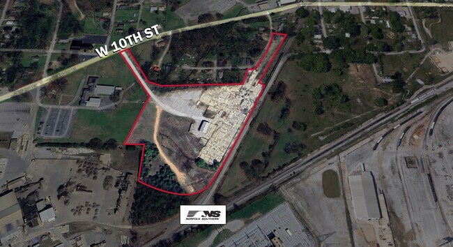
Eulaton Rd
22-01-12-2-003-058.002
SEC 12 TSP 16 RNG 07 A PARCEL IN NW1/4 SEC 12 BEG 620 E & 830 N OF SW COR NW1/4 TH N 428 NE 516.6 SE 423.2 SW 374.9 W 554.8 T
Officebuilding
CALHOUN
B and X Area of moderate flood hazard, usually the area between the limits of the 100-year and 500-year floods.
Alabama
2025
7.93 AC
2025
Gadsden/Anniston Area
000400
Other Market Areas
33,036 SF
Anniston-Oxford, AL
NEARBY LISTINGS FOR SALE OR LEASE
-
-
View all Anniston listings for lease on LoopNet.com
DEMOGRAPHICS near Eulaton Rd
1 mile
3 mile
5 mile
2025 Total Population
2,874
22,353
44,024
2030 Population
2,920
22,945
44,443
Pop Growth 2025-2030
+ 1.60%
+ 2.65%
+ 0.95%
Average Age
42
42
42
2025 Total Households
1,207
9,266
18,188
HH Growth 2025-2030
+ 1.49%
+ 2.75%
+ 0.94%
Median Household Inc
$38,709
$35,156
$41,409
Avg Household Size
2.30
2.20
2.30
2025 Avg HH Vehicles
2.00
2.00
2.00
Median Home Value
$80,537
$81,628
$125,597
Median Year Built
1971
1962
1972
Nearby Places
Map Layers
Map Styles
 Street
 Aerial
Transit
 Traffic
 Biking
Places
Listings with unknown addresses are not visible on the map
- Restaurants
- Banks
- Shops
- Fitness
- Groceries
PUBLIC TRANSPORTATION
COMMUTER RAIL
Drive
Walk
Distance
6 min
2.7 mi
SALE & LEASE HISTORY
LISTING DATE
SALE/LEASE

Jul 24, 2025
For Lease
Jul 23, 2025
For Sale
Nearby Properties
Address
Land Use
TOTAL SIZE
Lot Size
Zoning
Address
Land Use
TOTAL SIZE
Lot Size
Zoning
319,650 SF
10.69 AC
Address
Land Use
TOTAL SIZE
Lot Size
Zoning
12,496 SF
7.39 AC
Address
Land Use
TOTAL SIZE
Lot Size
Zoning
4,520 SF
8.20 AC
Address
Land Use
TOTAL SIZE
Lot Size
Zoning
73,027 SF
1.60 AC
Address
Land Use
TOTAL SIZE
Lot Size
Zoning
21,766 SF
3.06 AC
Address
Land Use
TOTAL SIZE
Lot Size
Zoning
2,728 SF
47 AC
Address
Land Use
TOTAL SIZE
Lot Size
Zoning
17,254 SF
22 AC
Address
Land Use
TOTAL SIZE
Lot Size
Zoning
31,832 SF
16 AC
Address
Land Use
TOTAL SIZE
Lot Size
Zoning
14,082 SF
3.85 AC
Address
Land Use
TOTAL SIZE
Lot Size
Zoning
5,581 SF
1.01 AC
Address
Land Use
TOTAL SIZE
Lot Size
Zoning
3.67 AC
Address
Land Use
TOTAL SIZE
Lot Size
Zoning
6.94 AC
Address
Land Use
TOTAL SIZE
Lot Size
Zoning
6,400 SF
12.24 AC
Address
Land Use
TOTAL SIZE
Lot Size
Zoning
6,912 SF
12.68 AC
Address
Land Use
TOTAL SIZE
Lot Size
Zoning
34,564 SF
1.60 AC
Address
Land Use
TOTAL SIZE
Lot Size
Zoning
42,128 SF
Address
Land Use
TOTAL SIZE
Lot Size
Zoning
13,568 SF
1.60 AC
Address
Land Use
TOTAL SIZE
Lot Size
Zoning
40,520 SF
4.01 AC
Address
Land Use
TOTAL SIZE
Lot Size
Zoning
47,164 SF
1.37 AC
Address
Land Use
TOTAL SIZE
Lot Size
Zoning
Address
Land Use
TOTAL SIZE
Lot Size
Zoning
65,545 SF
0.80 AC
Address
Land Use
TOTAL SIZE
Lot Size
Zoning
93,926 SF
26.88 AC
Address
Land Use
TOTAL SIZE
Lot Size
Zoning
48,263 SF
4.05 AC
Address
Land Use
TOTAL SIZE
Lot Size
Zoning
6,032 SF
41 AC
Address
Land Use
TOTAL SIZE
Lot Size
Zoning
51,372 SF
0.91 AC
Address
Land Use
TOTAL SIZE
Lot Size
Zoning
15,884 SF
0.46 AC
Address
Land Use
TOTAL SIZE
Lot Size
Zoning
21,310 SF
0.57 AC
Address
Land Use
TOTAL SIZE
Lot Size
Zoning
38,812 SF
0.92 AC
Address
Land Use
TOTAL SIZE
Lot Size
Zoning
37,080 SF
3.92 AC
Address
Land Use
TOTAL SIZE
Lot Size
Zoning
53,679 SF
0.69 AC
The World's #1 Commercial Real Estate Marketplace
Connect with us
© 2026 CoStar Group
The information above has been obtained from sources believed reliable. While we do not doubt its accuracy we have not verified it and make no guarantee, warranty or representation about it. It is your responsibility to independently confirm its accuracy and completeness. Any projections, opinions, assumptions, or estimates used are for example only and do not represent the current or future performance of the property. The value of this transaction to you depends on tax and other factors which should be evaluated by your tax, financial, and legal advisors. You and your advisors should conduct a careful, independent investigation of the property to determine to your satisfaction the suitability of the property for your needs.