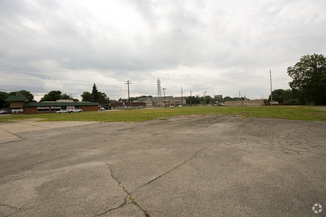
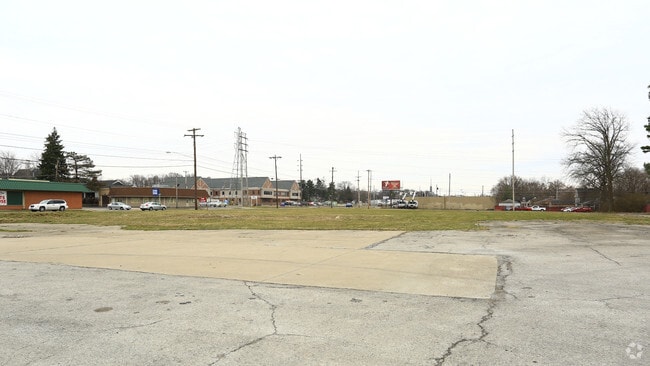
Property Record
Ewing Rd, Youngstown, OH 44512

Current Lease Availabilities
Property Detail
Ewing Rd
Youngstown-Warren, OH
LOT 3 50 X 200 BOARDMAN PARK PLAN
29-065-0-310.00-0
MAHONING
Commercialacreage
Ohio
R2
3
2025
0.24 AC
2025
Boardman
811700
Youngstown/Warren/Boardman
NEARBY LISTINGS FOR SALE OR LEASE
DEMOGRAPHICS near Ewing Rd
1 mile
3 mile
5 mile
2025 Total Population
8,865
59,553
125,444
2030 Population
8,788
59,124
124,806
Pop Growth 2025-2030
(0.87%)
(0.72%)
(0.51%)
Average Age
41
42
43
2025 Total Households
3,866
26,477
54,570
HH Growth 2025-2030
(0.85%)
(0.75%)
(0.55%)
Median Household Inc
$62,779
$56,160
$53,537
Avg Household Size
2.20
2.20
2.20
2025 Avg HH Vehicles
2.00
2.00
2.00
Median Home Value
$144,057
$146,272
$144,236
Median Year Built
1955
1960
1959
Nearby Places
Map Layers
Map Styles
 Street
 Aerial
Transit
 Traffic
 Biking
Places
Listings with unknown addresses are not visible on the map
- Restaurants
- Banks
- Shops
- Fitness
- Groceries
Nearby Properties
Address
Land Use
TOTAL SIZE
Lot Size
Zoning
Address
Land Use
TOTAL SIZE
Lot Size
Zoning
489,784 SF
22.26 AC
C
Address
Land Use
TOTAL SIZE
Lot Size
Zoning
252,909 SF
22.37 AC
C
Address
Land Use
TOTAL SIZE
Lot Size
Zoning
436,605 SF
64.24 AC
C
Address
Land Use
TOTAL SIZE
Lot Size
Zoning
318,339 SF
14.66 AC
R1
Address
Land Use
TOTAL SIZE
Lot Size
Zoning
88,996 SF
10.94 AC
C
Address
Land Use
TOTAL SIZE
Lot Size
Zoning
22.26 AC
Address
Land Use
TOTAL SIZE
Lot Size
Zoning
41,835 SF
7.46 AC
I
Address
Land Use
TOTAL SIZE
Lot Size
Zoning
47,538 SF
16.14 AC
C
Address
Land Use
TOTAL SIZE
Lot Size
Zoning
71,619 SF
12.76 AC
C
Address
Land Use
TOTAL SIZE
Lot Size
Zoning
140,889 SF
14.71 AC
C
Address
Land Use
TOTAL SIZE
Lot Size
Zoning
41,443 SF
0.93 AC
C
Address
Land Use
TOTAL SIZE
Lot Size
Zoning
134,650 SF
16.10 AC
C
Address
Land Use
TOTAL SIZE
Lot Size
Zoning
91,900 SF
7.60 AC
C
Address
Land Use
TOTAL SIZE
Lot Size
Zoning
57,178 SF
16.42 AC
R2
Address
Land Use
TOTAL SIZE
Lot Size
Zoning
100,565 SF
15.03 AC
R3
Address
Land Use
TOTAL SIZE
Lot Size
Zoning
61,141 SF
1.01 AC
C
Address
Land Use
TOTAL SIZE
Lot Size
Zoning
96,005 SF
3.89 AC
C
Address
Land Use
TOTAL SIZE
Lot Size
Zoning
108,150 SF
6.06 AC
C
Address
Land Use
TOTAL SIZE
Lot Size
Zoning
36,466 SF
6.49 AC
C
Address
Land Use
TOTAL SIZE
Lot Size
Zoning
39,370 SF
10.58 AC
C
Address
Land Use
TOTAL SIZE
Lot Size
Zoning
56,688 SF
10.33 AC
R1
Address
Land Use
TOTAL SIZE
Lot Size
Zoning
66,482 SF
10.80 AC
Address
Land Use
TOTAL SIZE
Lot Size
Zoning
141,528 SF
16.11 AC
C
Address
Land Use
TOTAL SIZE
Lot Size
Zoning
23,583 SF
9.76 AC
C
Address
Land Use
TOTAL SIZE
Lot Size
Zoning
140,132 SF
8.91 AC
C
Address
Land Use
TOTAL SIZE
Lot Size
Zoning
123,138 SF
8.16 AC
C
Address
Land Use
TOTAL SIZE
Lot Size
Zoning
29,735 SF
8.65 AC
C
Address
Land Use
TOTAL SIZE
Lot Size
Zoning
51,967 SF
10.60 AC
C
Address
Land Use
TOTAL SIZE
Lot Size
Zoning
69,600 SF
5.84 AC
C
Address
Land Use
TOTAL SIZE
Lot Size
Zoning
134,320 SF
3.36 AC
The World's #1 Commercial Real Estate Marketplace
Connect with us
© 2026 CoStar Group
The information above has been obtained from sources believed reliable. While we do not doubt its accuracy we have not verified it and make no guarantee, warranty or representation about it. It is your responsibility to independently confirm its accuracy and completeness. Any projections, opinions, assumptions, or estimates used are for example only and do not represent the current or future performance of the property. The value of this transaction to you depends on tax and other factors which should be evaluated by your tax, financial, and legal advisors. You and your advisors should conduct a careful, independent investigation of the property to determine to your satisfaction the suitability of the property for your needs.