Property Record
Executive Park Dr, Ellicott City, MD 21043
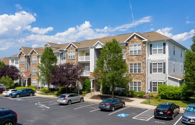


Property Detail
Executive Park Dr
02-410214
PAR A 10.861A BUILDA EXECUTIVE PARK DR MONTJOY PHASES I,II &III
Apartment
HOWARD
RA15
Maryland
B and X Area of moderate flood hazard, usually the area between the limits of the 100-year and 500-year floods.
a
2024
10.86 AC
2025
Ellicott City
602800
Baltimore
14,040 SF
Baltimore-Columbia-Towson, MD
NEARBY LISTINGS FOR SALE OR LEASE
DEMOGRAPHICS near Executive Park Dr
1 mile
3 mile
5 mile
2025 Total Population
8,783
87,851
216,274
2030 Population
8,805
88,919
218,725
Pop Growth 2025-2030
+ 0.25%
+ 1.22%
+ 1.13%
Average Age
41
41
40
2025 Total Households
3,210
33,432
80,499
HH Growth 2025-2030
+ 0.16%
+ 1.28%
+ 1.19%
Median Household Inc
$139,904
$138,419
$132,550
Avg Household Size
2.70
2.60
2.60
2025 Avg HH Vehicles
2.00
2.00
2.00
Median Home Value
$612,385
$582,216
$550,818
Median Year Built
1985
1985
1985
Nearby Places
Map Layers
Map Styles
 Street
 Aerial
Layers
 Traffic
 Biking
Places
Listings with unknown addresses are not visible on the map
- Restaurants
- Banks
- Shops
- Fitness
- Groceries
PUBLIC TRANSPORTATION
COMMUTER RAIL
Dorsey Marc Sb (CAMDEN - WASHINGTON - Maryland Transit Administration)
Drive
Walk
Distance
Dorsey Marc Sb (CAMDEN - WASHINGTON - Maryland Transit Administration)
12 min
7.2 mi
Dorsey Marc Nb (CAMDEN - WASHINGTON - Maryland Transit Administration)
Drive
Walk
Distance
Dorsey Marc Nb (CAMDEN - WASHINGTON - Maryland Transit Administration)
12 min
7.2 mi
AIRPORT
Baltimore/Washington International Thurgood Marshall
Drive
Walk
Distance
Baltimore/Washington International Thurgood Marshall
21 min
13.6 mi
Ronald Reagan Washington Ntl
Drive
Walk
Distance
Ronald Reagan Washington Ntl
55 min
34.8 mi
Freight Ports
Port of Baltimore
Drive
Walk
Distance
Port of Baltimore
25 min
16.5 mi
Nearby Properties
Address
Land Use
TOTAL SIZE
Lot Size
Zoning
Address
Land Use
TOTAL SIZE
Lot Size
Zoning
454,000 SF
62.33 AC
NT
Address
Land Use
TOTAL SIZE
Lot Size
Zoning
47,815 SF
11.76 AC
NT
Address
Land Use
TOTAL SIZE
Lot Size
Zoning
233,265 SF
28.95 AC
NT
Address
Land Use
TOTAL SIZE
Lot Size
Zoning
1,930 SF
49.68 AC
PSC
Address
Land Use
TOTAL SIZE
Lot Size
Zoning
218,688 SF
1.11 AC
NT
Address
Land Use
TOTAL SIZE
Lot Size
Zoning
279,539 SF
68.15 AC
R20
Address
Land Use
TOTAL SIZE
Lot Size
Zoning
17,528 SF
20.15 AC
NT
Address
Land Use
TOTAL SIZE
Lot Size
Zoning
309,703 SF
39.71 AC
R20
Address
Land Use
TOTAL SIZE
Lot Size
Zoning
11,244 SF
23.20 AC
NT
Address
Land Use
TOTAL SIZE
Lot Size
Zoning
56,584 SF
12.03 AC
RA15
Address
Land Use
TOTAL SIZE
Lot Size
Zoning
195,996 SF
48.91 AC
NT
Address
Land Use
TOTAL SIZE
Lot Size
Zoning
214,009 SF
8.99 AC
NT
Address
Land Use
TOTAL SIZE
Lot Size
Zoning
234,007 SF
49.96 AC
NT
Address
Land Use
TOTAL SIZE
Lot Size
Zoning
237,128 SF
24.77 AC
B2
Address
Land Use
TOTAL SIZE
Lot Size
Zoning
24,716 SF
10.05 AC
NT
Address
Land Use
TOTAL SIZE
Lot Size
Zoning
49,443 SF
27.21 AC
NT
Address
Land Use
TOTAL SIZE
Lot Size
Zoning
132,865 SF
27.08 AC
SC
Address
Land Use
TOTAL SIZE
Lot Size
Zoning
208,312 SF
5.85 AC
NT
Address
Land Use
TOTAL SIZE
Lot Size
Zoning
16,651 SF
11.65 AC
NT
Address
Land Use
TOTAL SIZE
Lot Size
Zoning
32,000 SF
26.24 AC
NT
Address
Land Use
TOTAL SIZE
Lot Size
Zoning
21,726 SF
10.14 AC
NT
Address
Land Use
TOTAL SIZE
Lot Size
Zoning
25,936 SF
12.02 AC
NT
Address
Land Use
TOTAL SIZE
Lot Size
Zoning
117,444 SF
19.97 AC
POR
Address
Land Use
TOTAL SIZE
Lot Size
Zoning
58,592 SF
9.53 AC
NT
Address
Land Use
TOTAL SIZE
Lot Size
Zoning
15,956 SF
10.80 AC
NT
Address
Land Use
TOTAL SIZE
Lot Size
Zoning
1,163 SF
4.49 AC
TOD
Address
Land Use
TOTAL SIZE
Lot Size
Zoning
6,300 SF
11.10 AC
B2B1
Address
Land Use
TOTAL SIZE
Lot Size
Zoning
117,518 SF
22.27 AC
RSC
Address
Land Use
TOTAL SIZE
Lot Size
Zoning
88,229 SF
10 AC
NT
The World's #1 Commercial Real Estate Marketplace
Connect with us
© 2026 CoStar Group
The information above has been obtained from sources believed reliable. While we do not doubt its accuracy we have not verified it and make no guarantee, warranty or representation about it. It is your responsibility to independently confirm its accuracy and completeness. Any projections, opinions, assumptions, or estimates used are for example only and do not represent the current or future performance of the property. The value of this transaction to you depends on tax and other factors which should be evaluated by your tax, financial, and legal advisors. You and your advisors should conduct a careful, independent investigation of the property to determine to your satisfaction the suitability of the property for your needs.