Property Record
77&Primera Expway 77 & Primera, Harlingen, TX 78552


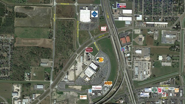
NEARBY LISTINGS FOR SALE OR LEASE
Property Detail
77&Primera Expway 77 & Primera
Brownsville-Harlingen, TX
Cunninghams Subdivision Survey 26
973510-0190-000000
CUNNINGHAM SUBDIVISION PT BLK 19, 9.8300 ACRES
Agriculturalland
Cameron
X
Texas
48061C0255F
9.83 AC
2024
Greater Harlingen
2025
Brownsville/Harlingen
010405
DEMOGRAPHICS near 77&Primera Expway 77 & Primera
1 Mile
3 Mile
5 Mile
2024 Total Population
4,300
41,180
83,694
2029 Population
4,296
41,889
85,574
Pop Growth 2024-2029
(0.09%)
+ 1.72%
+ 2.25%
Average Age
38
37
37
2024 Total Households
1,381
13,820
28,554
HH Growth 2024-2029
(0.29%)
+ 1.67%
+ 2.24%
Median Household Inc
$50,420
$50,981
$50,746
Avg Household Size
3.00
2.90
2.80
2024 Avg HH Vehicles
2.00
2.00
2.00
Median Home Value
$72,834
$104,845
$103,855
Median Year Built
1990
1986
1986
Nearby Places
Map Layers
Map Styles
 Street
 Aerial
- Restaurants
- Banks
- Shops
- Fitness
- Groceries
PUBLIC TRANSPORTATION
AIRPORT
Valley International
DRIVE
WALK
Distance
Valley International
7 min
4.2 mi
Brownsville/South Padre Island International
DRIVE
WALK
Distance
Brownsville/South Padre Island International
39 min
31.0 mi
Freight Ports
Port of Brownsville
DRIVE
WALK
Distance
Port of Brownsville
32 min
28.7 mi
SALE & LEASE HISTORY
LISTING DATE
SALE/LEASE

Sep 24, 2016
For Sale
May 01, 2017
For Sale
Apr 09, 2018
For Sale
Nearby Properties
Address
Land Use
TOTAL SIZE
Lot Size
Zoning
Address
Land Use
TOTAL SIZE
Lot Size
Zoning
43,540 SF
26.19 AC
C
Address
Land Use
TOTAL SIZE
Lot Size
Zoning
293,886 SF
23.57 AC
Address
Land Use
TOTAL SIZE
Lot Size
Zoning
100,090 SF
15 AC
Address
Land Use
TOTAL SIZE
Lot Size
Zoning
74,848 SF
2.30 AC
Address
Land Use
TOTAL SIZE
Lot Size
Zoning
391,617 SF
23.20 AC
C
Address
Land Use
TOTAL SIZE
Lot Size
Zoning
176,365 SF
14.65 AC
Address
Land Use
TOTAL SIZE
Lot Size
Zoning
72,063 SF
2.29 AC
Address
Land Use
TOTAL SIZE
Lot Size
Zoning
152,724 SF
17.78 AC
Address
Land Use
TOTAL SIZE
Lot Size
Zoning
63,450 SF
2.88 AC
Address
Land Use
TOTAL SIZE
Lot Size
Zoning
13,924 SF
31.33 AC
C
Address
Land Use
TOTAL SIZE
Lot Size
Zoning
15,085 SF
51.10 AC
C
Address
Land Use
TOTAL SIZE
Lot Size
Zoning
76,756 SF
15.35 AC
Address
Land Use
TOTAL SIZE
Lot Size
Zoning
63,381 SF
3.15 AC
Address
Land Use
TOTAL SIZE
Lot Size
Zoning
81,569 SF
36.61 AC
Address
Land Use
TOTAL SIZE
Lot Size
Zoning
91,630 SF
11.17 AC
Address
Land Use
TOTAL SIZE
Lot Size
Zoning
89,508 SF
9.90 AC
Address
Land Use
TOTAL SIZE
Lot Size
Zoning
20,062 SF
47.54 AC
C
Address
Land Use
TOTAL SIZE
Lot Size
Zoning
134,367 SF
14.42 AC
Address
Land Use
TOTAL SIZE
Lot Size
Zoning
79,466 SF
6.23 AC
C
Address
Land Use
TOTAL SIZE
Lot Size
Zoning
68,826 SF
6.27 AC
Address
Land Use
TOTAL SIZE
Lot Size
Zoning
116,913 SF
8.44 AC
C
Address
Land Use
TOTAL SIZE
Lot Size
Zoning
90,376 SF
1.93 AC
Address
Land Use
TOTAL SIZE
Lot Size
Zoning
20.64 AC
C
Address
Land Use
TOTAL SIZE
Lot Size
Zoning
60,050 SF
1.98 AC
Address
Land Use
TOTAL SIZE
Lot Size
Zoning
47,388 SF
11.64 AC
Address
Land Use
TOTAL SIZE
Lot Size
Zoning
17,925 SF
6.34 AC
Address
Land Use
TOTAL SIZE
Lot Size
Zoning
73,669 SF
9.47 AC
C
Address
Land Use
TOTAL SIZE
Lot Size
Zoning
147,186 SF
10 AC
Address
Land Use
TOTAL SIZE
Lot Size
Zoning
144,000 SF
7.05 AC
Address
Land Use
TOTAL SIZE
Lot Size
Zoning
43,715 SF
8 AC
The World's #1 Commercial Real Estate Marketplace
Connect with us
© 2026 CoStar Group
The information above has been obtained from sources believed reliable. While we do not doubt its accuracy we have not verified it and make no guarantee, warranty or representation about it. It is your responsibility to independently confirm its accuracy and completeness. Any projections, opinions, assumptions, or estimates used are for example only and do not represent the current or future performance of the property. The value of this transaction to you depends on tax and other factors which should be evaluated by your tax, financial, and legal advisors. You and your advisors should conduct a careful, independent investigation of the property to determine to your satisfaction the suitability of the property for your needs.