Property Record
Fairwinds Rd, Landrum, SC 29356

NEARBY LISTINGS FOR SALE OR LEASE
-
-
View all Landrum listings for sale on LoopNet.com
Property Detail
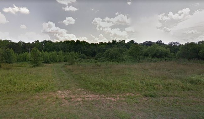
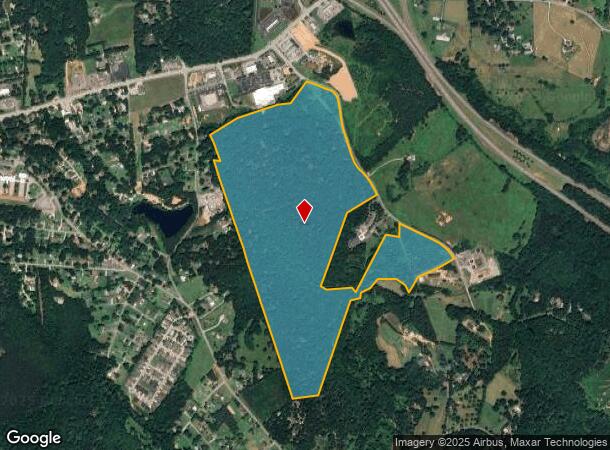
Fairwinds Rd
Spartanburg, SC
Mary A Christopher Estate
1-08-00-035.00
W SIDE FAIRWINDS RD S OF HWY 14 E 2004 UNRECORDED PLAT IN FILE HWY R/W TAKEN 42.2001.9 TR 104
Commercialacreage
Spartanburg
X
South Carolina
45083C0016D
2
2024
119.33 AC
2025
Upper Spartanburg County
002404
Greenville/Spartanburg
DEMOGRAPHICS near Fairwinds Rd
1 Mile
3 Mile
5 Mile
2024 Total Population
1,063
5,613
14,880
2029 Population
1,200
6,341
16,665
Pop Growth 2024-2029
+ 12.89%
+ 12.97%
+ 12.00%
Average Age
45
45
47
2024 Total Households
482
2,417
6,381
HH Growth 2024-2029
+ 13.07%
+ 13.12%
+ 12.05%
Median Household Inc
$40,300
$51,243
$55,063
Avg Household Size
2.20
2.30
2.30
2024 Avg HH Vehicles
2.00
2.00
2.00
Median Home Value
$195,454
$235,814
$265,300
Median Year Built
1970
1977
1983
Nearby Places
Map Layers
Map Styles
 Street
 Aerial
- Restaurants
- Banks
- Shops
- Fitness
- Groceries
PUBLIC TRANSPORTATION
AIRPORT
Greenville Spartanburg International
DRIVE
WALK
Distance
Greenville Spartanburg International
43 min
32.6 mi
Asheville Regional
DRIVE
WALK
Distance
Asheville Regional
42 min
33.0 mi
Freight Ports
North Charleston Terminal
DRIVE
WALK
Distance
North Charleston Terminal
239 min
213.4 mi
SALE & LEASE HISTORY
LISTING DATE
SALE/LEASE

Jun 27, 2019
For Sale
Jun 22, 2018
For Sale
Nearby Properties
Address
Land Use
TOTAL SIZE
Lot Size
Zoning
Address
Land Use
TOTAL SIZE
Lot Size
Zoning
166.74 AC
RE5
Address
Land Use
TOTAL SIZE
Lot Size
Zoning
7,703 SF
190.87 AC
RE5
Address
Land Use
TOTAL SIZE
Lot Size
Zoning
332.64 AC
Address
Land Use
TOTAL SIZE
Lot Size
Zoning
9,745 SF
10.01 AC
Address
Land Use
TOTAL SIZE
Lot Size
Zoning
2,290 SF
23.19 AC
RE5
Address
Land Use
TOTAL SIZE
Lot Size
Zoning
2,812 SF
3.26 AC
RE5
Address
Land Use
TOTAL SIZE
Lot Size
Zoning
13.05 AC
Address
Land Use
TOTAL SIZE
Lot Size
Zoning
2.43 AC
MX
Address
Land Use
TOTAL SIZE
Lot Size
Zoning
15.18 AC
Address
Land Use
TOTAL SIZE
Lot Size
Zoning
4.61 AC
RE5
Address
Land Use
TOTAL SIZE
Lot Size
Zoning
2.59 AC
Address
Land Use
TOTAL SIZE
Lot Size
Zoning
2.20 AC
MX
Address
Land Use
TOTAL SIZE
Lot Size
Zoning
1,410 SF
31.21 AC
RE5
Address
Land Use
TOTAL SIZE
Lot Size
Zoning
1,065 SF
32.46 AC
RE5
Address
Land Use
TOTAL SIZE
Lot Size
Zoning
Address
Land Use
TOTAL SIZE
Lot Size
Zoning
1,380 SF
30.08 AC
AR5
Address
Land Use
TOTAL SIZE
Lot Size
Zoning
1,584 SF
8.79 AC
RE5
Address
Land Use
TOTAL SIZE
Lot Size
Zoning
2.70 AC
MX
Address
Land Use
TOTAL SIZE
Lot Size
Zoning
22.88 AC
RE5
Address
Land Use
TOTAL SIZE
Lot Size
Zoning
8.57 AC
RE5
Address
Land Use
TOTAL SIZE
Lot Size
Zoning
1,991 SF
2.10 AC
MX
Address
Land Use
TOTAL SIZE
Lot Size
Zoning
3.64 AC
MX
Address
Land Use
TOTAL SIZE
Lot Size
Zoning
4,264 SF
1.13 AC
MX
Address
Land Use
TOTAL SIZE
Lot Size
Zoning
1.04 AC
MX
Address
Land Use
TOTAL SIZE
Lot Size
Zoning
51.65 AC
Address
Land Use
TOTAL SIZE
Lot Size
Zoning
5.38 AC
MX
Address
Land Use
TOTAL SIZE
Lot Size
Zoning
1,953 SF
7.48 AC
RE5
Address
Land Use
TOTAL SIZE
Lot Size
Zoning
2,274 SF
2.27 AC
MX
Address
Land Use
TOTAL SIZE
Lot Size
Zoning
8.07 AC
RE5
Address
Land Use
TOTAL SIZE
Lot Size
Zoning
4.31 AC
The World's #1 Commercial Real Estate Marketplace
Connect with us
© 2026 CoStar Group
The information above has been obtained from sources believed reliable. While we do not doubt its accuracy we have not verified it and make no guarantee, warranty or representation about it. It is your responsibility to independently confirm its accuracy and completeness. Any projections, opinions, assumptions, or estimates used are for example only and do not represent the current or future performance of the property. The value of this transaction to you depends on tax and other factors which should be evaluated by your tax, financial, and legal advisors. You and your advisors should conduct a careful, independent investigation of the property to determine to your satisfaction the suitability of the property for your needs.