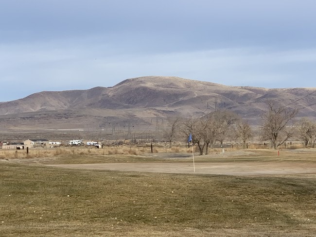
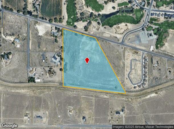
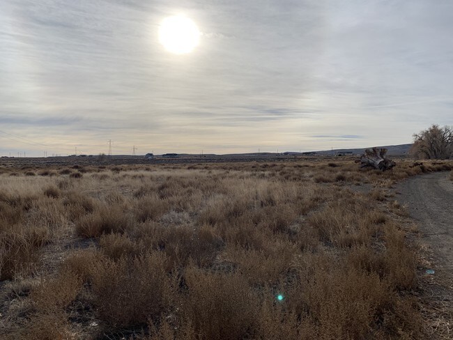
Property Record
Farm District Rd, Fernley, NV 89408

NEARBY LISTINGS FOR SALE OR LEASE
Property Detail
Farm District Rd
Fernley, NV
251311, Parcel Map
021-301-35
25EATED FROM SPLIT OF PARCEL # 021-301-29 FR N2 SE4 SE4; FR NE4 SE4/ PARCEL 1 OF PM #251311
Commercialacreage
Lyon
X
Nevada
32031C3175G
26.55 AC
2026
Lyon County
2025
Reno/Sparks
960107
DEMOGRAPHICS near Farm District Rd
1 Mile
3 Mile
5 Mile
2024 Total Population
2,886
7,131
19,841
2029 Population
3,181
7,859
21,892
Pop Growth 2024-2029
+ 10.22%
+ 10.21%
+ 10.34%
Average Age
42
39
39
2024 Total Households
1,045
2,470
7,060
HH Growth 2024-2029
+ 10.14%
+ 10.16%
+ 10.31%
Median Household Inc
$99,582
$93,300
$86,808
Avg Household Size
2.70
2.90
2.80
2024 Avg HH Vehicles
3.00
3.00
2.00
Median Home Value
$343,052
$347,731
$328,605
Median Year Built
2001
2002
2001
Nearby Places
Map Layers
Map Styles
 Street
 Aerial
- Restaurants
- Banks
- Shops
- Fitness
- Groceries
SALE & LEASE HISTORY
LISTING DATE
SALE/LEASE

Oct 13, 2017
For Sale
Jan 25, 2019
For Sale
Nearby Properties
Address
Land Use
TOTAL SIZE
Lot Size
Zoning
Address
Land Use
TOTAL SIZE
Lot Size
Zoning
96,632 SF
19.48 AC
PF
Address
Land Use
TOTAL SIZE
Lot Size
Zoning
336,726 SF
20 AC
I
Address
Land Use
TOTAL SIZE
Lot Size
Zoning
382,923 SF
56.01 AC
I
Address
Land Use
TOTAL SIZE
Lot Size
Zoning
216,930 SF
13.15 AC
Address
Land Use
TOTAL SIZE
Lot Size
Zoning
255,300 SF
14.87 AC
I
Address
Land Use
TOTAL SIZE
Lot Size
Zoning
61,961 SF
6.26 AC
PF
Address
Land Use
TOTAL SIZE
Lot Size
Zoning
181,720 SF
10.94 AC
I
Address
Land Use
TOTAL SIZE
Lot Size
Zoning
188,220 SF
12.17 AC
I
Address
Land Use
TOTAL SIZE
Lot Size
Zoning
13,653 SF
10.34 AC
C2
Address
Land Use
TOTAL SIZE
Lot Size
Zoning
80.23 AC
RR1
Address
Land Use
TOTAL SIZE
Lot Size
Zoning
54,228 SF
11.10 AC
I
Address
Land Use
TOTAL SIZE
Lot Size
Zoning
35.41 AC
PD
Address
Land Use
TOTAL SIZE
Lot Size
Zoning
6,029 SF
2.31 AC
C2
Address
Land Use
TOTAL SIZE
Lot Size
Zoning
10 AC
C2
Address
Land Use
TOTAL SIZE
Lot Size
Zoning
33.29 AC
PD
Address
Land Use
TOTAL SIZE
Lot Size
Zoning
8.39 AC
C2
Address
Land Use
TOTAL SIZE
Lot Size
Zoning
4,546 SF
2.25 AC
MULT
Address
Land Use
TOTAL SIZE
Lot Size
Zoning
136.64 AC
PD
Address
Land Use
TOTAL SIZE
Lot Size
Zoning
6,400 SF
4.85 AC
I
Address
Land Use
TOTAL SIZE
Lot Size
Zoning
5.44 AC
C2
Address
Land Use
TOTAL SIZE
Lot Size
Zoning
2,406 SF
112.39 AC
RR5
Address
Land Use
TOTAL SIZE
Lot Size
Zoning
14.64 AC
C2
Address
Land Use
TOTAL SIZE
Lot Size
Zoning
2,612 SF
5 AC
SF20
Address
Land Use
TOTAL SIZE
Lot Size
Zoning
3.89 AC
C2
Address
Land Use
TOTAL SIZE
Lot Size
Zoning
1,848 SF
9.20 AC
PF
Address
Land Use
TOTAL SIZE
Lot Size
Zoning
10 AC
C2
Address
Land Use
TOTAL SIZE
Lot Size
Zoning
10 AC
C2
Address
Land Use
TOTAL SIZE
Lot Size
Zoning
6.68 AC
I
Address
Land Use
TOTAL SIZE
Lot Size
Zoning
1,968 SF
0.48 AC
RR
The World's #1 Commercial Real Estate Marketplace
Connect with us
© 2026 CoStar Group
The information above has been obtained from sources believed reliable. While we do not doubt its accuracy we have not verified it and make no guarantee, warranty or representation about it. It is your responsibility to independently confirm its accuracy and completeness. Any projections, opinions, assumptions, or estimates used are for example only and do not represent the current or future performance of the property. The value of this transaction to you depends on tax and other factors which should be evaluated by your tax, financial, and legal advisors. You and your advisors should conduct a careful, independent investigation of the property to determine to your satisfaction the suitability of the property for your needs.