Property Record
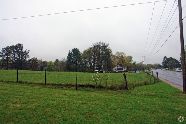
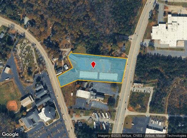
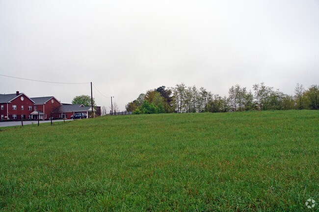
Farrs Bridge Rd, Greenville, SC 29617
NEARBY LISTINGS FOR SALE OR LEASE
Property Detail
Farrs Bridge Rd
Greenville-Anderson-Mauldin, SC
Williams J E Prop
B005.02-01-024.00
MAP B005.02; 2
Residentialacreage
Greenville
X
South Carolina
45045C0313E
024.00
2025
4.19 AC
2024
West Side Greenville
003707
Greenville/Spartanburg
DEMOGRAPHICS near Farrs Bridge Rd
1 Mile
3 Mile
5 Mile
2024 Total Population
4,234
35,983
96,980
2029 Population
4,710
39,680
107,301
Pop Growth 2024-2029
+ 11.24%
+ 10.27%
+ 10.64%
Average Age
41
39
39
2024 Total Households
1,693
14,224
38,699
HH Growth 2024-2029
+ 11.40%
+ 10.36%
+ 10.94%
Median Household Inc
$46,924
$45,340
$47,674
Avg Household Size
2.40
2.40
2.40
2024 Avg HH Vehicles
2.00
2.00
2.00
Median Home Value
$152,748
$170,580
$193,909
Median Year Built
1983
1981
1984
Nearby Places
Map Layers
Map Styles
 Street
 Aerial
- Restaurants
- Banks
- Shops
- Fitness
- Groceries
PUBLIC TRANSPORTATION
COMMUTER RAIL
DRIVE
WALK
Distance
10 min
4.5 mi
AIRPORT
Greenville Spartanburg International
DRIVE
WALK
Distance
Greenville Spartanburg International
32 min
19.4 mi
SALE & LEASE HISTORY
LISTING DATE
SALE/LEASE

Mar 22, 2019
For Sale
Nearby Properties
Address
Land Use
TOTAL SIZE
Lot Size
Zoning
Address
Land Use
TOTAL SIZE
Lot Size
Zoning
14.41 AC
R15
Address
Land Use
TOTAL SIZE
Lot Size
Zoning
703.30 AC
RS
Address
Land Use
TOTAL SIZE
Lot Size
Zoning
10.10 AC
RM
Address
Land Use
TOTAL SIZE
Lot Size
Zoning
10.17 AC
RM
Address
Land Use
TOTAL SIZE
Lot Size
Zoning
2.14 AC
RM
Address
Land Use
TOTAL SIZE
Lot Size
Zoning
2.21 AC
RMA
Address
Land Use
TOTAL SIZE
Lot Size
Zoning
4.97 AC
RM20
Address
Land Use
TOTAL SIZE
Lot Size
Zoning
22.92 AC
R10
Address
Land Use
TOTAL SIZE
Lot Size
Zoning
1.83 AC
RM
Address
Land Use
TOTAL SIZE
Lot Size
Zoning
165.20 AC
RS
Address
Land Use
TOTAL SIZE
Lot Size
Zoning
18.22 AC
RM
Address
Land Use
TOTAL SIZE
Lot Size
Zoning
5.05 AC
C2
Address
Land Use
TOTAL SIZE
Lot Size
Zoning
1.43 AC
C1N
Address
Land Use
TOTAL SIZE
Lot Size
Zoning
153.11 AC
R10
Address
Land Use
TOTAL SIZE
Lot Size
Zoning
1,410 SF
10.17 AC
R10
Address
Land Use
TOTAL SIZE
Lot Size
Zoning
15.82 AC
Address
Land Use
TOTAL SIZE
Lot Size
Zoning
100 AC
RS
Address
Land Use
TOTAL SIZE
Lot Size
Zoning
5.10 AC
C2
Address
Land Use
TOTAL SIZE
Lot Size
Zoning
3,008 SF
25.76 AC
C1
Address
Land Use
TOTAL SIZE
Lot Size
Zoning
6.35 AC
RM
Address
Land Use
TOTAL SIZE
Lot Size
Zoning
0.14 AC
C3
Address
Land Use
TOTAL SIZE
Lot Size
Zoning
63.70 AC
RS
Address
Land Use
TOTAL SIZE
Lot Size
Zoning
38.88 AC
C1
Address
Land Use
TOTAL SIZE
Lot Size
Zoning
39.90 AC
RM
Address
Land Use
TOTAL SIZE
Lot Size
Zoning
10.49 AC
C2
Address
Land Use
TOTAL SIZE
Lot Size
Zoning
1.70 AC
C2
Address
Land Use
TOTAL SIZE
Lot Size
Zoning
33.50 AC
R10
Address
Land Use
TOTAL SIZE
Lot Size
Zoning
24.50 AC
RM
Address
Land Use
TOTAL SIZE
Lot Size
Zoning
43 AC
R12
Address
Land Use
TOTAL SIZE
Lot Size
Zoning
4.03 AC
RS
The World's #1 Commercial Real Estate Marketplace
Connect with us
© 2026 CoStar Group
The information above has been obtained from sources believed reliable. While we do not doubt its accuracy we have not verified it and make no guarantee, warranty or representation about it. It is your responsibility to independently confirm its accuracy and completeness. Any projections, opinions, assumptions, or estimates used are for example only and do not represent the current or future performance of the property. The value of this transaction to you depends on tax and other factors which should be evaluated by your tax, financial, and legal advisors. You and your advisors should conduct a careful, independent investigation of the property to determine to your satisfaction the suitability of the property for your needs.