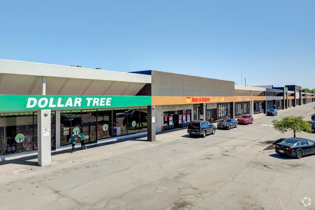
Property Record
Fenton Rd, Burton, MI 48529

NEARBY LISTINGS FOR SALE OR LEASE
Property Detail
Fenton Rd
Flint, MI
Burton Gardens Subdivision
59-30-551-110
A PARCEL OF LAND BEG 650 FT E OF SW COR OF N 1/2 OF SW 1/4 TH N 1283.35 FT TO S LINE OF HEMPHILL RD TH N 89 DEG 53 MIN 15 SEC
Commercialacreage
Genesee
X
Michigan
26049C0302D
16,a,c
2024
0.10 AC
2025
Flint
011302
Detroit
DEMOGRAPHICS near Fenton Rd
1 mile
3 mile
5 mile
2024 Total Population
11,481
60,374
138,329
2029 Population
11,341
59,842
138,236
Pop Growth 2024-2029
(1.22%)
(0.88%)
(0.07%)
Average Age
38
38
39
2024 Total Households
4,778
25,368
58,320
HH Growth 2024-2029
(1.34%)
(0.92%)
(0.19%)
Median Household Inc
$33,874
$39,358
$41,758
Avg Household Size
2.30
2.30
2.30
2024 Avg HH Vehicles
1.00
1.00
1.00
Median Home Value
$67,169
$82,159
$93,406
Median Year Built
1957
1959
1962
Nearby Places
Map Layers
Map Styles
 Street
 Aerial
Transit
 Traffic
 Biking
Places
Listings with unknown addresses are not visible on the map
- Restaurants
- Banks
- Shops
- Fitness
- Groceries
PUBLIC TRANSPORTATION
COMMUTER RAIL
Flint Amtrak Station (Blue Water - Amtrak)
Drive
Walk
Distance
Flint Amtrak Station (Blue Water - Amtrak)
9 min
4.6 mi
AIRPORT
Bishop International
Drive
Walk
Distance
Bishop International
19 min
7.5 mi
Freight Ports
Port of Toledo
Drive
Walk
Distance
Port of Toledo
132 min
111.9 mi
SALE & LEASE HISTORY
LISTING DATE
SALE/LEASE

Sep 25, 2016
For Lease
Oct 07, 2024
For Sale
Mar 10, 2020
For Lease
Nearby Properties
Address
Land Use
TOTAL SIZE
Lot Size
Zoning
Address
Land Use
TOTAL SIZE
Lot Size
Zoning
381,509 SF
371.45 AC
PC
Address
Land Use
TOTAL SIZE
Lot Size
Zoning
340,418 SF
45.65 AC
GC
Address
Land Use
TOTAL SIZE
Lot Size
Zoning
Address
Land Use
TOTAL SIZE
Lot Size
Zoning
247,329 SF
31.10 AC
MDM
Address
Land Use
TOTAL SIZE
Lot Size
Zoning
51.26 AC
HDM
Address
Land Use
TOTAL SIZE
Lot Size
Zoning
33.65 AC
MDM
Address
Land Use
TOTAL SIZE
Lot Size
Zoning
911,140 SF
Address
Land Use
TOTAL SIZE
Lot Size
Zoning
120,487 SF
5.81 AC
PRC
Address
Land Use
TOTAL SIZE
Lot Size
Zoning
45,095 SF
6.42 AC
GC
Address
Land Use
TOTAL SIZE
Lot Size
Zoning
130,291 SF
Address
Land Use
TOTAL SIZE
Lot Size
Zoning
70,994 SF
8.89 AC
GC
Address
Land Use
TOTAL SIZE
Lot Size
Zoning
112,232 SF
196 AC
Address
Land Use
TOTAL SIZE
Lot Size
Zoning
65,746 SF
3.97 AC
C-4
Address
Land Use
TOTAL SIZE
Lot Size
Zoning
Address
Land Use
TOTAL SIZE
Lot Size
Zoning
144,896 SF
0.23 AC
DC
Address
Land Use
TOTAL SIZE
Lot Size
Zoning
45,204 SF
6.43 AC
M-M
Address
Land Use
TOTAL SIZE
Lot Size
Zoning
115,556 SF
2.50 AC
DE
Address
Land Use
TOTAL SIZE
Lot Size
Zoning
75,536 SF
8.97 AC
PRC
Address
Land Use
TOTAL SIZE
Lot Size
Zoning
69,232 SF
2.75 AC
C-3A
Address
Land Use
TOTAL SIZE
Lot Size
Zoning
100,000 SF
Address
Land Use
TOTAL SIZE
Lot Size
Zoning
15.19 AC
M-M
Address
Land Use
TOTAL SIZE
Lot Size
Zoning
58,648 SF
5.80 AC
OS
Address
Land Use
TOTAL SIZE
Lot Size
Zoning
100,750 SF
Address
Land Use
TOTAL SIZE
Lot Size
Zoning
9.88 AC
HDM
Address
Land Use
TOTAL SIZE
Lot Size
Zoning
68,571 SF
0.81 AC
DC
Address
Land Use
TOTAL SIZE
Lot Size
Zoning
118,750 SF
21.26 AC
C-3A
Address
Land Use
TOTAL SIZE
Lot Size
Zoning
246,759 SF
19.03 AC
CC
Address
Land Use
TOTAL SIZE
Lot Size
Zoning
64,150 SF
3.64 AC
PRC
Address
Land Use
TOTAL SIZE
Lot Size
Zoning
48,557 SF
2.99 AC
Address
Land Use
TOTAL SIZE
Lot Size
Zoning
225,506 SF
31.13 AC
CE
The World's #1 Commercial Real Estate Marketplace
Connect with us
© 2026 CoStar Group
The information above has been obtained from sources believed reliable. While we do not doubt its accuracy we have not verified it and make no guarantee, warranty or representation about it. It is your responsibility to independently confirm its accuracy and completeness. Any projections, opinions, assumptions, or estimates used are for example only and do not represent the current or future performance of the property. The value of this transaction to you depends on tax and other factors which should be evaluated by your tax, financial, and legal advisors. You and your advisors should conduct a careful, independent investigation of the property to determine to your satisfaction the suitability of the property for your needs.