Property Record
Fifth St North Paul Clark Dr, Olean, NY 14760

NEARBY LISTINGS FOR SALE OR LEASE
Property Detail
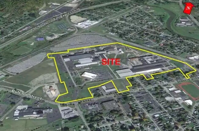
Fifth St North Paul Clark Dr
Olean, NY
Cattaraugus
041200-094-048-0001-002-001-0000
New York
Manufacturinglight
2.001
2024
88.10 AC
2024
New York West Area
961800
Other Market Areas
6,889 SF
DEMOGRAPHICS near Fifth St North Paul Clark Dr
1 Mile
3 Mile
5 Mile
2024 Total Population
7,255
19,679
24,092
2029 Population
7,193
19,543
23,930
Pop Growth 2024-2029
(0.85%)
(0.69%)
(0.67%)
Average Age
41
41
42
2024 Total Households
3,214
8,160
10,011
HH Growth 2024-2029
(0.90%)
(0.78%)
(0.77%)
Median Household Inc
$44,124
$49,988
$53,030
Avg Household Size
2.10
2.10
2.20
2024 Avg HH Vehicles
1.00
1.00
2.00
Median Home Value
$65,286
$90,444
$96,820
Median Year Built
1946
1948
1949
Nearby Places
Map Layers
Map Styles
 Street
 Aerial
- Restaurants
- Banks
- Shops
- Fitness
- Groceries
SALE & LEASE HISTORY
LISTING DATE
SALE/LEASE

Jan 31, 2022
For Sale
Nearby Properties
Address
Land Use
TOTAL SIZE
Lot Size
Zoning
Address
Land Use
TOTAL SIZE
Lot Size
Zoning
326.55 AC
CF
Address
Land Use
TOTAL SIZE
Lot Size
Zoning
116,203 SF
9.07 AC
R3
Address
Land Use
TOTAL SIZE
Lot Size
Zoning
159,609 SF
29.60 AC
R3
Address
Land Use
TOTAL SIZE
Lot Size
Zoning
32,878 SF
11.10 AC
CC
Address
Land Use
TOTAL SIZE
Lot Size
Zoning
26,777 SF
9.65 AC
WC
Address
Land Use
TOTAL SIZE
Lot Size
Zoning
26,250 SF
16.65 AC
I2
Address
Land Use
TOTAL SIZE
Lot Size
Zoning
Address
Land Use
TOTAL SIZE
Lot Size
Zoning
222,845 SF
17 AC
C2
Address
Land Use
TOTAL SIZE
Lot Size
Zoning
8,944 SF
4.55 AC
R3
Address
Land Use
TOTAL SIZE
Lot Size
Zoning
23 AC
Address
Land Use
TOTAL SIZE
Lot Size
Zoning
2,816 SF
Address
Land Use
TOTAL SIZE
Lot Size
Zoning
6.57 AC
R1
Address
Land Use
TOTAL SIZE
Lot Size
Zoning
116,006 SF
16.80 AC
I2
Address
Land Use
TOTAL SIZE
Lot Size
Zoning
Address
Land Use
TOTAL SIZE
Lot Size
Zoning
104,870 SF
8 AC
AR
Address
Land Use
TOTAL SIZE
Lot Size
Zoning
117,634 SF
2.30 AC
GC
Address
Land Use
TOTAL SIZE
Lot Size
Zoning
60,287 SF
10.62 AC
GC
Address
Land Use
TOTAL SIZE
Lot Size
Zoning
90,875 SF
12 AC
I2
Address
Land Use
TOTAL SIZE
Lot Size
Zoning
106.40 AC
R1
Address
Land Use
TOTAL SIZE
Lot Size
Zoning
10 AC
CF
Address
Land Use
TOTAL SIZE
Lot Size
Zoning
67,513 SF
3.93 AC
Address
Land Use
TOTAL SIZE
Lot Size
Zoning
117,946 SF
11.62 AC
GC
Address
Land Use
TOTAL SIZE
Lot Size
Zoning
4 AC
R2
Address
Land Use
TOTAL SIZE
Lot Size
Zoning
7.20 AC
Address
Land Use
TOTAL SIZE
Lot Size
Zoning
68,400 SF
7.35 AC
C2
Address
Land Use
TOTAL SIZE
Lot Size
Zoning
42,074 SF
2.70 AC
C2
Address
Land Use
TOTAL SIZE
Lot Size
Zoning
61,850 SF
2.39 AC
Address
Land Use
TOTAL SIZE
Lot Size
Zoning
64,924 SF
2.57 AC
Address
Land Use
TOTAL SIZE
Lot Size
Zoning
23,326 SF
1.14 AC
CC
The World's #1 Commercial Real Estate Marketplace
Connect with us
© 2025 CoStar Group
The information above has been obtained from sources believed reliable. While we do not doubt its accuracy we have not verified it and make no guarantee, warranty or representation about it. It is your responsibility to independently confirm its accuracy and completeness. Any projections, opinions, assumptions, or estimates used are for example only and do not represent the current or future performance of the property. The value of this transaction to you depends on tax and other factors which should be evaluated by your tax, financial, and legal advisors. You and your advisors should conduct a careful, independent investigation of the property to determine to your satisfaction the suitability of the property for your needs.