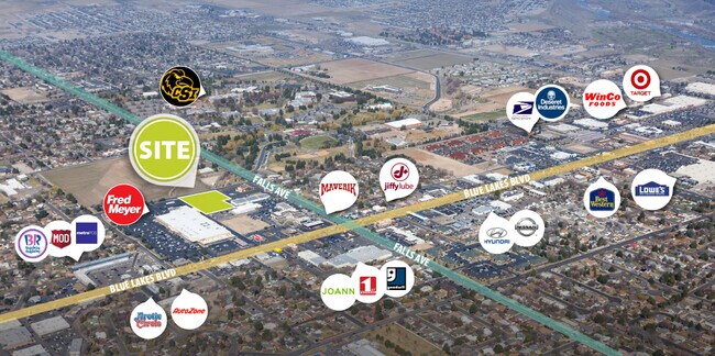
Property Record
825 Blue Lakes Blvd N, Twin Falls, ID 83301


Property Detail
825 Blue Lakes Blvd N
RPT00107090025A
TWIN FALLS ACRES INSIDE N12 S12 NE NE NE, EXC E 192 & EXC HWY (9-10-17)
Realpropertynec
TWIN FALLS
C-1
Idaho
B and X Area of moderate flood hazard, usually the area between the limits of the 100-year and 500-year floods.
1.57 AC
2025
Idaho South Area
2025
Other Market Areas
001100
Twin Falls, ID
NEARBY LISTINGS FOR SALE OR LEASE
DEMOGRAPHICS near 825 Blue Lakes Blvd N
1 mile
3 mile
5 mile
2025 Total Population
12,015
56,167
66,493
2030 Population
12,581
59,278
70,213
Pop Growth 2025-2030
+ 4.71%
+ 5.54%
+ 5.59%
Average Age
38
38
38
2025 Total Households
4,528
20,839
24,523
HH Growth 2025-2030
+ 4.79%
+ 5.63%
+ 5.68%
Median Household Inc
$64,171
$65,566
$66,931
Avg Household Size
2.50
2.60
2.60
2025 Avg HH Vehicles
2.00
2.00
2.00
Median Home Value
$289,977
$328,513
$332,728
Median Year Built
1970
1983
1988
Nearby Places
Map Layers
Map Styles
 Street
 Aerial
Transit
 Traffic
 Biking
Places
Listings with unknown addresses are not visible on the map
- Restaurants
- Banks
- Shops
- Fitness
- Groceries
SALE & LEASE HISTORY
LISTING DATE
SALE/LEASE

May 22, 2019
For Sale
Nearby Properties
Address
Land Use
TOTAL SIZE
Lot Size
Zoning
Address
Land Use
TOTAL SIZE
Lot Size
Zoning
38,811 SF
40.92 AC
C-1
Address
Land Use
TOTAL SIZE
Lot Size
Zoning
6,384 SF
5.89 AC
M-2
Address
Land Use
TOTAL SIZE
Lot Size
Zoning
225,980 SF
24.47 AC
C-1
Address
Land Use
TOTAL SIZE
Lot Size
Zoning
382,261 SF
11.44 AC
M-2
Address
Land Use
TOTAL SIZE
Lot Size
Zoning
35,638 SF
15.98 AC
C-1
Address
Land Use
TOTAL SIZE
Lot Size
Zoning
8.53 AC
C-1
Address
Land Use
TOTAL SIZE
Lot Size
Zoning
28,224 SF
7.10 AC
C-1
Address
Land Use
TOTAL SIZE
Lot Size
Zoning
48,191 SF
3.46 AC
C-1
Address
Land Use
TOTAL SIZE
Lot Size
Zoning
167,708 SF
14.90 AC
C-1
Address
Land Use
TOTAL SIZE
Lot Size
Zoning
24,284 SF
3.68 AC
C-1
Address
Land Use
TOTAL SIZE
Lot Size
Zoning
100,034 SF
8.01 AC
C-1
Address
Land Use
TOTAL SIZE
Lot Size
Zoning
160,432 SF
11.25 AC
C-1
Address
Land Use
TOTAL SIZE
Lot Size
Zoning
137,048 SF
12.66 AC
C-1
Address
Land Use
TOTAL SIZE
Lot Size
Zoning
71,798 SF
5.97 AC
C-1
Address
Land Use
TOTAL SIZE
Lot Size
Zoning
76,913 SF
2.88 AC
C-1
Address
Land Use
TOTAL SIZE
Lot Size
Zoning
240,740 SF
6.74 AC
M-2
Address
Land Use
TOTAL SIZE
Lot Size
Zoning
91,588 SF
3.16 AC
C-1
Address
Land Use
TOTAL SIZE
Lot Size
Zoning
116,676 SF
12.13 AC
C-1
Address
Land Use
TOTAL SIZE
Lot Size
Zoning
48,730 SF
4.67 AC
C-1
Address
Land Use
TOTAL SIZE
Lot Size
Zoning
9,440 SF
7.05 AC
R-6
Address
Land Use
TOTAL SIZE
Lot Size
Zoning
71,900 SF
2.67 AC
C-1
Address
Land Use
TOTAL SIZE
Lot Size
Zoning
114,844 SF
7.70 AC
C-1
Address
Land Use
TOTAL SIZE
Lot Size
Zoning
127,520 SF
16.82 AC
M-2
Address
Land Use
TOTAL SIZE
Lot Size
Zoning
20,016 SF
4.40 AC
R-6
Address
Land Use
TOTAL SIZE
Lot Size
Zoning
65,565 SF
2.14 AC
C-1
Address
Land Use
TOTAL SIZE
Lot Size
Zoning
40,730 SF
0.36 AC
O-T
Address
Land Use
TOTAL SIZE
Lot Size
Zoning
78,849 SF
18.66 AC
M-2
Address
Land Use
TOTAL SIZE
Lot Size
Zoning
29,988 SF
3.80 AC
Address
Land Use
TOTAL SIZE
Lot Size
Zoning
24,650 SF
2.13 AC
C-1
Address
Land Use
TOTAL SIZE
Lot Size
Zoning
9,220 SF
5.92 AC
R-4
The World's #1 Commercial Real Estate Marketplace
Connect with us
© 2026 CoStar Group
The information above has been obtained from sources believed reliable. While we do not doubt its accuracy we have not verified it and make no guarantee, warranty or representation about it. It is your responsibility to independently confirm its accuracy and completeness. Any projections, opinions, assumptions, or estimates used are for example only and do not represent the current or future performance of the property. The value of this transaction to you depends on tax and other factors which should be evaluated by your tax, financial, and legal advisors. You and your advisors should conduct a careful, independent investigation of the property to determine to your satisfaction the suitability of the property for your needs.