Property Record
Fincher Rd, Griffin, GA 30223
Property Detail
Fincher Rd
Atlanta-Sandy Springs-Roswell, GA
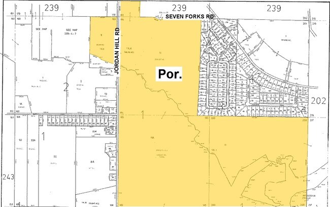
JORDAN HILL RD
201-01-002-C
SPALDING
Commercialacreage
Georgia
R2
185
A Areas with a 1% annual chance of flooding and a 26% chance of flooding over the life of a 30-year mortgage.
92.40 AC
2025
Spalding County
2025
Atlanta
160402
NEARBY LISTINGS FOR SALE OR LEASE
DEMOGRAPHICS near Fincher Rd
1 mile
3 mile
5 mile
2025 Total Population
3,837
10,331
34,034
2030 Population
4,138
11,093
36,516
Pop Growth 2025-2030
+ 7.84%
+ 7.38%
+ 7.29%
Average Age
39
41
40
2025 Total Households
1,229
3,550
12,044
HH Growth 2025-2030
+ 7.81%
+ 7.27%
+ 7.24%
Median Household Inc
$120,833
$109,694
$91,187
Avg Household Size
3.00
2.90
2.80
2025 Avg HH Vehicles
2.00
2.00
2.00
Median Home Value
$396,514
$387,438
$347,227
Median Year Built
2005
2005
2005
Nearby Places
Map Layers
Map Styles
 Street
 Aerial
Layers
 Traffic
 Biking
Places
Listings with unknown addresses are not visible on the map
- Restaurants
- Banks
- Shops
- Fitness
- Groceries
PUBLIC TRANSPORTATION
AIRPORT
Hartsfield - Jackson Atlanta International
Drive
Walk
Distance
Hartsfield - Jackson Atlanta International
42 min
30.6 mi
Freight Ports
Georgia Ports - Savannah
Drive
Walk
Distance
Georgia Ports - Savannah
247 min
217.4 mi
Nearby Properties
Address
Land Use
TOTAL SIZE
Lot Size
Zoning
Address
Land Use
TOTAL SIZE
Lot Size
Zoning
1,126,973 SF
88.82 AC
M1
Address
Land Use
TOTAL SIZE
Lot Size
Zoning
1,038,514 SF
141.54 AC
M1
Address
Land Use
TOTAL SIZE
Lot Size
Zoning
427,200 SF
67.92 AC
PD
Address
Land Use
TOTAL SIZE
Lot Size
Zoning
6,720 SF
1,081.34 AC
Address
Land Use
TOTAL SIZE
Lot Size
Zoning
155,664 SF
13.35 AC
C
Address
Land Use
TOTAL SIZE
Lot Size
Zoning
131,498 SF
86 AC
RA
Address
Land Use
TOTAL SIZE
Lot Size
Zoning
82,789 SF
2.85 AC
C3
Address
Land Use
TOTAL SIZE
Lot Size
Zoning
928 SF
31.25 AC
C2
Address
Land Use
TOTAL SIZE
Lot Size
Zoning
8,286 SF
1.01 AC
C1
Address
Land Use
TOTAL SIZE
Lot Size
Zoning
5,698 SF
1.51 AC
Address
Land Use
TOTAL SIZE
Lot Size
Zoning
48,488 SF
109 AC
UNKNOWN
Address
Land Use
TOTAL SIZE
Lot Size
Zoning
6,065 SF
155.70 AC
RA
Address
Land Use
TOTAL SIZE
Lot Size
Zoning
7,000 SF
2 AC
C1
Address
Land Use
TOTAL SIZE
Lot Size
Zoning
97.39 AC
R2
Address
Land Use
TOTAL SIZE
Lot Size
Zoning
64.01 AC
PDD
Address
Land Use
TOTAL SIZE
Lot Size
Zoning
23.64 AC
R2
Address
Land Use
TOTAL SIZE
Lot Size
Zoning
3,956 SF
1.58 AC
C
Address
Land Use
TOTAL SIZE
Lot Size
Zoning
8,580 SF
1.50 AC
Address
Land Use
TOTAL SIZE
Lot Size
Zoning
1,406 SF
183.89 AC
RA
Address
Land Use
TOTAL SIZE
Lot Size
Zoning
3,718 SF
21.66 AC
Address
Land Use
TOTAL SIZE
Lot Size
Zoning
16,134 SF
2.76 AC
C2
Address
Land Use
TOTAL SIZE
Lot Size
Zoning
4,420 SF
126.62 AC
R2-AR1
Address
Land Use
TOTAL SIZE
Lot Size
Zoning
16,817 SF
155.32 AC
C2
Address
Land Use
TOTAL SIZE
Lot Size
Zoning
18,134 SF
3.26 AC
Address
Land Use
TOTAL SIZE
Lot Size
Zoning
5,040 SF
1.95 AC
C2
The World's #1 Commercial Real Estate Marketplace
Connect with us
© 2026 CoStar Group
The information above has been obtained from sources believed reliable. While we do not doubt its accuracy we have not verified it and make no guarantee, warranty or representation about it. It is your responsibility to independently confirm its accuracy and completeness. Any projections, opinions, assumptions, or estimates used are for example only and do not represent the current or future performance of the property. The value of this transaction to you depends on tax and other factors which should be evaluated by your tax, financial, and legal advisors. You and your advisors should conduct a careful, independent investigation of the property to determine to your satisfaction the suitability of the property for your needs.