Property Record
Fish Branch Rd, Zolfo Springs, FL 33890

NEARBY LISTINGS FOR SALE OR LEASE
-
-
View all Zolfo Springs listings for sale on LoopNet.com
Property Detail
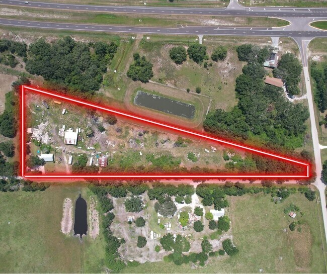
Fish Branch Rd
Wauchula, FL
J H Cokers Addition
1536-25-0000-05100-0000
COM NW COR NE1/4 OF SEC S 1085.91 FT TO PT ON S R/W OF SR 665 S 89DEG 47M 43S E 33 FT MOL TO E R/W SCL RR TO POB S 89 DEG 47M 43S E 56.20 FT TO W R/W OF OLD DIXIE HWY S 07 DEG 04M 57S W ALONG W R/W 277.69 FT S 89 DEG 29M 27S W 131.41 FT TO E R/W SCL
Residentialacreage
Hardee
X
Florida
12049C0431D
0.62 AC
2025
Florida Central South Area
2025
Other Market Areas
970102
DEMOGRAPHICS near Fish Branch Rd
1 Mile
3 Mile
5 Mile
2024 Total Population
110
756
1,276
2029 Population
112
782
1,341
Pop Growth 2024-2029
+ 1.82%
+ 3.44%
+ 5.09%
Average Age
44
49
48
2024 Total Households
41
293
499
HH Growth 2024-2029
+ 2.44%
+ 3.41%
+ 5.41%
Median Household Inc
$42,500
$48,749
$48,124
Avg Household Size
2.60
2.30
2.40
2024 Avg HH Vehicles
2.00
2.00
2.00
Median Home Value
$116,667
$147,500
$133,333
Median Year Built
1991
1992
1993
Nearby Places
Map Layers
Map Styles
 Street
 Aerial
- Restaurants
- Banks
- Shops
- Fitness
- Groceries
SALE & LEASE HISTORY
LISTING DATE
SALE/LEASE

Aug 22, 2023
For Sale
Nearby Properties
Address
Land Use
TOTAL SIZE
Lot Size
Zoning
Address
Land Use
TOTAL SIZE
Lot Size
Zoning
6,313 SF
470 AC
A-10
Address
Land Use
TOTAL SIZE
Lot Size
Zoning
640 AC
A-10
Address
Land Use
TOTAL SIZE
Lot Size
Zoning
71,546 SF
23.16 AC
A-10
Address
Land Use
TOTAL SIZE
Lot Size
Zoning
14,642 SF
40 AC
A-1
Address
Land Use
TOTAL SIZE
Lot Size
Zoning
5,940 SF
70.35 AC
I-1
Address
Land Use
TOTAL SIZE
Lot Size
Zoning
6,792 SF
30.20 AC
A-10
Address
Land Use
TOTAL SIZE
Lot Size
Zoning
5,019 SF
41 AC
A-10
Address
Land Use
TOTAL SIZE
Lot Size
Zoning
52.80 AC
A-1
Address
Land Use
TOTAL SIZE
Lot Size
Zoning
9,626 SF
29.28 AC
A-10
Address
Land Use
TOTAL SIZE
Lot Size
Zoning
4,041 SF
28.65 AC
A-10
Address
Land Use
TOTAL SIZE
Lot Size
Zoning
Address
Land Use
TOTAL SIZE
Lot Size
Zoning
607 AC
A-1
Address
Land Use
TOTAL SIZE
Lot Size
Zoning
6,792 SF
10.04 AC
A-10
Address
Land Use
TOTAL SIZE
Lot Size
Zoning
4,847 SF
3.23 AC
A-1
Address
Land Use
TOTAL SIZE
Lot Size
Zoning
3,919 SF
80.27 AC
A-10
Address
Land Use
TOTAL SIZE
Lot Size
Zoning
2,942 SF
5 AC
A-10
Address
Land Use
TOTAL SIZE
Lot Size
Zoning
40 AC
A-10
Address
Land Use
TOTAL SIZE
Lot Size
Zoning
4,200 SF
202.83 AC
A-10
Address
Land Use
TOTAL SIZE
Lot Size
Zoning
6,000 SF
5.59 AC
I-1
Address
Land Use
TOTAL SIZE
Lot Size
Zoning
2,490 SF
273 AC
A-1
Address
Land Use
TOTAL SIZE
Lot Size
Zoning
5,173 SF
22.87 AC
A-1
Address
Land Use
TOTAL SIZE
Lot Size
Zoning
3,020 SF
90 AC
A-1
Address
Land Use
TOTAL SIZE
Lot Size
Zoning
2,046 SF
14.20 AC
A-10
Address
Land Use
TOTAL SIZE
Lot Size
Zoning
30 AC
A-10
Address
Land Use
TOTAL SIZE
Lot Size
Zoning
2,160 SF
5 AC
A-1
Address
Land Use
TOTAL SIZE
Lot Size
Zoning
1,876 SF
5 AC
A-1
Address
Land Use
TOTAL SIZE
Lot Size
Zoning
1,746 SF
2.91 AC
A-10
Address
Land Use
TOTAL SIZE
Lot Size
Zoning
3,570 SF
3.40 AC
A-1
Address
Land Use
TOTAL SIZE
Lot Size
Zoning
4,020 SF
10 AC
A-10
Address
Land Use
TOTAL SIZE
Lot Size
Zoning
3,978 SF
122.50 AC
A-1
The World's #1 Commercial Real Estate Marketplace
Connect with us
© 2025 CoStar Group
The information above has been obtained from sources believed reliable. While we do not doubt its accuracy we have not verified it and make no guarantee, warranty or representation about it. It is your responsibility to independently confirm its accuracy and completeness. Any projections, opinions, assumptions, or estimates used are for example only and do not represent the current or future performance of the property. The value of this transaction to you depends on tax and other factors which should be evaluated by your tax, financial, and legal advisors. You and your advisors should conduct a careful, independent investigation of the property to determine to your satisfaction the suitability of the property for your needs.