Property Record
W Fox Ridge Dr, Boise, ID 83709
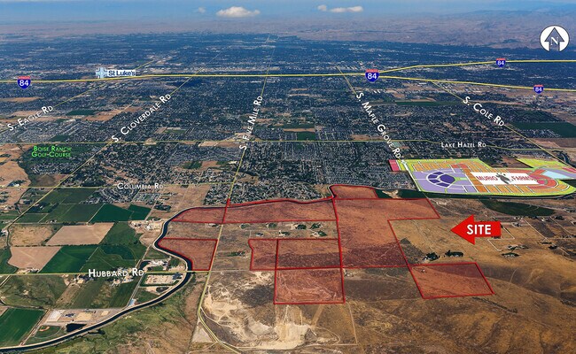
Property Detail
W Fox Ridge Dr
S1411131500
PAR #1800 POR SE4NE4 LYING SOUTH OF NEW YORK CANAL SEC 10 2N 1E
Vacantlandnec
ADA
RP
Idaho
B and X Area of moderate flood hazard, usually the area between the limits of the 100-year and 500-year floods.
160 AC
2025
South Ada County
2025
Boise City/Nampa
010101
Boise City, ID
NEARBY LISTINGS FOR SALE OR LEASE
DEMOGRAPHICS near W Fox Ridge Dr
1 mile
3 mile
5 mile
2025 Total Population
4,530
38,674
84,760
2030 Population
4,718
40,566
89,391
Pop Growth 2025-2030
+ 4.15%
+ 4.89%
+ 5.46%
Average Age
37
39
40
2025 Total Households
1,459
12,671
28,601
HH Growth 2025-2030
+ 4.52%
+ 5.29%
+ 5.89%
Median Household Inc
$76,596
$98,715
$104,706
Avg Household Size
3.00
2.80
2.80
2025 Avg HH Vehicles
2.00
2.00
2.00
Median Home Value
$416,140
$475,070
$511,882
Median Year Built
2001
2004
2004
Nearby Places
Map Layers
Map Styles
 Street
 Aerial
Layers
 Traffic
 Biking
Places
Listings with unknown addresses are not visible on the map
- Restaurants
- Banks
- Shops
- Fitness
- Groceries
PUBLIC TRANSPORTATION
AIRPORT
Boise Air Trml/Gowen Field
Drive
Walk
Distance
Boise Air Trml/Gowen Field
28 min
9.1 mi
Freight Ports
Port of Portland
Drive
Walk
Distance
Port of Portland
487 min
434.6 mi
SALE & LEASE HISTORY
LISTING DATE
SALE/LEASE

Sep 23, 2021
For Sale
Nearby Properties
Address
Land Use
TOTAL SIZE
Lot Size
Zoning
Address
Land Use
TOTAL SIZE
Lot Size
Zoning
164,981 SF
7.47 AC
R20
Address
Land Use
TOTAL SIZE
Lot Size
Zoning
70.14 AC
SP-03
Address
Land Use
TOTAL SIZE
Lot Size
Zoning
120.94 AC
M-1D/DA
Address
Land Use
TOTAL SIZE
Lot Size
Zoning
121,203 SF
5.56 AC
LO
Address
Land Use
TOTAL SIZE
Lot Size
Zoning
12,231 SF
6.72 AC
R-12
Address
Land Use
TOTAL SIZE
Lot Size
Zoning
17,175 SF
2.96 AC
C1
Address
Land Use
TOTAL SIZE
Lot Size
Zoning
9.87 AC
R-8
Address
Land Use
TOTAL SIZE
Lot Size
Zoning
14,739 SF
1.74 AC
C2
Address
Land Use
TOTAL SIZE
Lot Size
Zoning
15,290 SF
0.56 AC
C2
Address
Land Use
TOTAL SIZE
Lot Size
Zoning
42,680 SF
3.46 AC
C2
Address
Land Use
TOTAL SIZE
Lot Size
Zoning
40.19 AC
R-6
Address
Land Use
TOTAL SIZE
Lot Size
Zoning
5,148 SF
1.48 AC
C2
Address
Land Use
TOTAL SIZE
Lot Size
Zoning
15,217 SF
286.60 AC
R-6
Address
Land Use
TOTAL SIZE
Lot Size
Zoning
20 AC
M-1D
Address
Land Use
TOTAL SIZE
Lot Size
Zoning
4,268 SF
2.02 AC
C2
Address
Land Use
TOTAL SIZE
Lot Size
Zoning
20.88 AC
SP-03
Address
Land Use
TOTAL SIZE
Lot Size
Zoning
12.61 AC
R-8
Address
Land Use
TOTAL SIZE
Lot Size
Zoning
12,904 SF
121.58 AC
RUT
Address
Land Use
TOTAL SIZE
Lot Size
Zoning
4,337 SF
2.55 AC
C1
Address
Land Use
TOTAL SIZE
Lot Size
Zoning
11.23 AC
C2
Address
Land Use
TOTAL SIZE
Lot Size
Zoning
14.84 AC
SP-03
Address
Land Use
TOTAL SIZE
Lot Size
Zoning
20,484 SF
2.36 AC
C2
Address
Land Use
TOTAL SIZE
Lot Size
Zoning
14,779 SF
2.50 AC
C2
Address
Land Use
TOTAL SIZE
Lot Size
Zoning
17.63 AC
C2
Address
Land Use
TOTAL SIZE
Lot Size
Zoning
80 AC
RP
Address
Land Use
TOTAL SIZE
Lot Size
Zoning
1,079 SF
9.24 AC
RUT
Address
Land Use
TOTAL SIZE
Lot Size
Zoning
17.44 AC
R-6
Address
Land Use
TOTAL SIZE
Lot Size
Zoning
16.49 AC
R-6
Address
Land Use
TOTAL SIZE
Lot Size
Zoning
15.90 AC
R-6
The World's #1 Commercial Real Estate Marketplace
Connect with us
© 2026 CoStar Group
The information above has been obtained from sources believed reliable. While we do not doubt its accuracy we have not verified it and make no guarantee, warranty or representation about it. It is your responsibility to independently confirm its accuracy and completeness. Any projections, opinions, assumptions, or estimates used are for example only and do not represent the current or future performance of the property. The value of this transaction to you depends on tax and other factors which should be evaluated by your tax, financial, and legal advisors. You and your advisors should conduct a careful, independent investigation of the property to determine to your satisfaction the suitability of the property for your needs.