Property Record
Flat Rock Pl, Westbrook, CT 06498
NEARBY LISTINGS FOR SALE OR LEASE
Property Detail
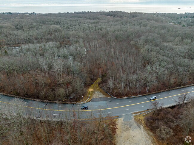
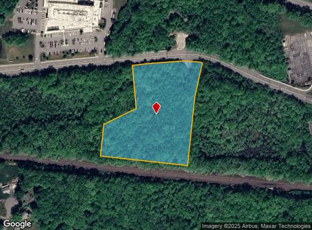
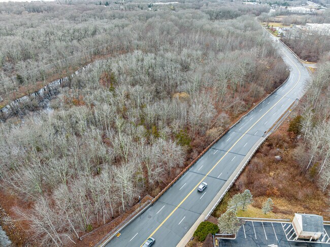
Flat Rock Pl
165 028
Middlesex
Industrialacreage
Connecticut
X
28
09007C0341J
5.43 AC
2024
SW Midlsx/Old Saybrk/Rt 9
2025
Hartford
680102
Hartford-West Hartford-East Hartford, CT
DEMOGRAPHICS near Flat Rock Pl
1 mile
3 mile
5 mile
2024 Total Population
3,002
12,654
33,859
2029 Population
3,085
13,051
34,488
Pop Growth 2024-2029
+ 2.76%
+ 3.14%
+ 1.86%
Average Age
48
49
49
2024 Total Households
1,382
5,721
15,032
HH Growth 2024-2029
+ 3.11%
+ 3.32%
+ 1.96%
Median Household Inc
$71,751
$89,304
$97,666
Avg Household Size
2.10
2.20
2.20
2024 Avg HH Vehicles
2.00
2.00
2.00
Median Home Value
$378,387
$390,395
$393,980
Median Year Built
1974
1970
1969
Nearby Places
Map Layers
Map Styles
 Street
 Aerial
Transit
 Traffic
 Biking
Places
Listings with unknown addresses are not visible on the map
- Restaurants
- Banks
- Shops
- Fitness
- Groceries
PUBLIC TRANSPORTATION
COMMUTER RAIL
Westbrook (Commuter Rail - Shore Line East)
Drive
Walk
Distance
Westbrook (Commuter Rail - Shore Line East)
2 min
15 min
0.8 mi
Westbrook (Shore Line East - Shore Line East)
Drive
Walk
Distance
Westbrook (Shore Line East - Shore Line East)
2 min
15 min
0.8 mi
AIRPORT
Tweed/New Haven
Drive
Walk
Distance
Tweed/New Haven
33 min
25.0 mi
Freight Ports
Port of New Haven
Drive
Walk
Distance
Port of New Haven
33 min
25.6 mi
Nearby Properties
Address
Land Use
TOTAL SIZE
Lot Size
Zoning
Address
Land Use
TOTAL SIZE
Lot Size
Zoning
91,300 SF
8.03 AC
TIC
Address
Land Use
TOTAL SIZE
Lot Size
Zoning
159,832 SF
110.10 AC
RR
Address
Land Use
TOTAL SIZE
Lot Size
Zoning
14.87 AC
NCD
Address
Land Use
TOTAL SIZE
Lot Size
Zoning
35.40 AC
B-2
Address
Land Use
TOTAL SIZE
Lot Size
Zoning
39.32 AC
LI/LDR
Address
Land Use
TOTAL SIZE
Lot Size
Zoning
322.64 AC
RR/MDR
Address
Land Use
TOTAL SIZE
Lot Size
Zoning
624 SF
43.91 AC
CB
Address
Land Use
TOTAL SIZE
Lot Size
Zoning
14.78 AC
B-4
Address
Land Use
TOTAL SIZE
Lot Size
Zoning
46.69 AC
MDR
Address
Land Use
TOTAL SIZE
Lot Size
Zoning
49.71 AC
TIC
Address
Land Use
TOTAL SIZE
Lot Size
Zoning
101,587 SF
34.34 AC
A
Address
Land Use
TOTAL SIZE
Lot Size
Zoning
14.25 AC
A
Address
Land Use
TOTAL SIZE
Lot Size
Zoning
35.50 AC
CB
Address
Land Use
TOTAL SIZE
Lot Size
Zoning
10.80 AC
I-1
Address
Land Use
TOTAL SIZE
Lot Size
Zoning
22,984 SF
6.58 AC
MDR
Address
Land Use
TOTAL SIZE
Lot Size
Zoning
17,833 SF
3.87 AC
A
Address
Land Use
TOTAL SIZE
Lot Size
Zoning
7.36 AC
B1
Address
Land Use
TOTAL SIZE
Lot Size
Zoning
25,144 SF
3.74 AC
B-4
Address
Land Use
TOTAL SIZE
Lot Size
Zoning
64,427 SF
1.46 AC
Address
Land Use
TOTAL SIZE
Lot Size
Zoning
85,800 SF
11.56 AC
LI/RR
Address
Land Use
TOTAL SIZE
Lot Size
Zoning
291,816 SF
29.64 AC
I-1
Address
Land Use
TOTAL SIZE
Lot Size
Zoning
55,250 SF
4.41 AC
B-4
Address
Land Use
TOTAL SIZE
Lot Size
Zoning
11.70 AC
NCD
Address
Land Use
TOTAL SIZE
Lot Size
Zoning
8.44 AC
B-2
Address
Land Use
TOTAL SIZE
Lot Size
Zoning
24,632 SF
4.48 AC
LI
Address
Land Use
TOTAL SIZE
Lot Size
Zoning
22,970 SF
1.25 AC
A
Address
Land Use
TOTAL SIZE
Lot Size
Zoning
32,752 SF
6.73 AC
TIC
Address
Land Use
TOTAL SIZE
Lot Size
Zoning
7,321 SF
0.79 AC
A
Address
Land Use
TOTAL SIZE
Lot Size
Zoning
18,494 SF
10.40 AC
RU
Address
Land Use
TOTAL SIZE
Lot Size
Zoning
37,246 SF
25.83 AC
LDR
The World's #1 Commercial Real Estate Marketplace
Connect with us
© 2026 CoStar Group
The information above has been obtained from sources believed reliable. While we do not doubt its accuracy we have not verified it and make no guarantee, warranty or representation about it. It is your responsibility to independently confirm its accuracy and completeness. Any projections, opinions, assumptions, or estimates used are for example only and do not represent the current or future performance of the property. The value of this transaction to you depends on tax and other factors which should be evaluated by your tax, financial, and legal advisors. You and your advisors should conduct a careful, independent investigation of the property to determine to your satisfaction the suitability of the property for your needs.