Property Record
Florin Rd, Sacramento, CA 95829


NEARBY LISTINGS FOR SALE OR LEASE
Property Detail
Florin Rd
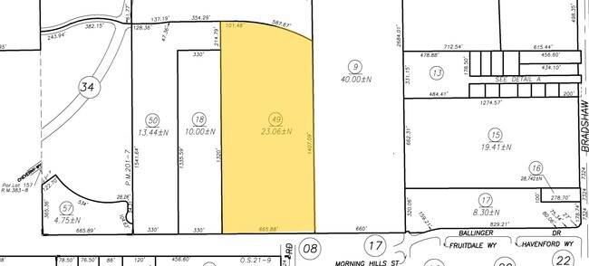
066-0070-049
POR N 1/2 SEC 5 T7N R6E DES AS BEG AT CENTER SD SEC 5; TH FRPOB N0%1108W 1,551.24 FT; TH S89%3824E 101.46 FT; TH CURVINGRT,
Recreationalacreage
Sacramento
X
California
06067C0327H
23.06 AC
2024
Outer Sacramento County
2025
Sacramento
009311
Sacramento--Roseville--Arden-Arcade, CA
DEMOGRAPHICS near Florin Rd
1 Mile
3 Mile
5 Mile
2024 Total Population
5,427
53,705
223,357
2029 Population
5,646
54,029
224,615
Pop Growth 2024-2029
+ 4.04%
+ 0.60%
+ 0.56%
Average Age
38
38
38
2024 Total Households
1,692
15,886
70,569
HH Growth 2024-2029
+ 4.02%
+ 0.54%
+ 0.60%
Median Household Inc
$112,811
$92,445
$75,647
Avg Household Size
3.20
3.30
3.00
2024 Avg HH Vehicles
2.00
2.00
2.00
Median Home Value
$495,317
$442,678
$415,426
Median Year Built
2011
1994
1985
Nearby Places
Map Layers
Map Styles
 Street
 Aerial
- Restaurants
- Banks
- Shops
- Fitness
- Groceries
PUBLIC TRANSPORTATION
AIRPORT
Sacramento International
DRIVE
WALK
Distance
Sacramento International
38 min
25.7 mi
Freight Ports
Port of Stockton
DRIVE
WALK
Distance
Port of Stockton
59 min
44.7 mi
Nearby Properties
Address
Land Use
TOTAL SIZE
Lot Size
Zoning
Address
Land Use
TOTAL SIZE
Lot Size
Zoning
149,566 SF
9.68 AC
M-2S
Address
Land Use
TOTAL SIZE
Lot Size
Zoning
187,080 SF
10.01 AC
SPA M-1
Address
Land Use
TOTAL SIZE
Lot Size
Zoning
584,820 SF
29.12 AC
M-2S
Address
Land Use
TOTAL SIZE
Lot Size
Zoning
281,404 SF
21.43 AC
M-2
Address
Land Use
TOTAL SIZE
Lot Size
Zoning
319,485 SF
16.35 AC
M-2S
Address
Land Use
TOTAL SIZE
Lot Size
Zoning
158,710 SF
14.02 AC
M-1 (NPA)
Address
Land Use
TOTAL SIZE
Lot Size
Zoning
204,290 SF
11.86 AC
RD-20
Address
Land Use
TOTAL SIZE
Lot Size
Zoning
188,144 SF
16.90 AC
M-2S
Address
Land Use
TOTAL SIZE
Lot Size
Zoning
12.04 AC
M-1S-R
Address
Land Use
TOTAL SIZE
Lot Size
Zoning
161,834 SF
15.23 AC
LC
Address
Land Use
TOTAL SIZE
Lot Size
Zoning
167,152 SF
7.53 AC
RD-20
Address
Land Use
TOTAL SIZE
Lot Size
Zoning
90,925 SF
9.77 AC
AR-1
Address
Land Use
TOTAL SIZE
Lot Size
Zoning
75,765 SF
19.04 AC
M-1S-R
Address
Land Use
TOTAL SIZE
Lot Size
Zoning
126,925 SF
10.35 AC
SPA
Address
Land Use
TOTAL SIZE
Lot Size
Zoning
144,000 SF
5.79 AC
SPA
Address
Land Use
TOTAL SIZE
Lot Size
Zoning
43,855 SF
14.38 AC
M-2S-R
Address
Land Use
TOTAL SIZE
Lot Size
Zoning
800 SF
2.43 AC
M-1 (SM)
Address
Land Use
TOTAL SIZE
Lot Size
Zoning
216,400 SF
11.68 AC
M-2S
Address
Land Use
TOTAL SIZE
Lot Size
Zoning
1,404 SF
16.14 AC
M-2S
Address
Land Use
TOTAL SIZE
Lot Size
Zoning
88,280 SF
5.43 AC
M-1 (NPA)
Address
Land Use
TOTAL SIZE
Lot Size
Zoning
96,658 SF
6.39 AC
M-2S
Address
Land Use
TOTAL SIZE
Lot Size
Zoning
96,838 SF
8.10 AC
M-2S
Address
Land Use
TOTAL SIZE
Lot Size
Zoning
111,135 SF
5.65 AC
M-2S
Address
Land Use
TOTAL SIZE
Lot Size
Zoning
87,926 SF
4.81 AC
RD-30
Address
Land Use
TOTAL SIZE
Lot Size
Zoning
55,143 SF
4.46 AC
SC
Address
Land Use
TOTAL SIZE
Lot Size
Zoning
17.32 AC
RD-7 RD-10
Address
Land Use
TOTAL SIZE
Lot Size
Zoning
108,941 SF
4.31 AC
RD-20
Address
Land Use
TOTAL SIZE
Lot Size
Zoning
49,900 SF
6.16 AC
RD-20
Address
Land Use
TOTAL SIZE
Lot Size
Zoning
11.09 AC
RD-5
Address
Land Use
TOTAL SIZE
Lot Size
Zoning
100,000 SF
5.66 AC
M-2S
The World's #1 Commercial Real Estate Marketplace
Connect with us
© 2025 CoStar Group
The information above has been obtained from sources believed reliable. While we do not doubt its accuracy we have not verified it and make no guarantee, warranty or representation about it. It is your responsibility to independently confirm its accuracy and completeness. Any projections, opinions, assumptions, or estimates used are for example only and do not represent the current or future performance of the property. The value of this transaction to you depends on tax and other factors which should be evaluated by your tax, financial, and legal advisors. You and your advisors should conduct a careful, independent investigation of the property to determine to your satisfaction the suitability of the property for your needs.